
100 Years of Wonder
It is described as “one of the world’s most scenic drives”. That’s the beautiful Chapman’s Peak Drive between Hout Bay and Noordhoek close to Cape Town.
Where did the name came from?
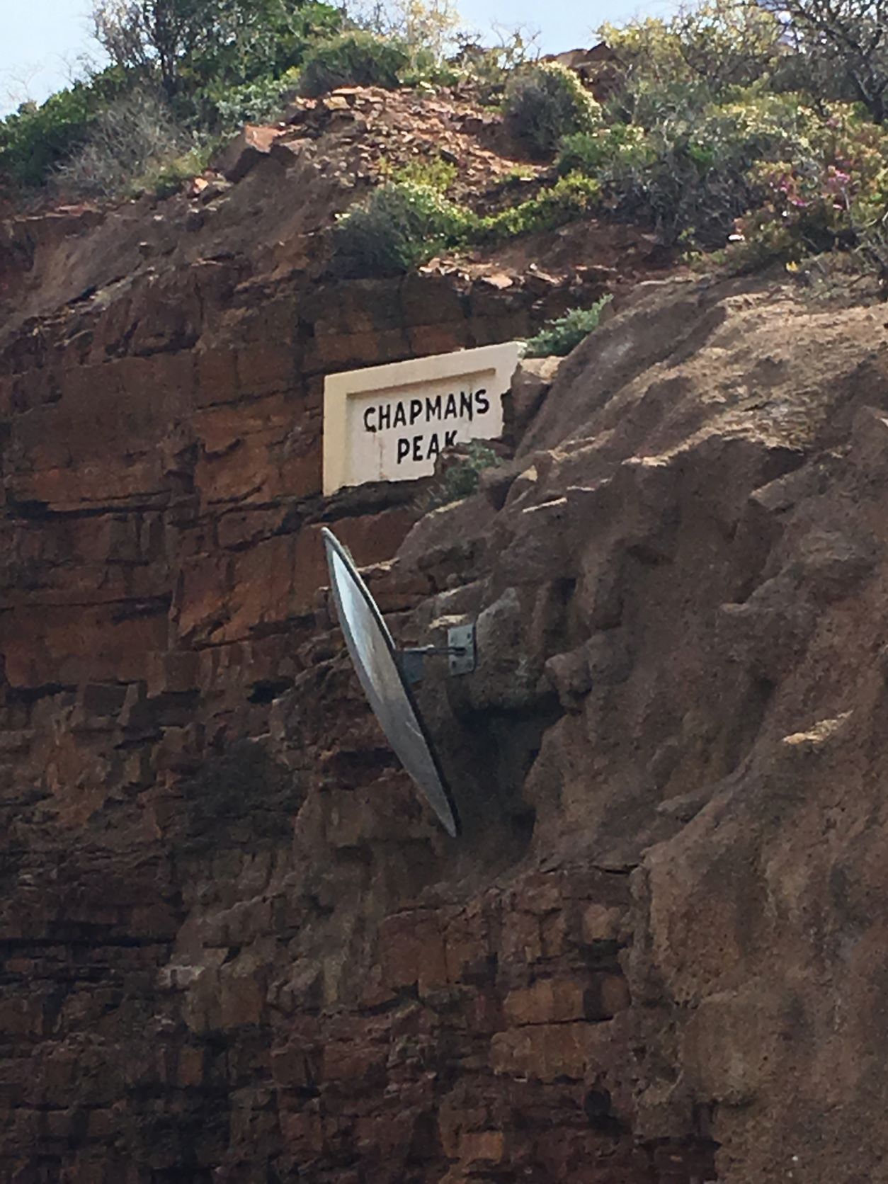
Chapman’s Peak Drive (also known as Chappies) was named after John Chapman, the first mate of an English ship (the Consent), which rounded the Cape of Good Hope in 1607. When the ship was anchored, the captain sent John Chapman to shore in search of provisions. Upon his successful return, the skipper named the bay Chapman’s Chaunce. However, this bay later becomes known as Hout Bay.
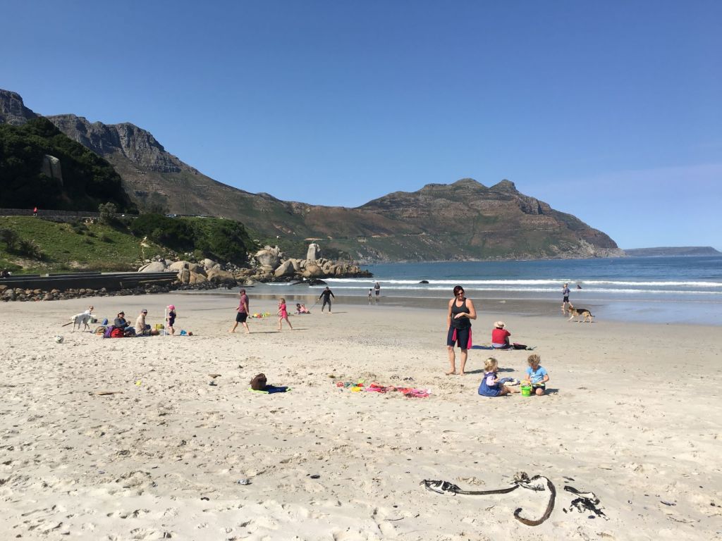
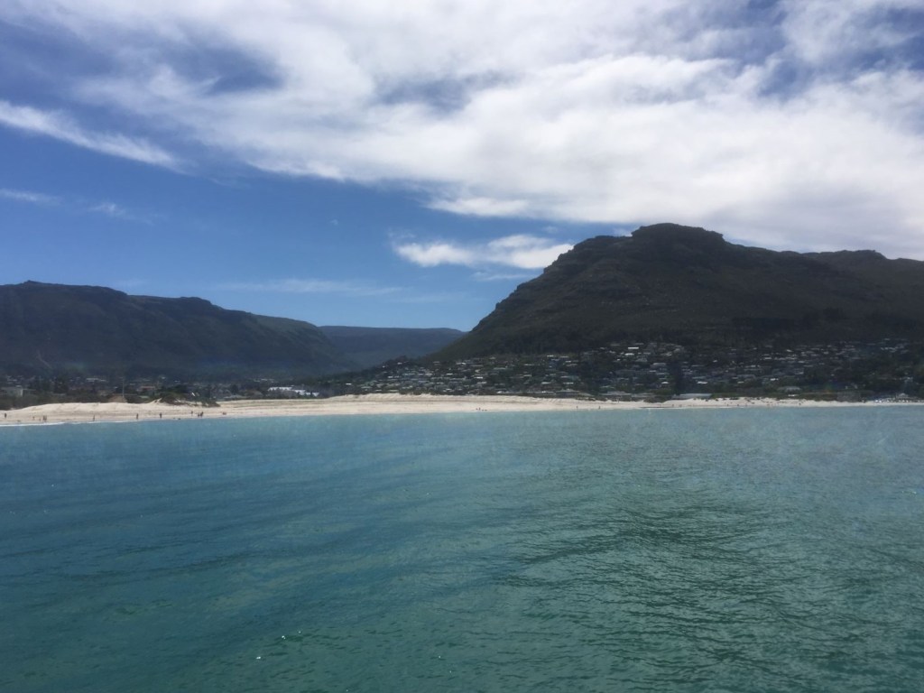
Hout Bay beach:
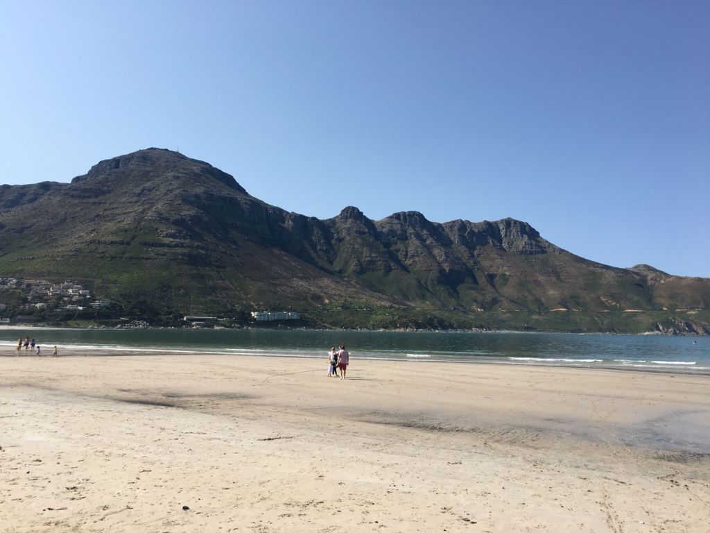
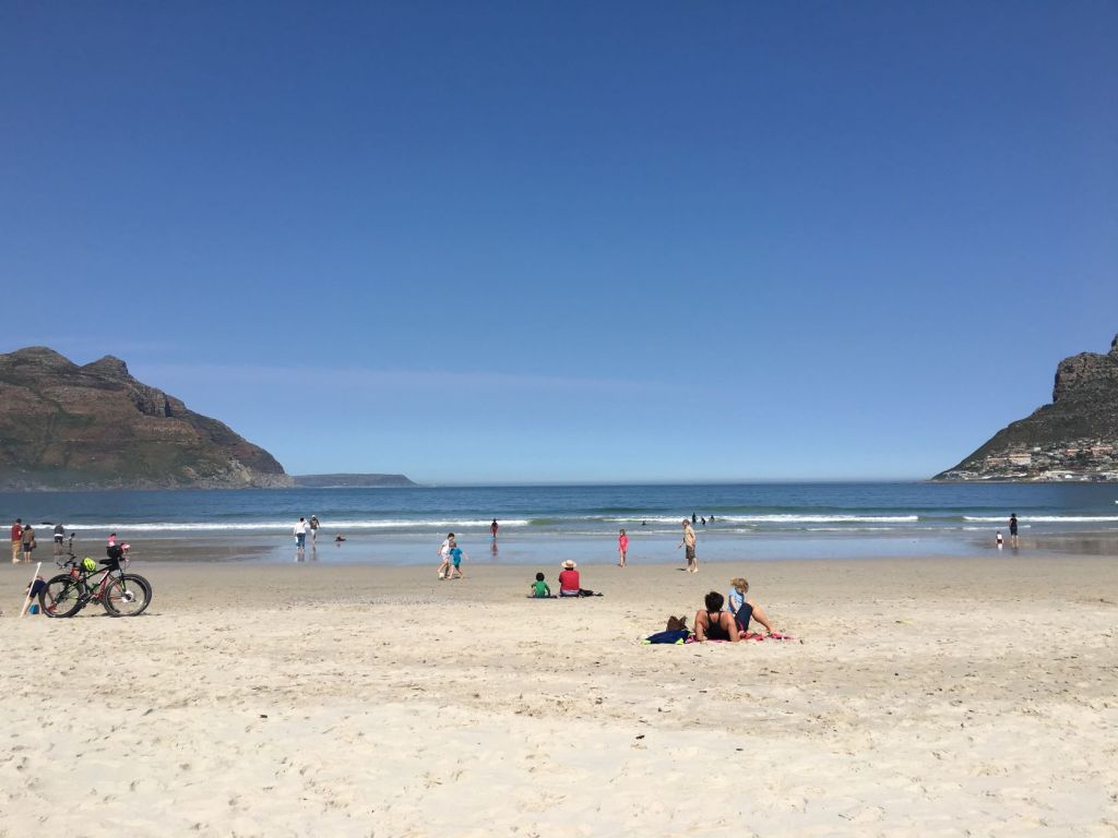
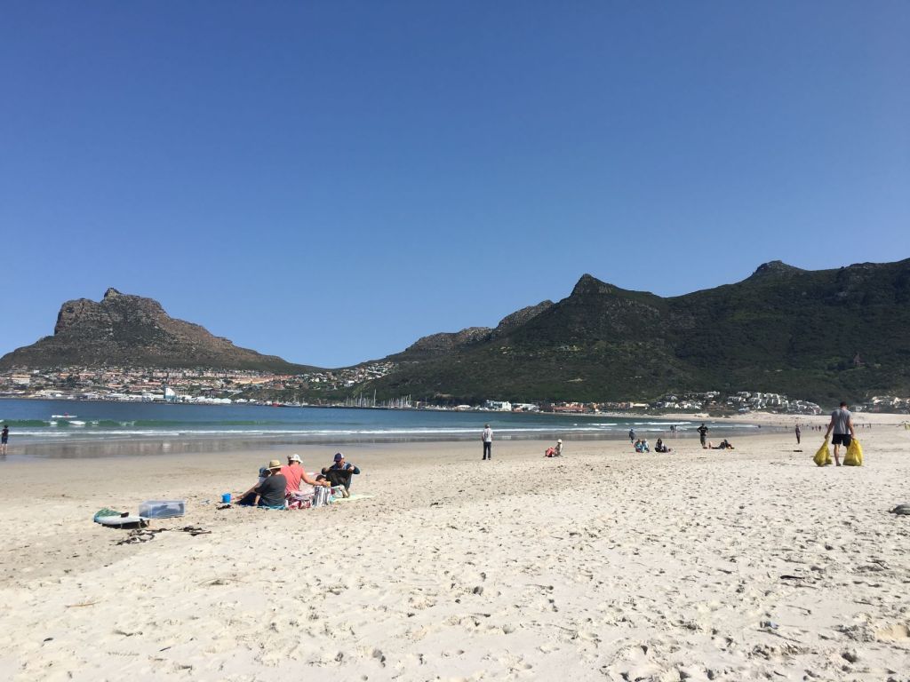
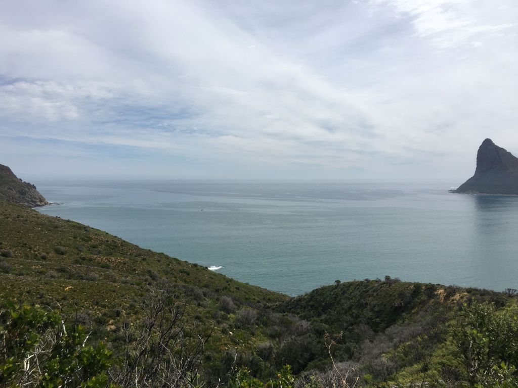
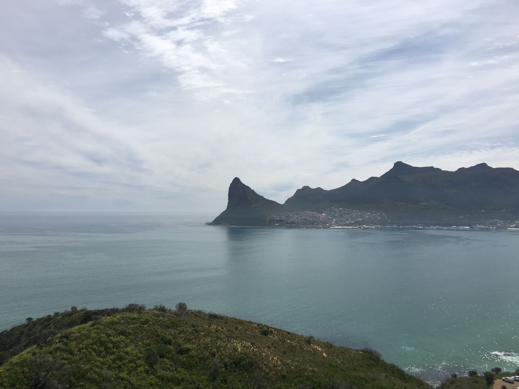
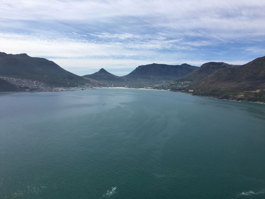
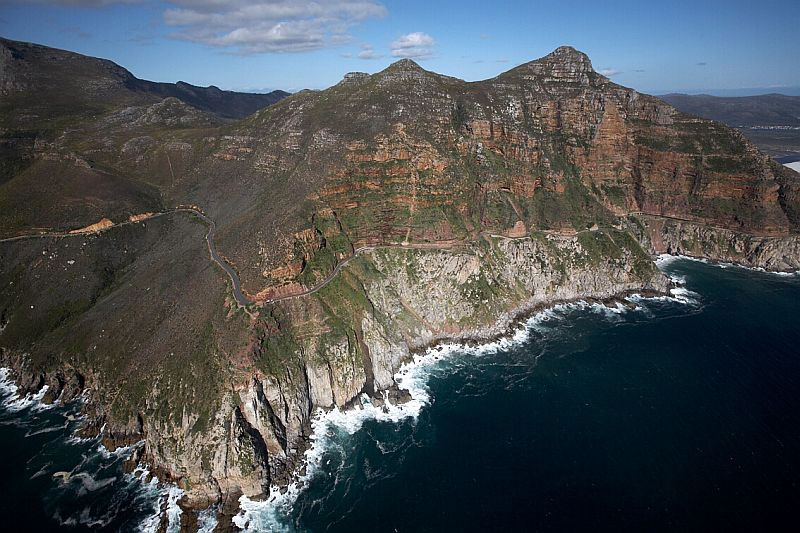
Before we get to Chapman’s Peak Drive, let’s go for a stroll on the beach of Hout Bay from where one can see the majestic Chapman’s Peak Drive.

While walking on the beach at Hout Bay, Chapman’s Peak Drive can clearly be seen running along the western side of the Cape Peninsula.
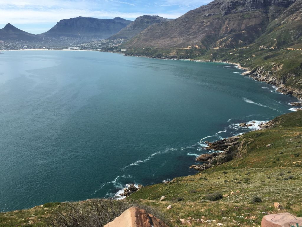
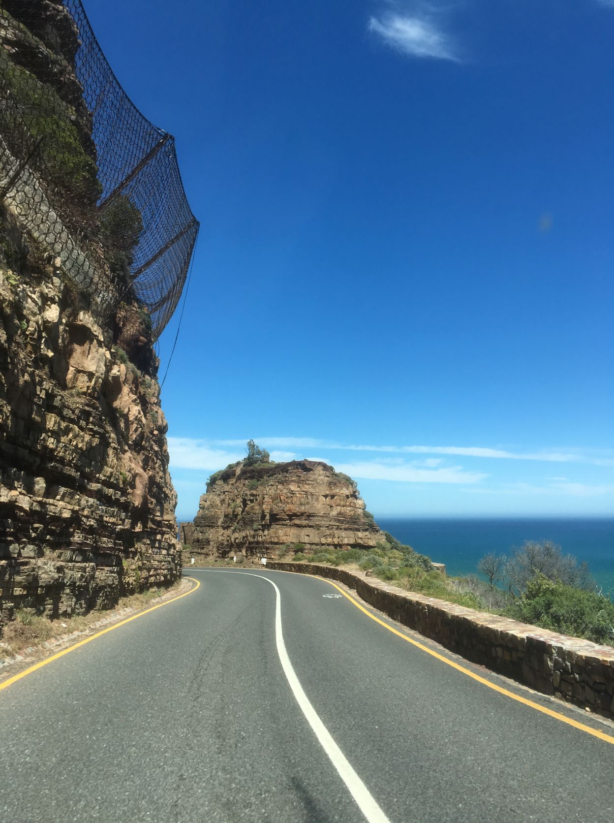
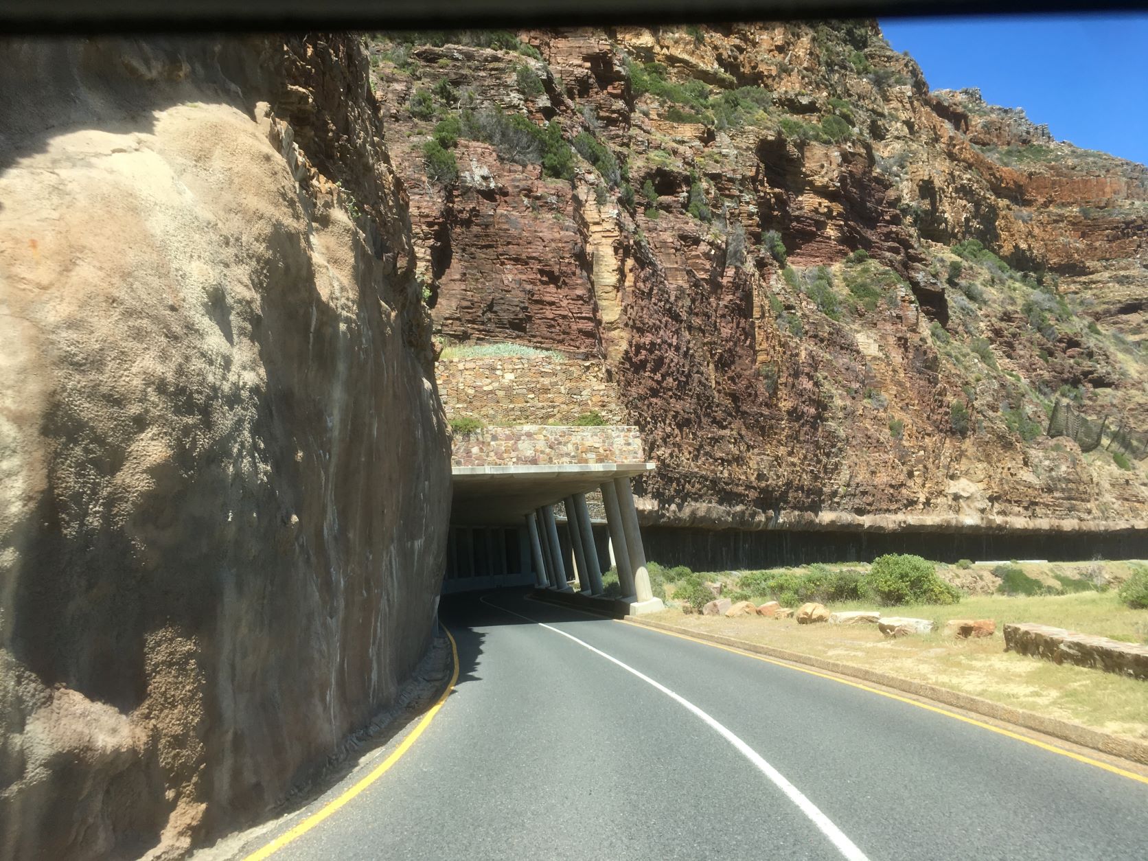
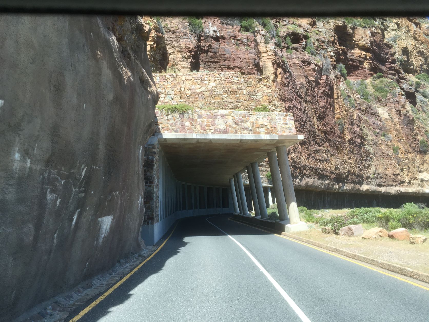
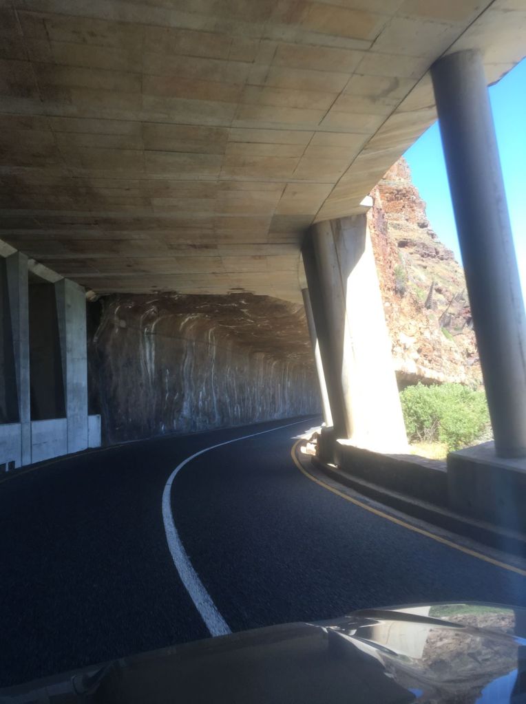
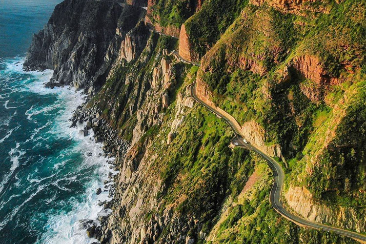
Chapman’s Peak Drive:
Hundreds of years after John Chapman saw Chapman’s Peak for the first time, work began in 1915 to cut a road along a series of ridges to connect Hout Bay and Noordhoek. It was officially opened on the 6th of May 1922 and then called Chapman’s Peak Drive.
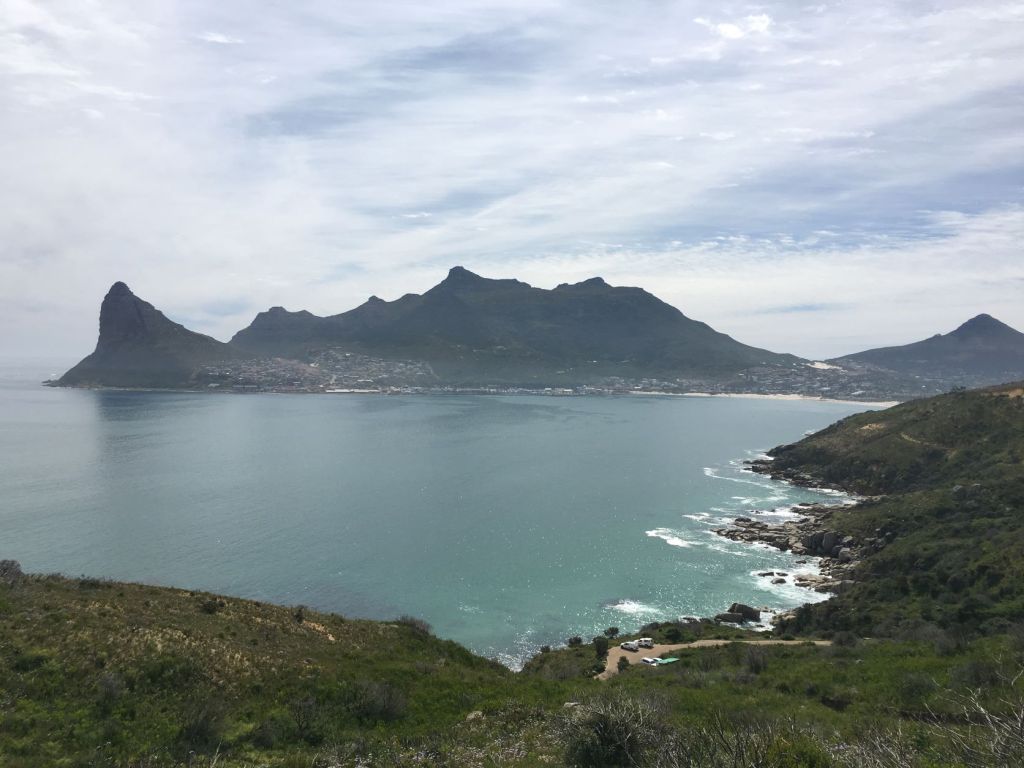
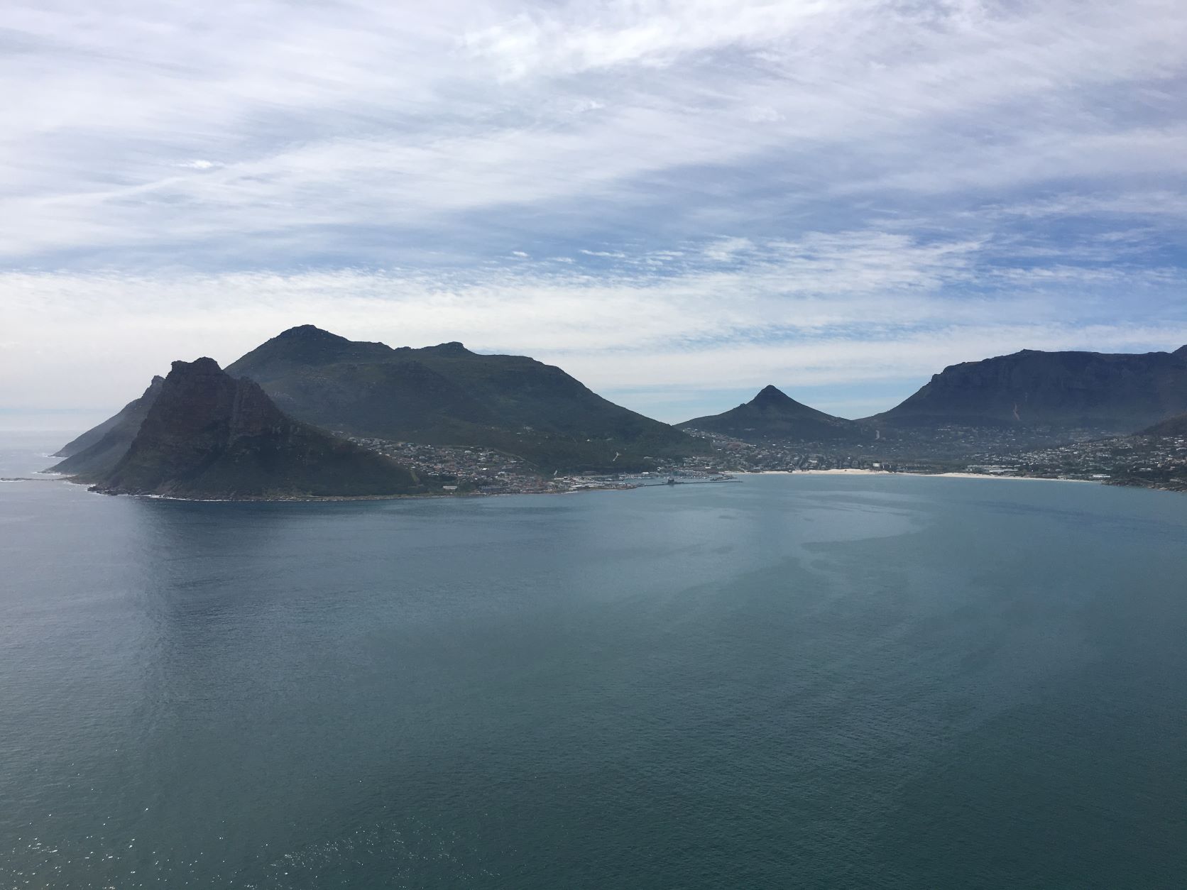
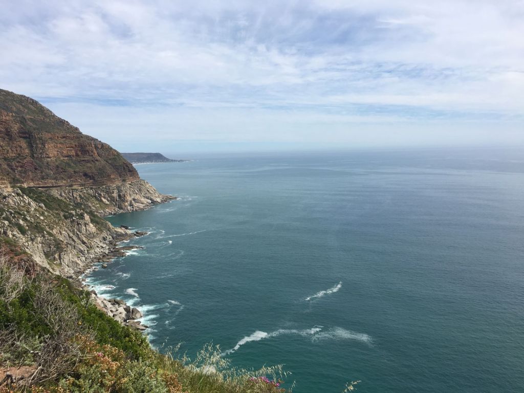
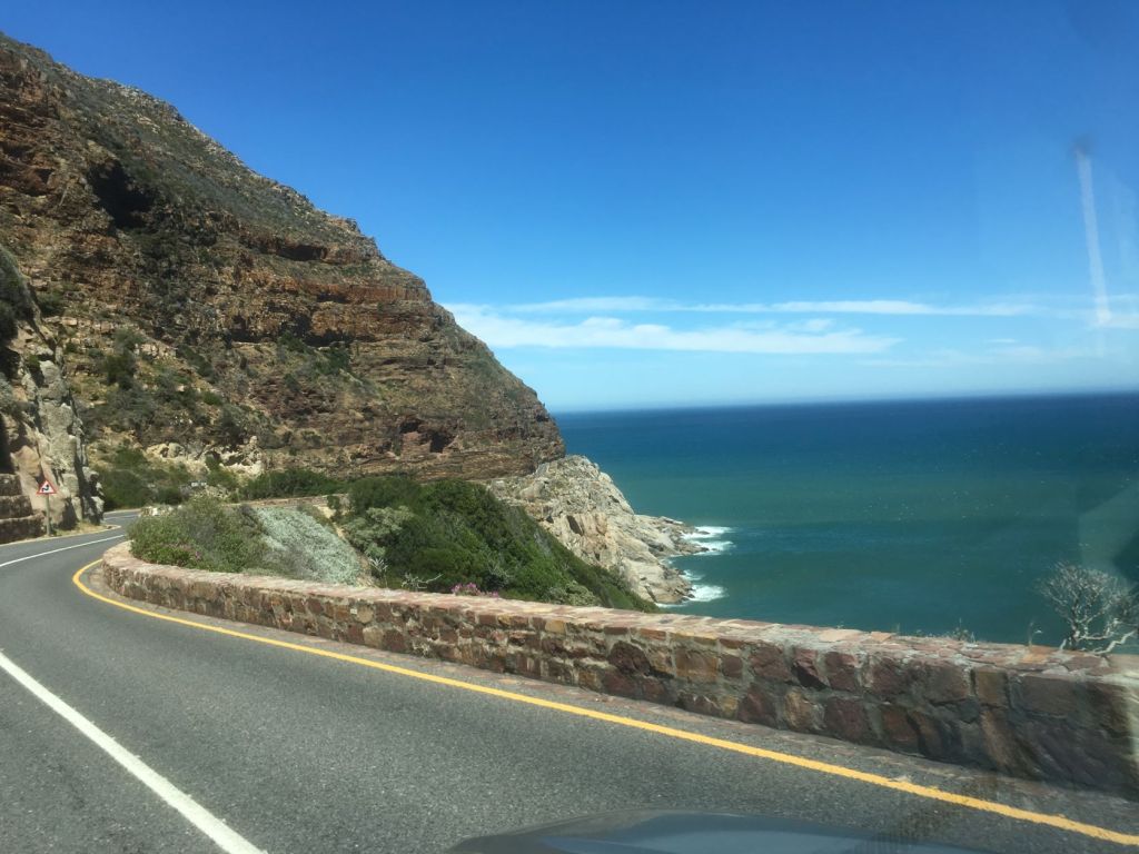
Chapman’s Peak Drive is 9km/5.6 miles long and has 114 curves. On the one side you have a panoramic view of the Atlantic Ocean and on the other the Western Mountains of the Cape Peninsula.
Chapman’s Peak Drive is a toll road (for travelling between the towns of Hout Bay and Noordhoek). Although, part of the drive is for free (like making use of the designated picnic areas, viewing spots and mountain trails, before reaching the Day Pass Control Point).
In 1962 the road was widened and in 1977 a portion of the road was washed away resulting in a bridge to replace the damaged section.
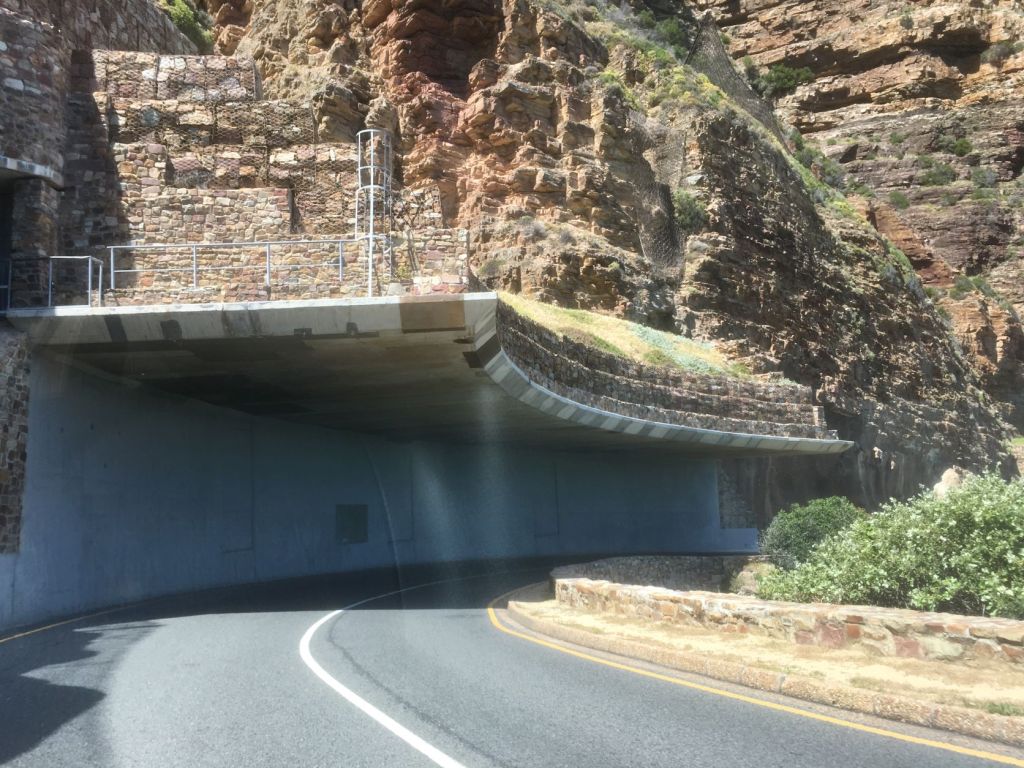
However, between 1998 and 2000, four deaths and several serious injuries occurred from rock fall incidents. The road was then closed to the public in order for suitable rock fall protection measures to be implemented.
Half tunneling, rock shelters and catch fences were brought into place to protect motorists from falling rocks. In 2003, Chapman’s Peak was re-opened to the public and heralded as a great success, enabling tourists and locals to once again experience the beauty of this drive.

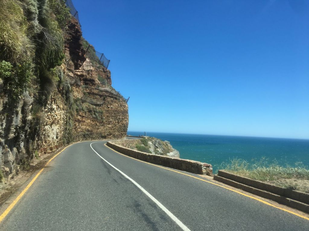
Chapman’s Peak is certainly one of the most picturesque drives we have ever experienced. Should you ever visit Cape Town, don’t miss the opportunity to enjoy this scenic drive!

Just gorgeous. Thanks for the road trip. Mel
LikeLiked by 1 person
It’s really beautiful … thank you for coming along Mel!
LikeLiked by 1 person
Corna, jy sal nou nie glo hoe tydig hierdie post van jou was nie. Ons het 3 nagte in Desember hierdie jaar om in Kaapstad te spandeer terwyl ons met n lekker Kaapse draai na Marilize se ouers in Jeffreysbaai reis, en ons het net hierdie afgelope naweek besluit om een dag opsy te sit vir Chapman’s Peak en Houtbaai (van waar ons ook n boottoer na Duiker Eiland gaan doen). Na hierdie blogpost van jou water my mond behoorlik!
LikeLiked by 1 person
Dit klink mos nou na ‘n heerlike vooruitsig! Ek se altyd, ‘n besoek aan die Kaap is nie volledig as jy nie ten minste net die eerste gedeelte van Chapman’s Peak gery het nie (waar jy nie hoef te betaal nie) en ‘n broodjie eet terwyl jy die ongelooflike uitsig geniet! Julle neem dit sommer nog ‘n ekstra lekkerte verder met die boottoer! Ek sien (nou al) uit na julle mooi foto’s!
LikeLiked by 1 person
Ek wens ook al hierdie laaste paar maande verby!
LikeLiked by 1 person
Verseker een van die mooiste asem-wegslaan plekke in ons land. ♡ Dankie vir hierdie mooi stukkie en ongelooflike prag fotos. ♡
LikeLiked by 1 person
O ja, die uitsigte hier is beslis asem-wegslaan! Dankie vir die inloer Lolla en jou mooi kommentaar. Lekker dag 🌸.
LikeLiked by 1 person
100 jaar oud! Sjoe, jy kan darem maar regtig mooi foto’s neem!
LikeLiked by 1 person
Baie dankie Toortsie, soos ek altyd se, dis nie moeilik om mooi foto’s van ‘n pragtige omgewing te neem nie 😉. Ek was verbaas om te lees dat Chapman’s Peak 100 jaar oud is – die pad lyk so goed … maar dan onthou mens die 3 jaar lange opgradering. Hulle het die rylaan so mooi gemaak, dis ‘n plesier om daarlangs te ry!
LikeLiked by 1 person
Hulle het darem seker altyd mooi na die pad gekyk. Ja, die omgewing is mooi, maar jy het die oog.
LikeLiked by 1 person
Baie dankie Toortsie 🌸.
LikeLike
Aah, breathtaking views. I can’t wait for the next time, it’s just not soon enough ☺️Your post really helped. Thank you for sharing Corna🌸💕
LikeLiked by 1 person
Yes Henrietta, this is such an awesome drive to do on a sunny day – the views are just so beautiful! I hope you don’t have to wait (too) long for the next visit … thank you for reading and your lovely comments 💌.
LikeLiked by 1 person
Wow, what a truly fascinating place to go for a drive, it can easily be featured as one of the world’s most scenic drives! I love those steep cliff faces and stunning views over the vast waters! Thanks for sharing and have a lovely day 🙂 Aiva xx
LikeLiked by 1 person
Thank you Aiva … yes, it is a really wonderful drive along the coast – the views are amazing (especially on a sunny day)! It surely must be under the top 10 scenic drives in the world (but maybe I’m just biased 😊). Have a great week.
LikeLiked by 1 person
🥰🥰🥰
LikeLiked by 1 person
Both Chapman’s Peak Drive and Hout Bay look divine Corna, more places to add to my Cape Town wish list! Thank you for introducing me to these lovely beauty spots. Hope you are enjoying pleasant autumnal weather. I’ve now brought out my summer dresses and finally put my duvet coat away here!
LikeLiked by 1 person
You must certainly add these places to your Cape Town wish list Marion … no visit to Cape Town will be complete without a visit to Chapman’s Peak Drive! The problem … there are many more beautiful places around Cape Town, you will need a LONG holiday 😉. Hooray for summer dresses! We have indeed great autumn weather – the afternoons tend to get a little bit chilly, but at least the sky is blue and the sun is shining!
LikeLiked by 1 person
That looks a fabulous drive, especially for the passenger(s) 😀
LikeLiked by 1 person
It’s a great drive … but you’re probably right, I much more prefer to be the passenger 😁.
LikeLiked by 1 person
It’s such a beautiful drive, just look at those beaches!
LikeLiked by 1 person
The drive is indeed fabulous … but oh, those beaches! We are fortunate to have so many white sandy beaches … can’t wait for summer again 😉.
LikeLike
Jou fotos is pragtig en jou inligting heerlik om te lees.
LikeLiked by 1 person
Ah, baie dankie Una 😊. Die mooie Kaap is naby aan ons harte – daar gebly vir 20 jaar en nog steeds is daar baie wat ons nog nie gesien het nie (en ander plekke wat ons weer en weer wil besoek).
LikeLike
Jou foto’s is pragtig Corna! Ons geniet dit altyd om daar te gaan ry, maar het nog nooit al die draaie getel nie! 😅🤣 Ons stop elke keer by die uitkyk plekke en word net nooit moeg vir die pragtige uitsig nie! Die strand is ook nie altyd waar ons kom nie, my man het ‘n baie sensetiewe vel en kan nie lank in die son wees nie. Dis sowaar alweer tyd dat ons weer daar moet gaan ry!
LikeLiked by 1 person
Baie dankie Aletta! Ons het ook nog nooit die draaie getel nie (maar Google vertel graag wat ons nie weet nie 😉). En ons stap net op Houtbaai se strand as daar nie te veel mense is nie – met ander woorde, nie in die somer nie! Ja, Chapman’s Peak is ‘n plek waar mens weer en weer kan gaan ry sonder om ooit moeg te word vir die asemrowende uitsigte, ne!
LikeLike
Ek stem saam!
LikeLiked by 1 person
I can see why the drive is so highly rated, so dramatic at every turn it seems. Sadly I don’t do too well with short curves on the road, but if ever such a drive was worth it. I don’t have an adjective that hasn’t already been used to describe the beaches, just… (insert unique adjective here). Love the ups and downs of the peaks that frame Hout Bay.
LikeLiked by 2 people
Just make sure you sit in the front passenger seat when you start this drive … or even better, that you’re the one driving! The views are so amazing that you will (hopefully) soon forget about the many curves in the road ☺️. Yes, our South African beaches are absolutely beautiful (I’m also sometimes running out of words to describe its loveliness) – that’s the place you want to be … even on a (sunny) winter’s day!
Thanks for taking the time to read about our latest trips, enjoy the rest of your week and take care.
LikeLiked by 1 person
Stunning scenery! All the turns on the scenic drive make me think of the road to Hana in Hawaii. Thanks for sharing!
LikeLiked by 2 people
Thanks Tricia 🌸. Oh, I will then have to visit Hawaii to experience that road! Thank you for reading and taking the time to post a comment. Hope you’re having a great week!
LikeLiked by 1 person
It’s a beautiful drive with lots of hairpin turns; but well worth the effort. I hope you’re having a great week too. Our close friends from the US are arriving today; we’re looking forward to spending time with them!
LikeLiked by 1 person
What a wonderful prospect of seeing your friends again! I’m sure you have so many things you want to show them – enjoy!!
LikeLiked by 1 person
Many, many years ago I took my mother to South Africa and I remember taking a tour that went to Hout Bay. It was a beautiful day such as the one you had and it was just lovely. Thank you for a wonderful memory!
LikeLiked by 2 people
I’m sure that Hout Bay (well, the beach at least) and Chapman’s Peak Drive still looks the same as what you’ve experienced it many years ago Carolyn ☺️. And you’re absolutely right, when it’s a lovely sunny day (which it is most of the time), it’s amazing to explore this area! I’m glad you enjoyed this post and that it brought back great memories!
LikeLiked by 1 person
Oh wow! I’m always blown away by the beauty in your pictures. Such a gorgeous place!
LikeLiked by 2 people
Thank you so much … I’m so happy you enjoyed this post 🌸. Chapman’s Peak Drive (and basically Cape Town surroundings) are beautiful and well worth a visit. From the sea to the mountains and from great coffee shops to wine farms – you’ve got everything here in very close proximity!
LikeLiked by 1 person
You got me at “great coffee shops” ☺️☺️☺️ I have noticed recently, that however much I love a neighborhood, or a town, or a city that I’m visiting, if I don’t find a nice coffee shop to sit in and to take everything in, I just feel like something is missing.
LikeLiked by 1 person
I totally agree with you! To spent a Saturday morning at a coffee shop is definitely one of my favourite things to do … and if there’s a view, even better!
LikeLiked by 1 person
Chapman’s Peak Drive looks super scenic. I love all the narrow winding roads (assuming traffic isn’t bad). The views along the way are just jaw dropping and gorgeous.
LikeLiked by 2 people
Absolutely Linda, this is one the most scenic and iconic drives one can do in the Cape Town area. Now that I’m thinking about the traffic … we never had problems with long queues of cars on Chapman’s Peak Drive – if you want to stop and admire the views, there are parking space at the viewpoints to stop and let traffic pass.
LikeLiked by 1 person
I wanna do that drive NOW!
LikeLiked by 2 people
It’s a really great drive … probably even better while sitting at one of the viewpoints watching a sunset. Oh, now I’m a bit romantic ☺️.
LikeLiked by 1 person
What a gorgeous drive I can see why it’s on the Scenic Drives list. The pictures from Hout Bay are gorgeous! Maggie
LikeLiked by 2 people
Thank you Maggie. We love this drive – especially on a sunny weekend! Hout Bay is certainly a lovely place to visit – especially while enjoying fish and chips on the beach!
LikeLike
What a beautiful place! I would be uncomfortable going under that half tunnel.
LikeLiked by 2 people
Yes, I love Chapman’s Peak Drive … or rather the views! The drive can be a bit intimidating (and fortunately the half tunnel is only 155m). But for those views, it certainly is worth it to drive!
LikeLiked by 1 person
Gorgeous! Reminds me of the Amalfi Coast.
LikeLiked by 1 person
We have seen some pictures of the Amalfi Coast before and I remember we then said, if we have to compare it with something we know, it must be our own Chapman’s Peak Drive 😊. But it would be great to experience the Amalfi Coast ourselves …
LikeLiked by 1 person
Wow! I can see why this is called one of the most scenic in the world. It’s beautiful!
LikeLiked by 2 people
Thank you Diana ☺️. Yes, I think this must be on our top 10 list of scenic drives … really beautiful (even more so on a sunny day)!
LikeLiked by 1 person
114 curves?! Wow! In some ways, this reminds me of Pacific Coast Highway in the area of Big Sur, California. What a lovely drive, Corna! I’m adding it to my must-see list when I visit you & Berto! 😁🌞😘
LikeLiked by 1 person
Well, then I would certainly enjoy the Pacific Coast Highway! That’s right … add that to your list, you’re going to need a LONG holiday in order for us to show you all the beautiful spots 😄.
LikeLiked by 1 person
😁
LikeLiked by 1 person
Thanks for this gorgeous drive, each view a new landscape. I would be terrified to be the driver, but would ride along if someone else would!
LikeLiked by 1 person
I’m glad you enjoyed this drive Ruth ☺️. It is one of the most beautiful drives in South Africa … and yes, I’m always happy to be the passenger!
LikeLiked by 1 person