
We all have these photos … throwback photos!
It’s described as ‘nostalgia-inducing pictures … from a different era of your life”.
Every Thursday we will throw a few photos of ‘way back when’ on our blog. Why on a Thursday? Because it’s just a day away from the weekend … and we love weekends!
You are welcome to join in or just enjoy the photos (#TB Thursday).
Table Mountain National Park, Constantia Nek – Western Cape Province (October 2013)
Some of you may remember that in last week’s TB Thursday post we hiked in hot weather to see the Second Waterfall in the Jonkershoek Nature Reserve. Only … we didn’t see any waterfall. However, this did not discourage us from taking on a very steep hike up Constantia Nek the following weekend. And this time we hoped to see some of Table Mountain’s dams.
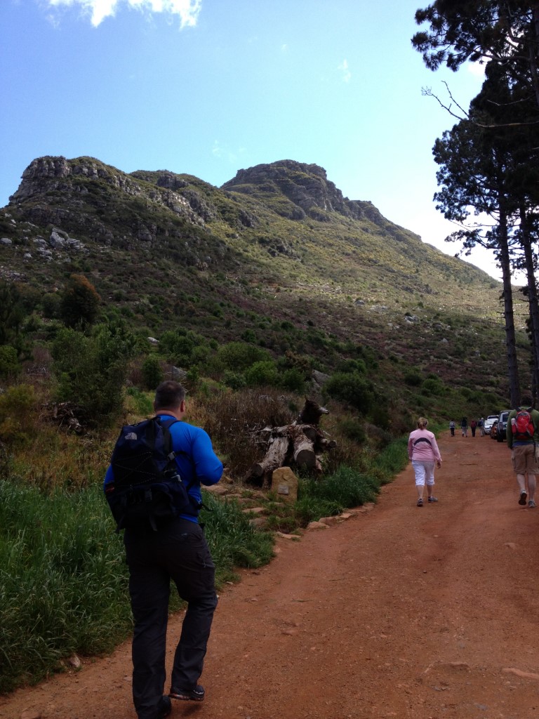
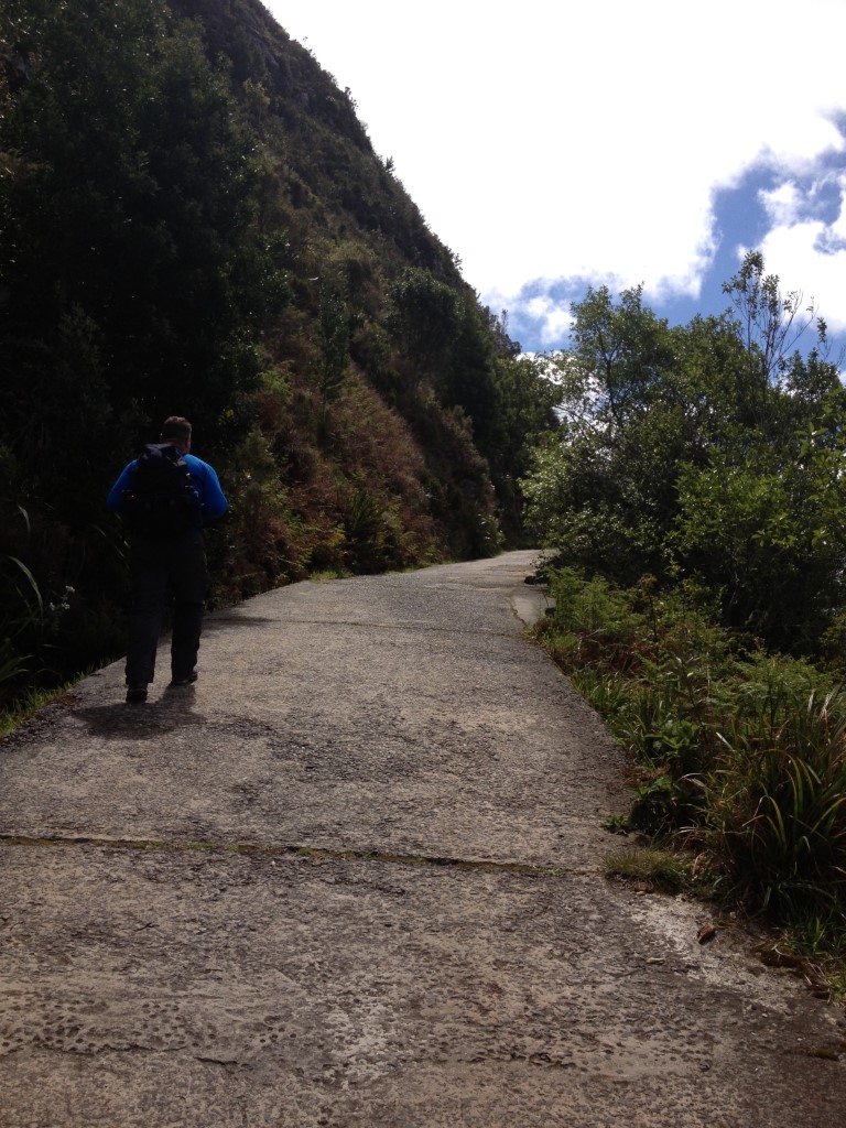
As soon as we left the parking area, it was already steep
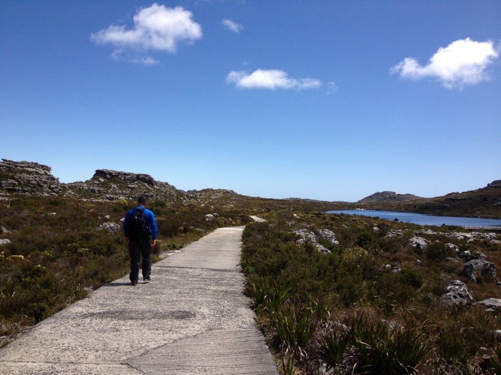
Constantia Nek is a very popular walking route up the south-east corner of Table Mountain. It starts on the forestry road and then winds its way to the top of the mountain. But don’t be fooled that it will be easy, because the route starts at 210m and will take you to 720m in just 5km. The good news is that the trail will level off once you’re on top of the mountain.
A steady climb at the start
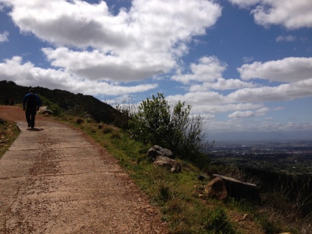
Halfway and lovely views towards Hout Bay and False Bay
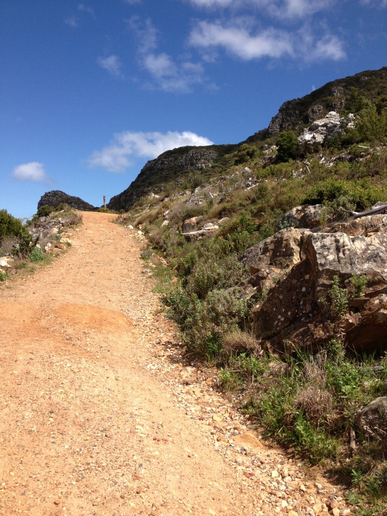
The second part of the route is quite challenging and there are some short but very steep sections. I remember Berto saying a couple of times “we’re almost there” and I’m like “we better or I’m going to pass out”!
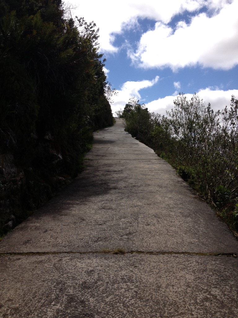
Steeper and steeper
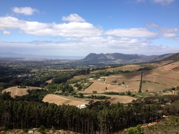
After reaching the top, we stopped for a while to catch our breath and enjoy the amazing views.
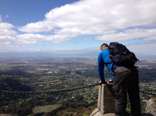
Berto rests while enjoying the views
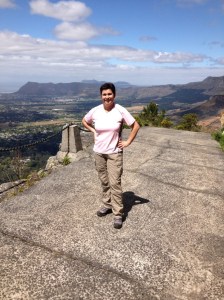
I put on a brave face after the steep climb
Looking back – around that corner the trail literally drops down into the valley
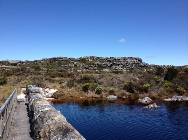
When we could breathe normally again, we walked towards the dams. We walked past the smallest dam, the De Villiers Dam and then followed the road to the Alexander and Victoria Dams.
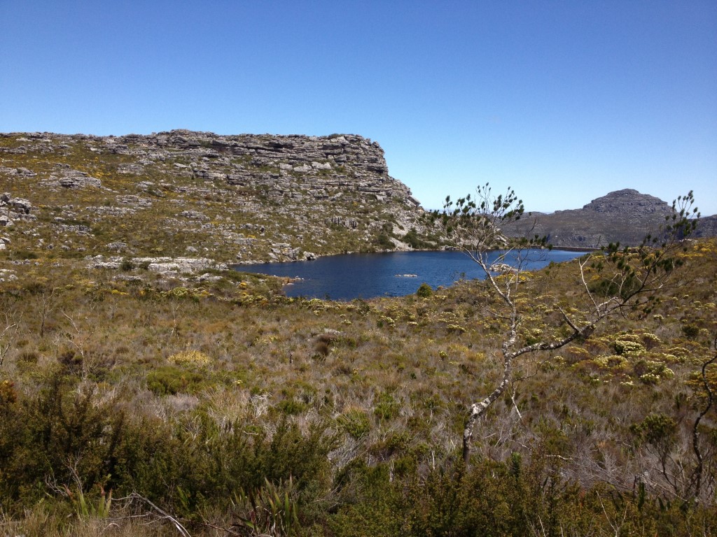
Alexander and Victoria Dams
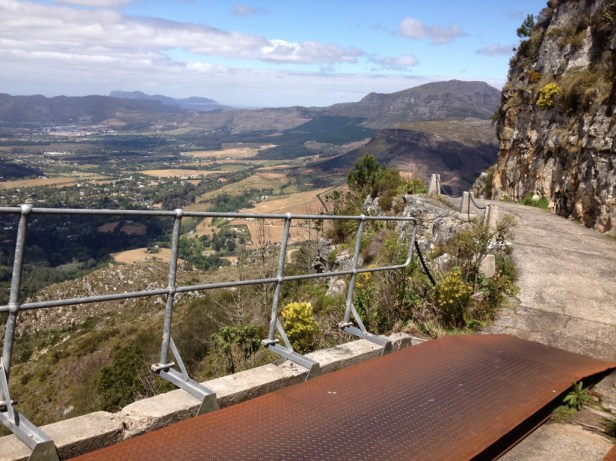
A little bit further down the road, we found the larger Woodhead and Hutchinson Dams. It was nice to walk along each dam wall.
A walk along the dam wall
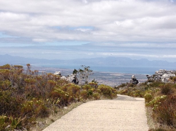
It was here that we reached the end of the paved path (* although nothing stops you from walking further to the upper cable station). But we decided to turn around here as our car was parked at Constantia Nek. It was also a good time to stop and get out our small hiking stove to make hot cappuccino.
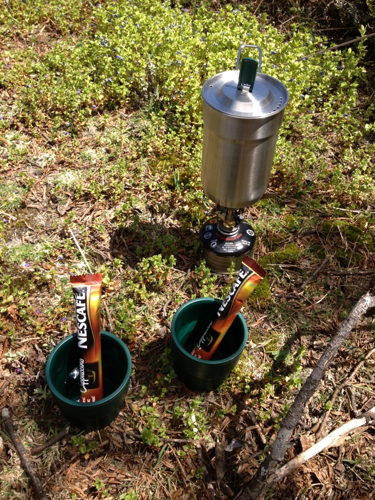
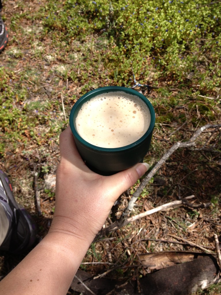
Cappuccino on the trail
After enjoying a sandwich and cappuccino, we walked the same way back down the mountain. On the way back, we walked past an overnight hut and made a note that we might have to stay here one day when we hike one of the longer trails.
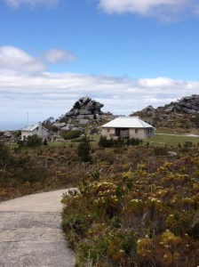
Overnight hut
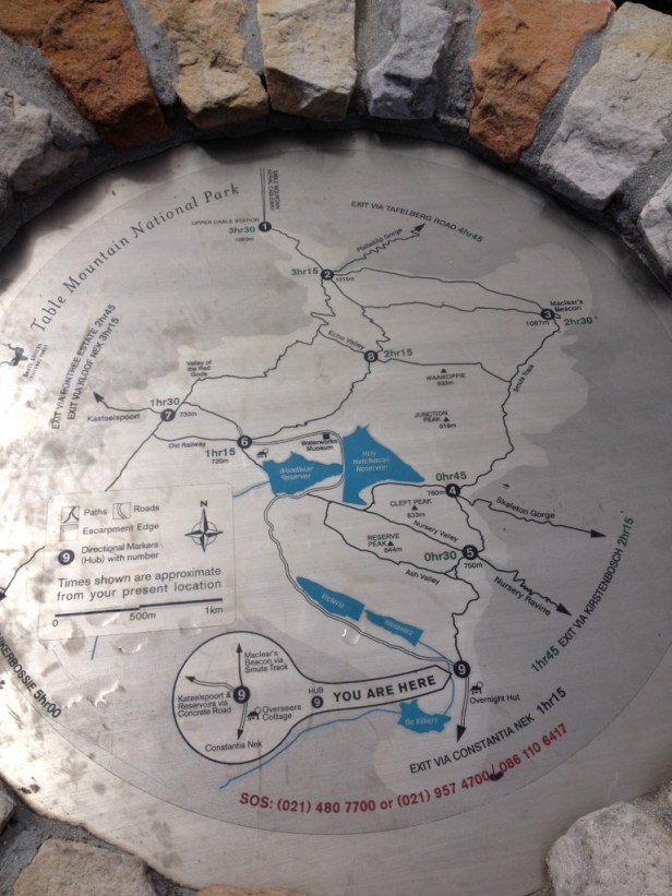
A map close to the overnight hut of the different trails
Although it was a challenge to walk up the mountain, it didn’t mean that it was so easy to walk back down. It’s hard on one’s knees and I think if it’s wet, this can be quite difficult. Lucky for us, it was a sunny day and we arrived safely back at our car.
The last flat section of the route before we walked back down the mountain
Note 1: * In 2014 we walked from the upper cable car station and finished the hike at the bottom of Constantia Nek. You are welcome to read the full hike here.
Note 2: We are going into the wild for the next few days. As soon as we’re back home, I will be active on the blog again.

Sjoe, dit lyk lekker! Ek was nog net op Tafelberg, en dink nie regtig stap is lekker nie, maar, jy sal my oortuig met hierdie foto’s
LikeLiked by 1 person
Ons is baie lief vir stap (my ouers het ons kleintyd baie laat loop, dis seker hoekom 😉). Dis ongelooflik om te sien hoe dit bo-op Tafelberg lyk … ‘n mens dink altyd dis plat, maar dis eintlik die teendeel.
LikeLiked by 1 person
Ek stem, dit is alles behalwe
LikeLiked by 1 person
Looks like a tough hike, but well worth it for the views, which are all stunningly beautiful. Lovely memory Corna!
LikeLiked by 1 person
Yes, although the distance is very short, it is very steep. But one is rewarded with such wonderful views … and that’s when I forget how difficult it was to get to the top 😁.
LikeLiked by 1 person
I was thinking that I’d love this walk, but not sure about the coming down again. I find that harder than going up these days. On firm track though I might be alright. Enjoy your time in the wilds!
LikeLiked by 1 person
You’re right Jo … I think if there were loose rocks on the path, the descent would have been very difficult. But because it’s paved, it’s actually relatively easy. Thank you, we had a great time in the wilderness – hope to share all the beauty with you soon.
LikeLiked by 1 person
Only you two would drag up a camping stove to have a cappuccino on a day hike! Looks beautiful, I’ve always wanted to hike in Table Mountain area. Maggie
LikeLiked by 1 person
Haha 😄, it’s that very cappuccino on top of the mountain that kept me going! Table Mountain has so many hiking trails and the views are incredible … I think ‘adrenaline junkies’ like you two will really enjoy hiking in this area!
LikeLiked by 1 person
Lovely views from the way up and from the top
LikeLiked by 1 person
Oh yes, one can hardly get enough of all those beautiful views!
LikeLiked by 1 person
Fantastic, you’re very lucky to have this on your doorstep (that’s doorstep in a worldwide sense). When we originally drew up our wish list for retirement travel, Cape Town and Table Mountain were right near the top of our list. They’re still waiting to be ticked.
LikeLiked by 1 person
One forgets how privileged you are to have this beautiful mountain with all its hiking trails on your doorstep, until the day you no longer lives there. Table Mountain has so many amazing trails – I think it’s something you two will really enjoy!
LikeLiked by 1 person
Beautiful, this is somewhere I definitely want to visit. A lovely hike and tremendous views Corna.
LikeLiked by 1 person
Marion, I think you will really enjoy Cape Town. Just taking the cable car to the top of Table Mountain is an amazing experience. I sure hope you get the opportunity one day.
LikeLiked by 1 person
I do hope so too Corna.
LikeLiked by 1 person
Looks like a view that’s worth the climb! Enjoy your trip!
LikeLiked by 1 person
Yes, you will definitely enjoy it … actually, I think as adventurous as you are, this climb will not be difficult at all! Thanks, we really enjoyed our trip – hope to share it with you soon (there are just SO MANY photos to go through)!
LikeLiked by 1 person
I attempted to write comments on the earlier post you mentioned but there was a hiccup so they may not have registered. It was lovely to see pictures from the top of Table Mountain and that seems like another pretty challenging hike. Sometimes I think walking on a path is more exhausting than clambering over rocks though admittedly I have never done a great deal of that! Yay Nescafe. How neat to have that little stove.
LikeLiked by 1 person
The views from the top of Table Mountain are amazing – I could never get enough of that! But you’re right, although the trail is very short, it’s quite challenging … but then, little kids do it (isn’t it amazing how much energy a child can have 😄). I really love tea, but when we go for a hike, we always pack the Nescafe – it’s at its best when you can enjoy it in nature! At the moment our hiking stove is still in Langebaan, but it will be the first thing we pack when we visit again (we missed it a lot this past weekend)!
LikeLike
These are such fantastic photos, Corna! Nothing comes close to climbing a towering mountain and looking down into valleys, over clouds and across great expanses of land. Thanks for sharing and have a good day 🙂 Aiva xx
LikeLiked by 1 person
I’m glad you enjoyed the photos Aiva. And you’re right, the views from the top are absolutely stunning … it makes the hard work to get to the top worth it! May you enjoy a wonderful week 🌸.
LikeLiked by 1 person
Oh my goodness I remember doing that walk so many times before my ankle really gave in… That steep climb, feeling out of breath, the stunning views that made it all worthwhile, and then…. That steep descent! And wobbly knees. Sjoe! But still worth it.
LikeLiked by 1 person
Oh Morag, it’s so nice to read that you understand how one feels when you conquer Constantia Nek 😃. You describe it exactly how I always felt when we walked there. But as you say, it’s all worth it when you get to the top and enjoy the beautiful views!
LikeLiked by 1 person
Sounds like a really tough hike but worth it for the views. Glad you and Berto made it down safely; it sounds like it could be dangerous!
LikeLiked by 1 person
It can definitely be dangerous when it rains (I think there’s a notice somewhere warning you not to walk there when it’s wet – or at least to be very careful). But on a sunny day it’s lovely to stand on top of Table Mountain and admire the views … that is until you have to walk back down there on wobbly knees!
LikeLiked by 1 person
Lyk my daai steiltes sal n mens se hart beter toets as enige EKG wyl jy op n “treadmill” draf! Gelukkig is die uitsig 1000x beter as die binnekant van n doktersspreekkamer!
LikeLiked by 1 person
Haha, dis ‘n goeie een Dries 😅. Jy’s heeltemal reg, ek kyk eerder die pragtige uitsig met ‘n vinnig kloppende hart vanaf die berg!
LikeLiked by 1 person
Oh wow aren’t old photos the best to go back and look at? You tried your best to get that perfect shot knowing that buying and processing film would cost you. Never really sure what you had until you got those photos printed. A different time for sure!
LikeLiked by 1 person
I love looking through our old photos. It sometimes also reminds me how much energy I had quite a few years back 😉. You’re absolutely right, today one takes 10 photos of a stunning view, but years ago you had to aim and aim well to get that one perfect photo!
LikeLiked by 1 person
Ek sou maar swaar gekry het met hierdie staptog van julle, Corna. Veral die knieë!
LikeLiked by 1 person
As ek nou daaraan dink dat ons hierdie roete 10 jaar gelede vir die laaste keer gestap het, wonder ek hoe dit sal gaan as ons nou daar moet uit! Hierdie roetes is een van daai waar ek nie weet of op of af die beter ene is nie 😁.
LikeLiked by 1 person
Julle het darem al op die mooiste plekke gestap! Dis so pragtig van daar bo af!
Julle moet julle wegbrekie geniet!
LikeLiked by 1 person
Ja, dis wonderlik hoeveel mooi plekke ‘n mens sien wanneer jy jou stapskoene aantrek … en daar is nog so baie wat ons wil gaan verken 😉. Dankie, die paar dae in die berge was ongelooflik lekker (alhoewel die reen ons so bietjie gekortwiek het). Ons is bly om veilig terug te wees by die huis – veral as ek hoor hoe die stormweer oor die Wes-Kaap gewoed het!
LikeLiked by 1 person
Ek het gewonder of julle kon gaan. Het julle baie reën gehad?
LikeLiked by 1 person
Ons was in die Baviaanskloof, maar moes Sondag halfpad omdraai omdat dit toe begin het om hard te reen. Die N2 was nogal ‘n nagmerrie om te ry – soveel bome wat tot op die hoofpad omgeval het. Gister het dit nog heelwat hier in Oos-Londen gereen en lyk my vandag ook … hopenlik skyn daar weer bietjie son van more af.
LikeLiked by 1 person
Ja die reën was erg hierdie naweek, bly julle is veilig by die huis. Vandag is dit ‘n pragtige dag!
LikeLiked by 1 person
Certainly rewarding once you get to the top – walking by the water is always such a tranquil and calming experience. I’ve often found the walk down after a particularly steep climb to be even more difficult. As you say it’s hard on the knees and can be easy to lose one’s footing. I do love the portable little stove and the snack break after a challenging hike. Hope you are enjoying your time in the wilderness!
LikeLiked by 1 person
Sometimes it’s good that you don’t always know what lies ahead, right? I’m not so sure I would have walked up Constantia Nek so diligently if I had known it was so steep 😄. We missed our hiking stove this past weekend, but we’ll bring it with us next time we go home again. Thank you so much Leighton, it was a challenging weekend … but incredibly beautiful. We will tell you about this soon.
LikeLiked by 1 person
That’s a lot of elevation gain, but I’m sure the nice views along the way provided great motivation to keep going. Naturally the view from the top was the best, and you got to see the dams.
LikeLiked by 1 person
Yes, the surprise was definitely to see the lovely dams on top of the mountain! When a hike starts steeps, you usually know it will be hard work to get to the top 😉. But like you said, all worth it!
LikeLiked by 1 person
Looks like a fabulous walk. Steep uphills certainly have you puffing, but I find it harder on the knees and hips going down nowadays so I use walking poles to help. Cheers
LikeLiked by 1 person
I agree – downhill is definitely harder on the knees. And we never walked with walking poles before, but used them for the first time this year – and will definitely do so in the future!
LikeLiked by 1 person
We’ve been using them since our guide in Nepal recommended them. Take at least one now on most walks of intermediate standard or harder. Cheers
LikeLiked by 1 person