
Western- & Southern Cape (Malgas, Witsand & Gourikwa Nature Reserve)
As we prepare for our next adventure starting soon, we’d like to take you to more of the beautiful places in and around Cape Town … trips we’ve enjoyed in the past.
Why don’t you join us for a quick road trip on some of the back roads in South Africa? In September 2019 we were invited to a friend’s birthday celebration weekend in Gouritzmond, a small coastal town in the Western Cape province, approximately 370km (230 miles) from Cape Town.
We spent the night in Bredasdorp, a lovely town in the Southern Overberg region and from here it was great to follow the dusty dirt roads (and not the main road, namely the busy N2) to reach Gouritzmond.

Malgas Pont:
I was specifically looking forward to our next destination, namely Malgas. It’s a very small village with a pontoon (often shortened to ‘pont’) that will take our car over the Breede River.
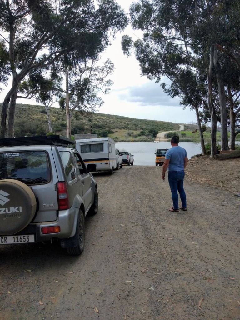
The pont can take a maximum of three cars (or 10ton cargo) over the Breede River. It is very unique in the sense that it’s the last hand drawn pont in South Africa, which is operated/pulled by men with shoulder harnesses and chains since 1860.
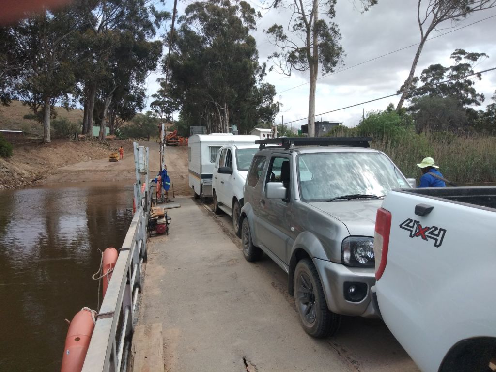
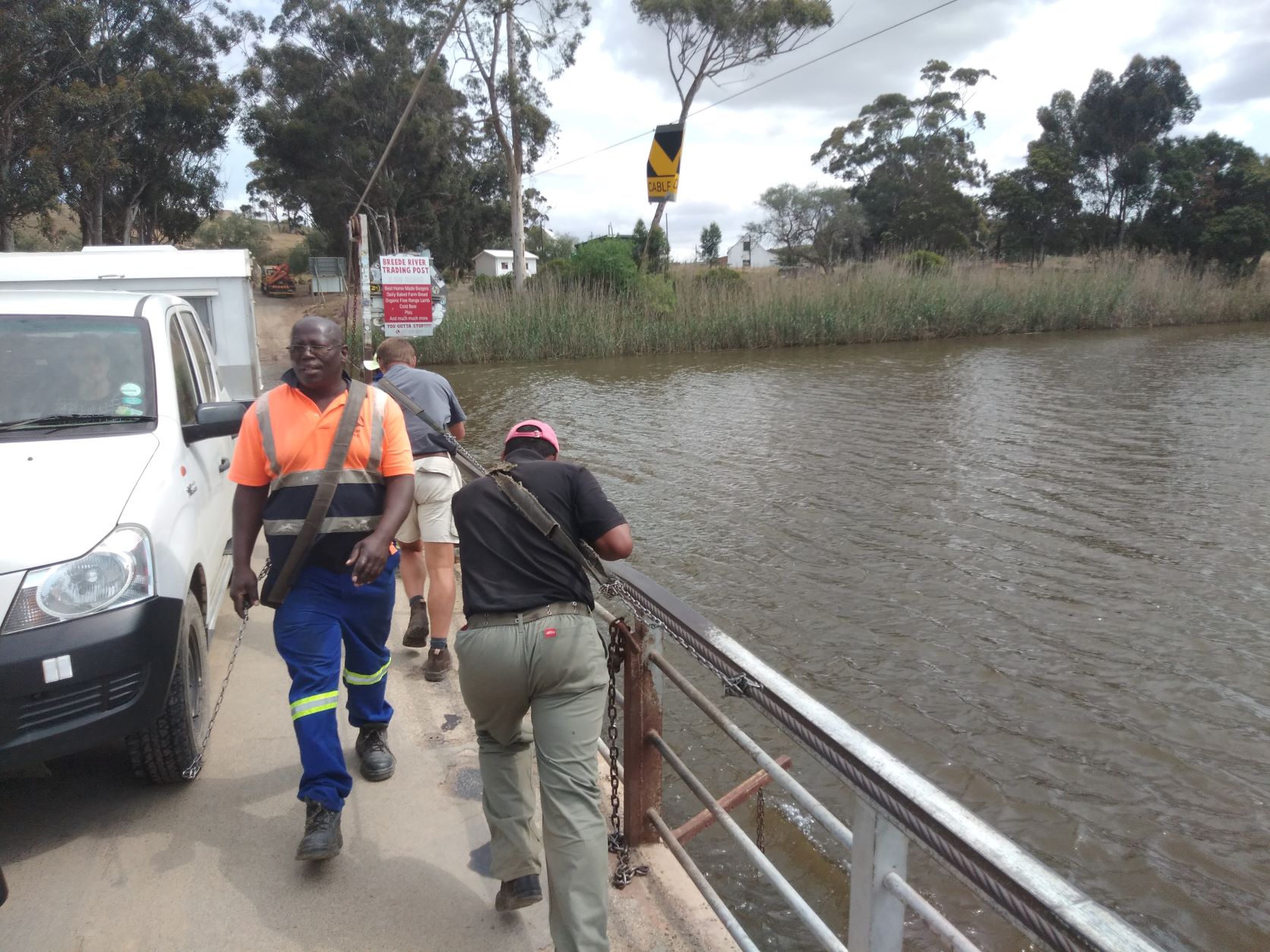
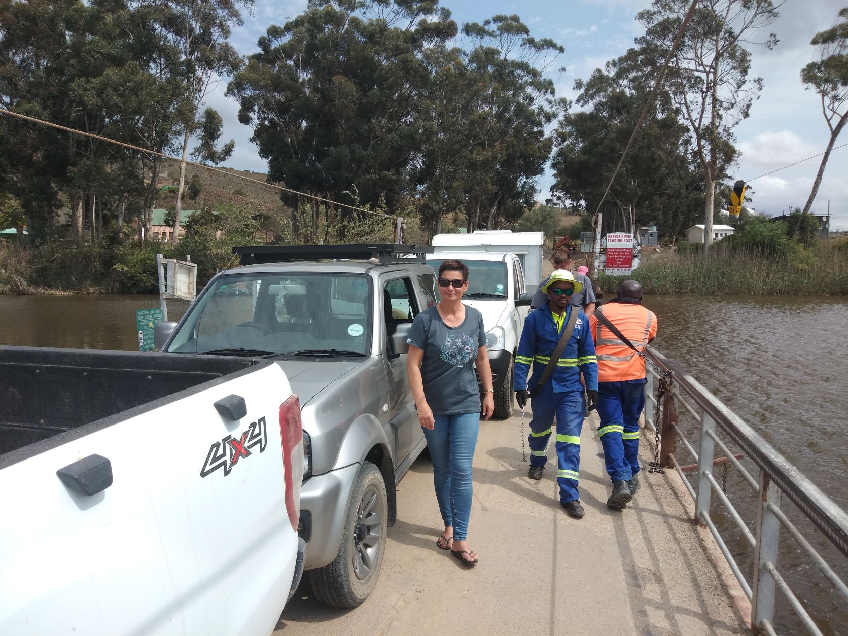
Keep in mind that the pont are only operating during daylight hours – from sunrise till sunset. To get the cars over with the pont, takes only a couple of minutes. But it’s such a delightful experience (and I loved the chatting going on between the pont staff and two young men that were also crossing the river with us … they actually jumped in and assisted the guys with the crossing).
(After some investigation we understand the ferry was motorised in December 2020. So it is clear that technology has also found its way to this remote place.)
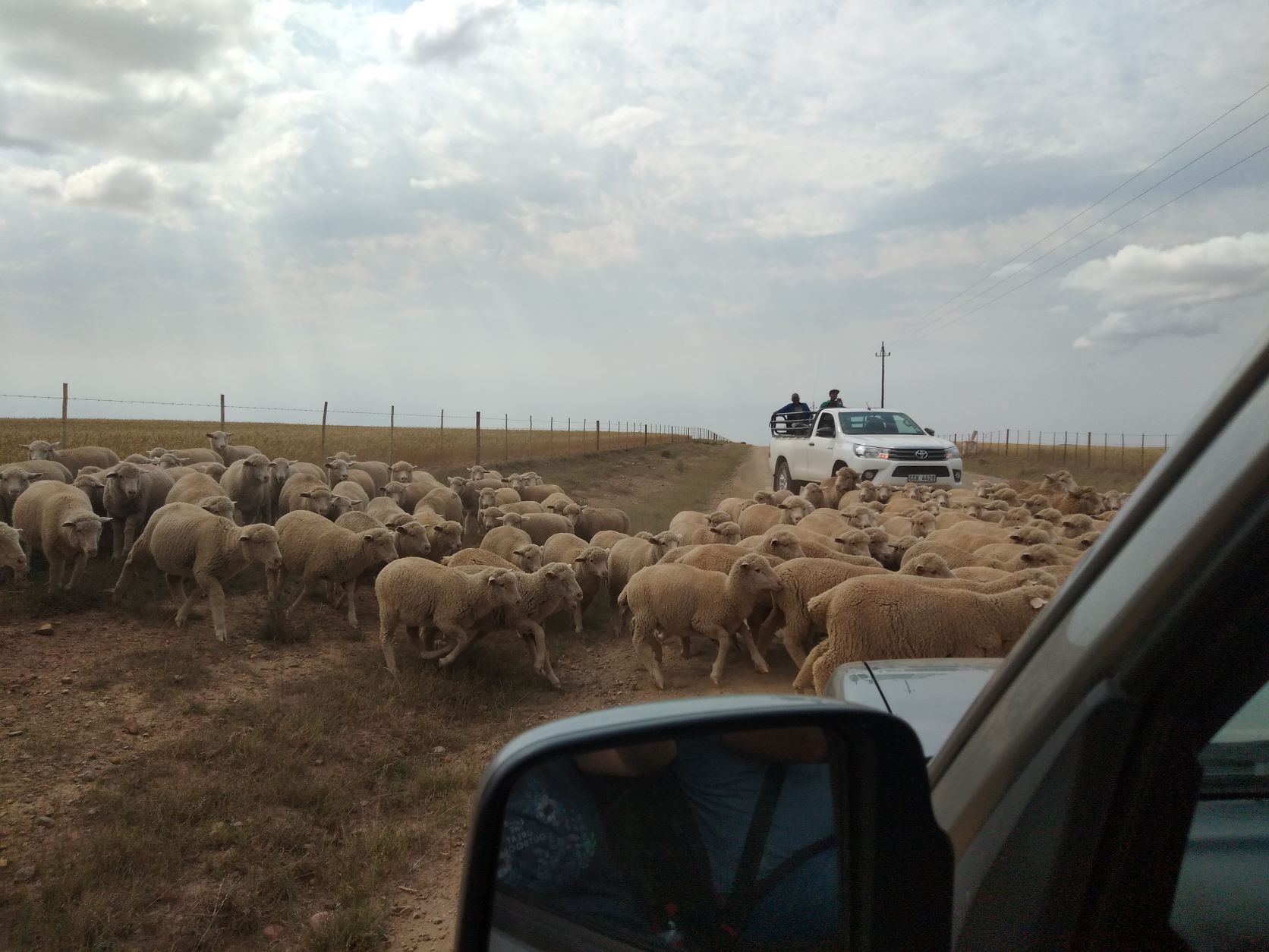
Traffic on farm roads:
We were now on our way to Witsand, situated at the mouth of the Breede River. To get there, we travelled on gravel roads snaking through the heartland of the Overberg farming community.
It was such a peaceful drive … worlds apart from the busy streets of city life … that was until we saw oncoming traffic – a farmer with his herd of sheep!

We thought it best to pull off to the side of the road and patiently waited for the sheep to pass us.

It was definitely a day to see animals (you will see more towards the end of this post). Before we entered Witsand, we saw a couple of zebras grazing in the fields next to the road.

Witsand:
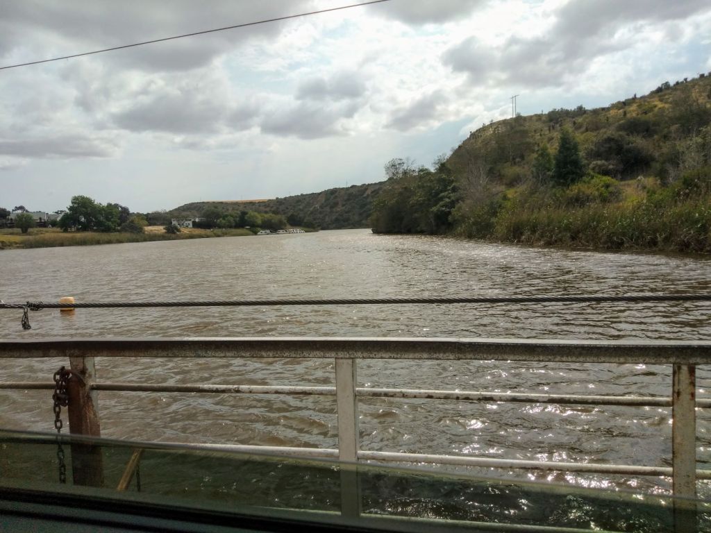
Around lunch time, we drove into Witsand. This is a small coastal town and situated at the mouth of the Breede River, also known as a good fishing area.
We stopped at the Barry Memorial Church, which was built by the Barry family in 1849. It’s an intimate rectangular whitewashed building with a sandstone façade, complete with a gable and thatched roof. This church is now a national monument and still in use for services and weddings.

There are (true) fishermen stories that some of the largest bull sharks were caught in the Breede River at Witsand … although no shark attacks on people have been recorded to date.
We stopped at a small café on our way out of Witsand where we bought a pie and coffee. The perfect place to enjoy these, were at a lookout point from where we could see the Breede River flowing into the ocean.
A place called Vermaaklikheid:
It’s not very easy to explain the name ‘Vermaaklikheid’ in English (‘vermaak’ would translate to ‘entertain’ … it could therefore be said that in English it’s called “Entertainment” … who wouldn’t want to live in a place with such a name)?

You can only reach Vermaaklikheid via gravel roads which means that not much has changed over the last 50 years for its residents. The area is a fynbos shrubland that has a temperate climate and more than 100 species of birds live here.
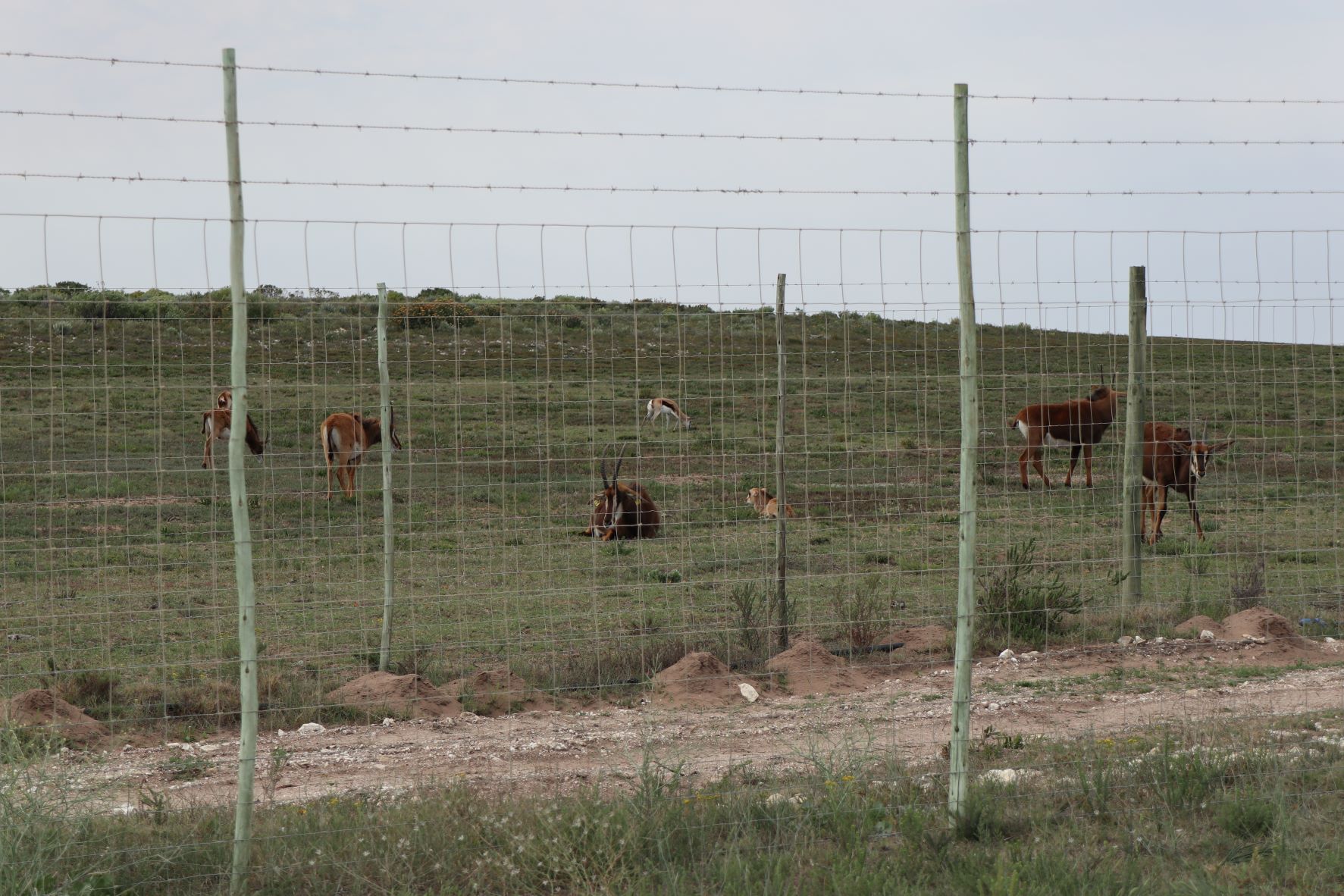
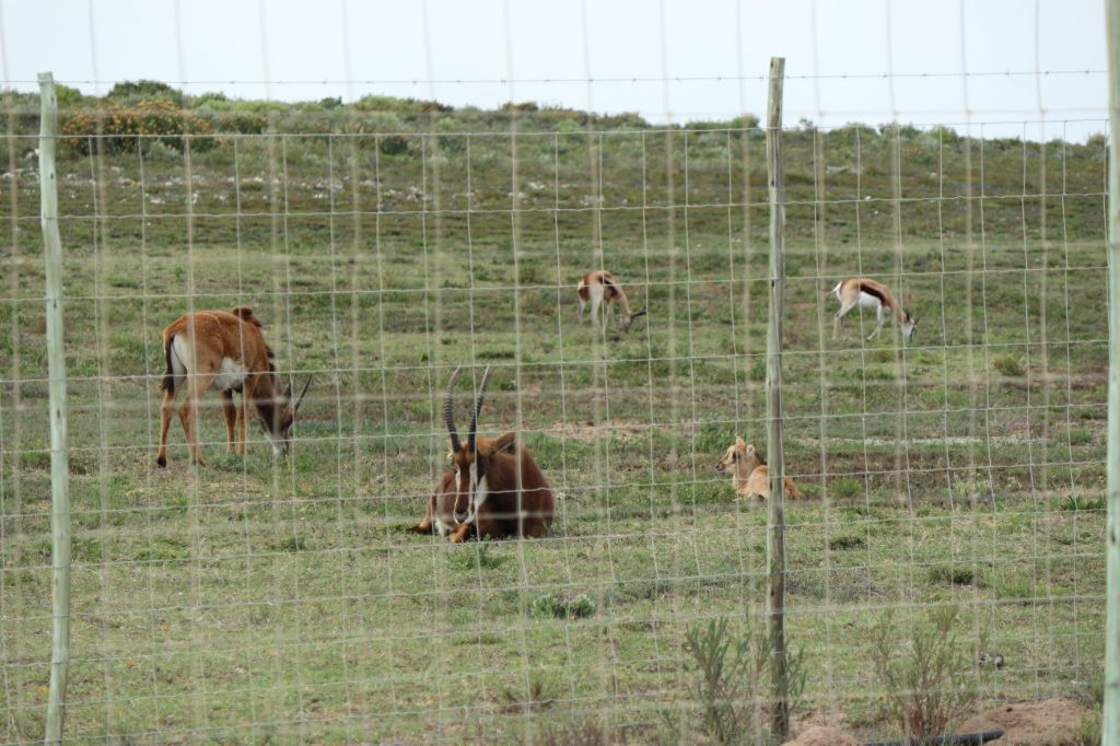
Gourikwa Nature Reserve:
Close to Gouritzmond, our final destination, the road took us pass the Gourikwa Nature Reserve. This nature reserve was actually once four farms before it became a nature reserve. Although we did not enter the reserve (another time hopefully), we were fortunate to see some wild animals close to the fence.
Here are just a few photo’s of our (unexpected) game drive:


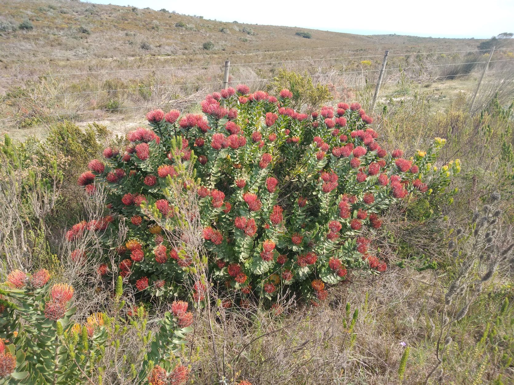
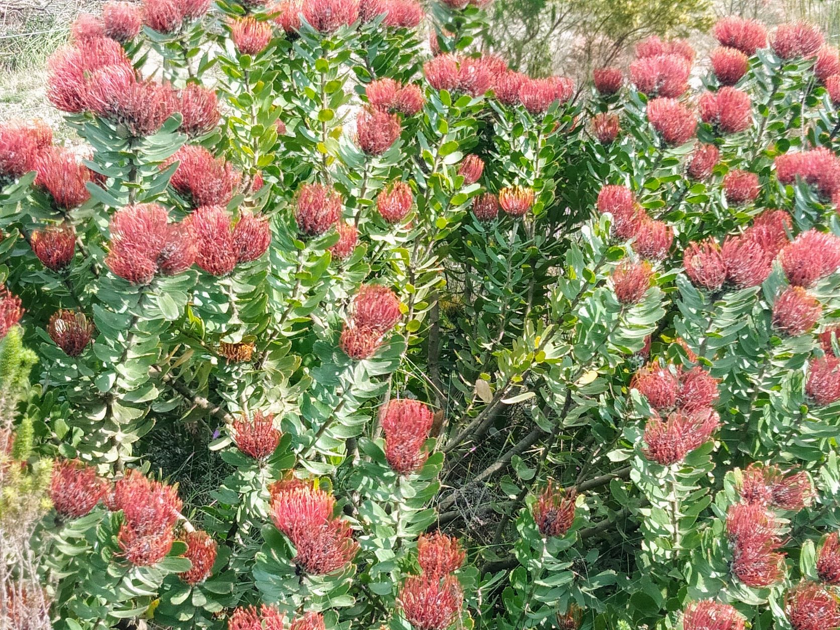
The fynbos shrubs next to the road was in such vibrant colours, that we stopped a couple of times to take some photo’s (and to smell them)!

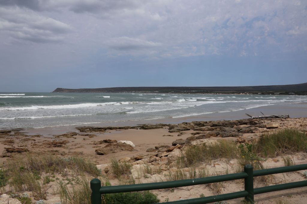
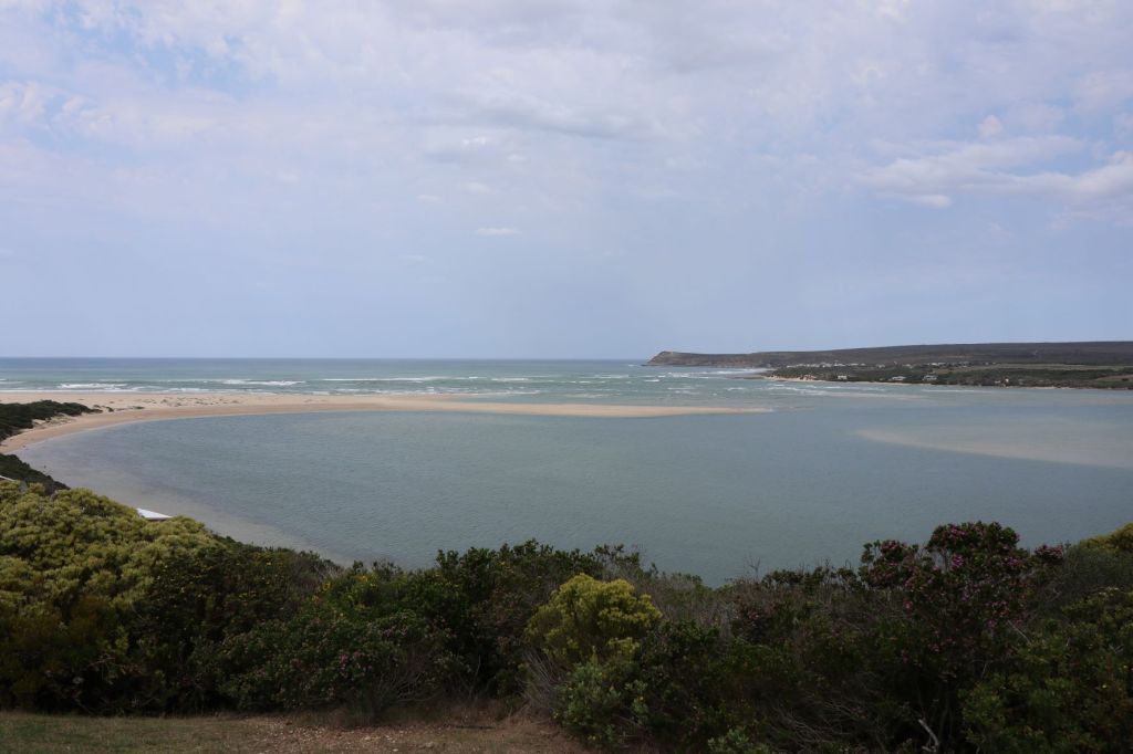
As we were nearing Gouritzmond, our destination, rain clouds started to gather. We were happy that we could see a part of our country we’ve not been to before in sunny weather!
We enjoyed a great weekend with our friends at Gouritzmond … and were happy that we took the dusty roads to get there.

You live in such a very beautiful country and it’s so nice that you have a partner who shares your passion for exploring.
LikeLiked by 1 person
Yes Carolyn, I’m sometimes amazed myself at all the beautiful places we have around us! And indeed … so privileged to share this with my “one and only” … otherwise, it would be no fun!
LikeLiked by 1 person
What an adorable pic of you two! This sounds like so much fun. I think you and Berto must have fun regardless of where you go or what you do. What a joyful way to live! I love the colorful bushes and all of the animals. And I’ve never seen a river crossing like that! Thanks for sharing views of your world, Corna! 🌞
LikeLiked by 1 person
Ah, thank you Lisa! You’re spot on my friend … we love to explore new places together (it’s so much more fun to do this with someone you love, isn’t it)? I’m glad you enjoyed the road trip – we certainly did! Thanks for reading and your lovely comments (as always), take care 🌸.
LikeLiked by 1 person
What an amazing trip Corna, I loved the pont and how it operates, the small white church and of course the sheep traffic jam that we often get here in the Dales. You might be interested to read about this small car ferry that we have used in Finland to get to our friend’s summer cottage. It is very unusual! https://lovetravellingblog.com/2016/09/06/day-13/
LikeLiked by 1 person
Thank you Marion, this was a great day trip on back roads we have not seen before. Yes, we loved the “traffic” on this road … so much better than hundreds of cars, isn’t it?
Oh, I loved your ferry trip in Finland – to take the rowing boat to collect the ferry, that sounds like so much fun!
LikeLiked by 1 person
Such a beautiful share, I especially enjoyed the colourful fynbos. Thank you so much for the encouragement to explore our beautiful country ❤️
LikeLiked by 1 person
Absolutely, who don’t love the look (and smell) of fynbos!! I think we have neglected our own country for far too long … there’s so many amazing places to explore! Thank you for reading and hope you are enjoying the rest of your weekend 💌.
LikeLiked by 1 person
Thank you Corna, enjoy💕🌸
LikeLiked by 1 person
That little hamlet is so cute! We’ve been hearing about the new variant in South Africa, stay safe you two. Maggie
LikeLiked by 1 person
Yes Maggie, the small places are always such a surprise to visit … we love to explore these hamlets (you know, the road less travelled) 😉. Thank you for your concern – my heart goes out to the tourists who had to leave our beautiful country in such a rush. We will see how things are panning out … we had a trip planned for next week (locally), but now we’ll have to wait on our government’s instructions 😔.
LikeLike
Wow, you live in such a beautiful place! My husband (aka theTravelsketcher) has been to SA on business, but I have not, as of yet. I hope to visit someday. Thanks for sharing this informative and lovely post!
LikeLiked by 1 person
Thank you Tricia! Yes, your husband told me he was in South Africa before … really hope you get the opportunity as well one day! I’m glad you enjoyed our trip on dusty roads. Take care, Corna 🌸.
LikeLiked by 1 person
Enjoyed this trip down Memory Lane. Such lovely landscapes and the animal life feels really exotic. Can’t say I’ve ever been on a hike where zebras are milling around. Like others I’m also charmed by the pont and love the contrast in colours between the dusty road and the deep red of the Fynbos Shrubs. Take care over there!
LikeLiked by 1 person
We are always excited to see wild animals somewhere on our travels here in SA (even more so when it’s unexpected and we’re not really on a game drive 😉). Yes, the pont was such a unique experience … I have actually just been informed that this pont is now motorised already for a couple of months – oh well, it was probably inevitable. Thank you for reading Leighton and enjoy your Sunday.
LikeLiked by 1 person
Ek sou nooit swartwitpense in daardie wereld verwag het nie! My gunsteling boksoort.
Ek dreig nou al lank dat as ons weer in die overberg is ons bietjie Witsand en De Hoop toe moet uitry. Jou wonderlike blog het my net verder oortuig. Baie dankie!
LikeLiked by 1 person
Daardie swartwitpense is mooi, ne! Ja, die Overberg area is ideaal vir ‘n ‘road trip’ – pragtige landskap (ons kom hopeloos te min daar). Ek het ook nou uitgevind die pont by Malgas is al sedert Desember 2020 gemotoriseerd … so daardie unieke (ou wereldse) ervaring is nou met tegnologie vervang. Dankie dat jy kom inloer het op ons blog, geniet julle Sondag.
LikeLiked by 1 person
I love the Springboks, and also that you were hiking with zebras…in the UK the most we get is a squirrel ha! The Fynbos are also colourful – thanks for sharing another beautiful place.
LikeLiked by 1 person
I love to see springboks (or any wild animals for that matter) in nature … and when it’s so unexpected, it’s even better! And yes, the vibrant colours of the fynbos shrubs are always a spectacle. Thank you for your visit on our blog and lovely comment. Take care, Corna 🌸.
LikeLiked by 1 person
It definitely sounds (and looks) like it was worth the drive to visit this beautiful hamlet. Sounds like quite the adventure to get to, but that’s awesome that it was filled with some great wildlife encounters.
LikeLiked by 1 person
Yes, sometimes it’s worth taking the longer (less travelled) road! We were so surprised with what we got to see on these dusty roads … especially the wildlife and colourful fynbos.
LikeLiked by 1 person
Oh, I did enjoy my ‘drive’ with you, especially the coastal views and spotting the zebra!
LikeLiked by 1 person
Ah, thank you for coming along Sarah. Yes, those views was pretty amazing … and the zebras a definite surprise!
LikeLiked by 1 person
Thank you for taking us along again! So much beautiful wildlife.
LikeLiked by 1 person
I’m glad you enjoyed the ride Diane! Yes, the wildlife was a definite highlight on this road trip!
LikeLike
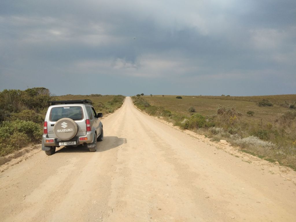
Really like your atmospheric photos looking down the dead straight open roads.
LikeLiked by 1 person
That’s something we see often on our road trips … those dead straight open roads … and we love it!
LikeLiked by 1 person
Wow, what a fun adventure and I have to say that you live in such a beautiful country! There’s nothing better than going on a road trip where you can see heaps of wild animals in their natural habitat. Thanks for sharing and have a nice day 🙂 Aiva xx
LikeLiked by 1 person
This was definitely a fun day on the less travelled roads Aiva! I’m glad you enjoyed the pictures of the wild animals (we love spotting them on our road trips)! Thanks for reading and your lovely comments. Take care and enjoy your week, Corna 🌸.
LikeLiked by 1 person
Now I understand the name of your blog – dusty roads. How wonderful to see zebras grazing in the wild.
LikeLiked by 1 person
You’ve got it spot on … the ‘dusty roads’ are from all of our hiking journeys and 4×4 adventures on these type of roads (and soon we’ll show more of the ‘wet roads’) 😉. To see those zebras so close to road, was such a surprise! Thank you for visiting, take care. Corna 🌸.
LikeLiked by 1 person
Ek is so ver agter met blogs lees! Ons was die naweek weg na Elandsbaai en ek is seker dat ek kommentaar op die pos gelewer het, maar kan dit nie vond nie! Lyk na ‘n interessante plek en die proteas is stunning. Die diere is nogal volop in daardie geweste!
LikeLiked by 1 person
Oe lekker Elandsbaai – ons sal darem seker binnekort ‘n paar foto’s sien, ne! Nee, ek sien jy het nog nie kommentaar gelewer nie … dalk begin lyk en klink ons posts net na mekaar (want orals is proteas 😄). Ek was self verbaas om so baie wilde diere te sien – dit was ‘n vreeslike mooi pad vir my!
LikeLike
Sal seker binnekort iets plaas. My dae te kort vir wat ek als wil doen😊
LikeLiked by 1 person
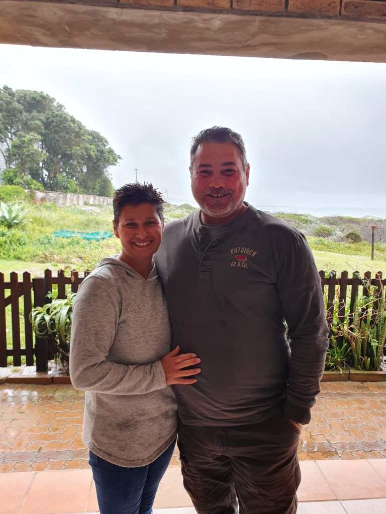
Corna, I am very happy about the adorable photo of you and your husband! You are a beautiful couple. It is wonderful to experience so many exciting adventures together and to plan new trips around the world over and over again. I enjoyed reading this entertaining report again. Thanks also for the beautiful photos that show me an area that I’ve never visited.
Corna, have a nice weekend! ☺️
Rosie from Germany
LikeLiked by 1 person
Thank yo so much Rosie! We love to travel (now more in and around our own country) … we are currently on a road trip from the west coast of South Africa to the north coast and we’re enjoying every moment!
Hope you have a great weekend too, take care. Corna 💌
LikeLiked by 1 person
♥️
LikeLiked by 1 person
beautiful photos
LikeLiked by 1 person
Thank you so much! This was such a nice day to be out on the gravel roads 😊.
LikeLike
Love everything about this! The sheep, the zebras, that church! Love how you were able to cross the river with 2 other cars, so cool. Wonderful photographs. Sounds like a great nature trip.
LikeLiked by 1 person
This was a beautiful backroad … actually, you’re reminding me that we should go there again! There’s so much to see on the less travelled roads and we love to turn off into small villages. One miss a lot when you just get straight onto the highway – but then you of course need to have time!
LikeLiked by 1 person
I understand!! We are backroad travelers, too. Some of the most beautiful places I’ve seen are down roads off of the normal busy paths. My boy and I used to drive unfamiliar country roads, and when we got to a T (intersection) I’d say, “Right or left?” Whichever way he chose, we went. Discovered a lot of cool places and thing’s doing that.
LikeLiked by 1 person
Ah, I like that … it’s like “flip a coin” 😀.
LikeLiked by 1 person