October 2021
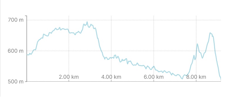
8.5km (5.2 miles)
- Estimated time to complete according to brochure: 6-7 hours
- Our time: 11.5 hours (!)
By just looking at our time spent on the trail today, you can imagine how this day turned out …
After our “night out of hell” (you can read about it here), we were not in the happiest mood to start walking … those damn mouse (or mice)! But we would get nowhere if we were not hitting the road soon and strapped our backpacks on after enjoying a big bowl of oats and two cups of strong coffee!
Let’s go:
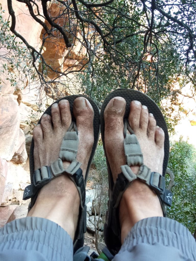
We left our hut at around 7:30 and followed the double-track towards the river. Here, the water was overflowing the road and we had to make a choice of how to cross this. There were two poles next to the road (that serves as a bridge) and Berto took that way. I thought I will not be able to balance myself and my heavy backpack on those poles and just walked (in my Bedrock sandals) through the water – how easy was that!
Almost immediately after crossing the river, we got to an uphill which continued for about 15 minutes … I was silently wondering whether this is how our day will turn out.

Halfway up the hill, we found a sign reading ‘Brandewynvoetpad’ (loosely translated, it would mean Brandy footpath) where we had to turn right.

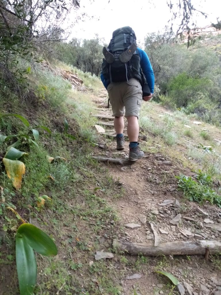
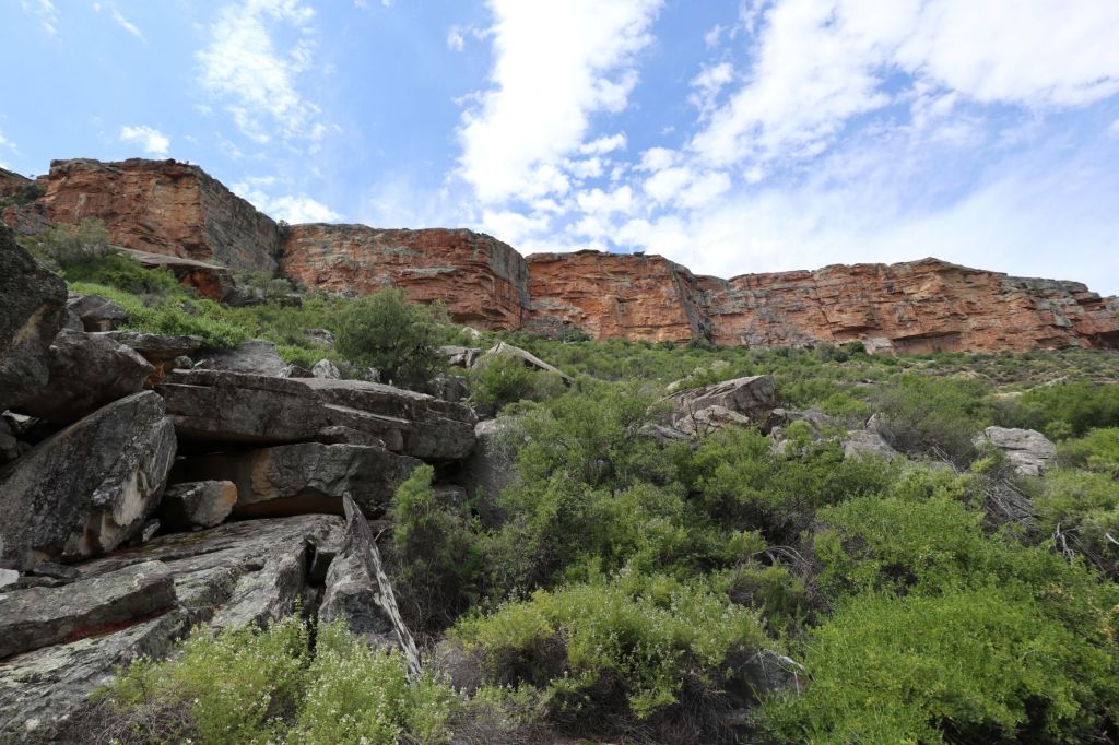
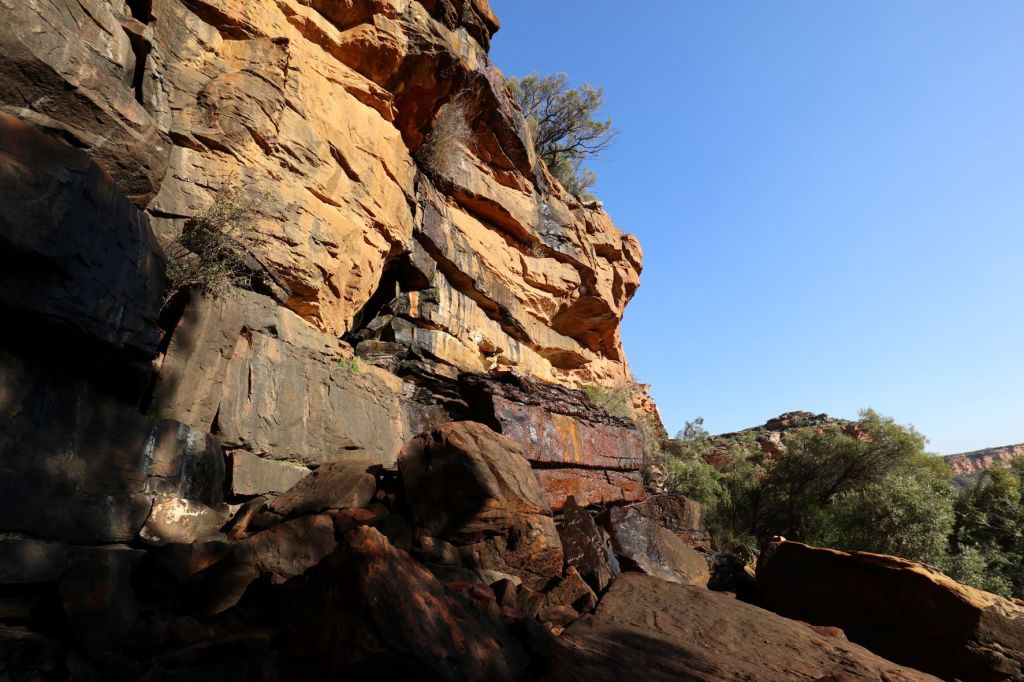
Although it was another uphill, the path ascends steadily to the base of the cliffs, and it was not that difficult to walk … perhaps also because it was still early in the morning.

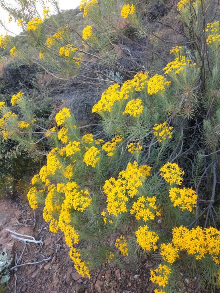
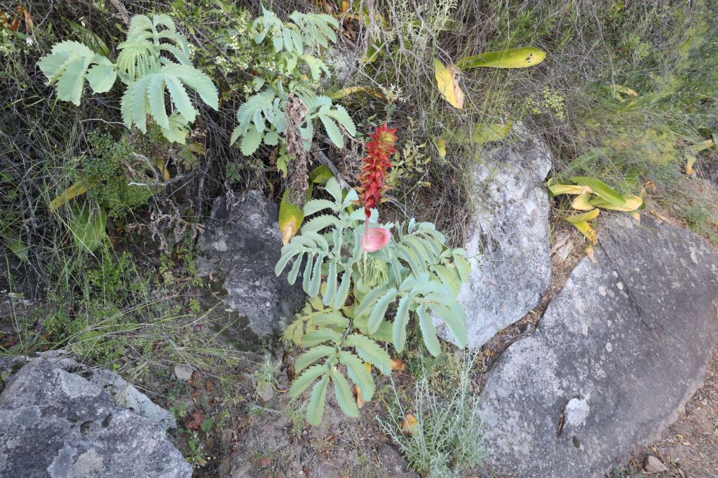
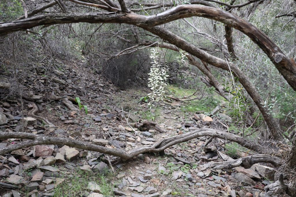
We also had some pretty flowers and plants close to our footpath – unfortunately, we don’t have the names of these … but can show you some pictures.
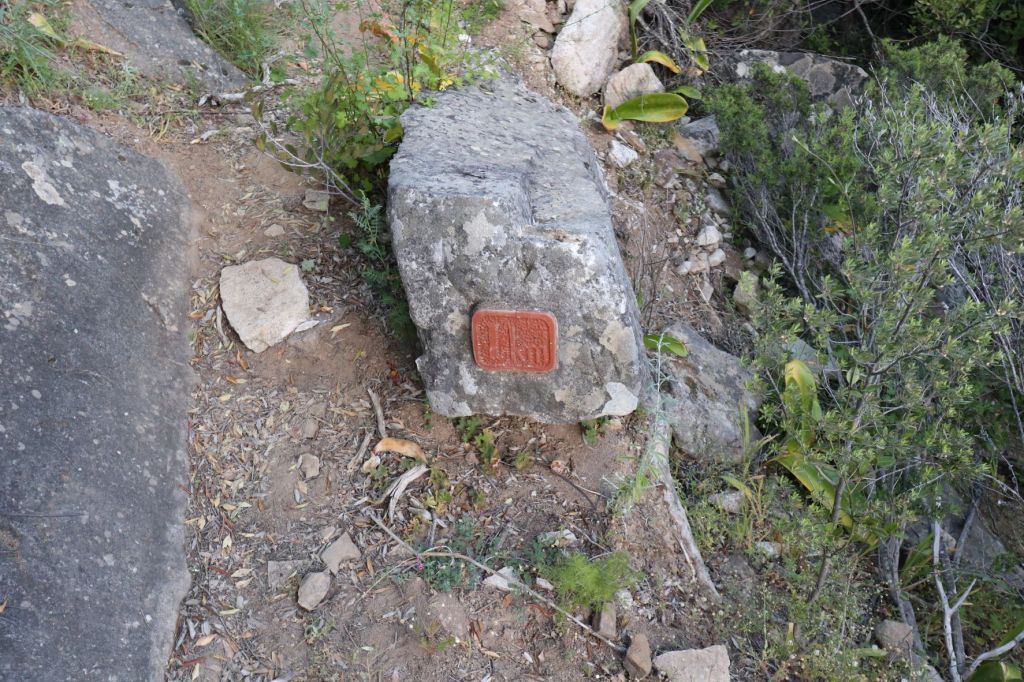
It was also on this path that we saw our first kilometer marker. Remember that I told you (for some unknown reason), the first 4km are not count as part of the trail? Well, I will have to let them know that it CERTAINLY is part of the trail!! We would see the kilometers ticking off for the next 4 days … sometimes it would took hours from one kilometer marker to the next.
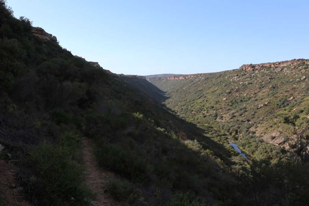
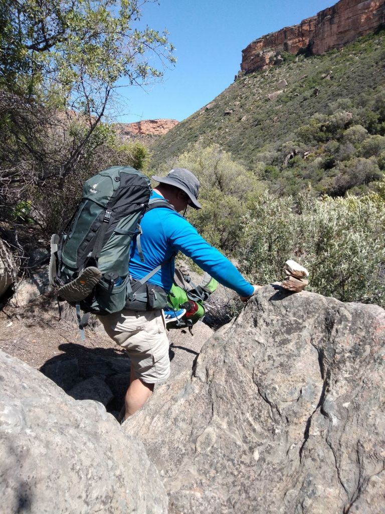
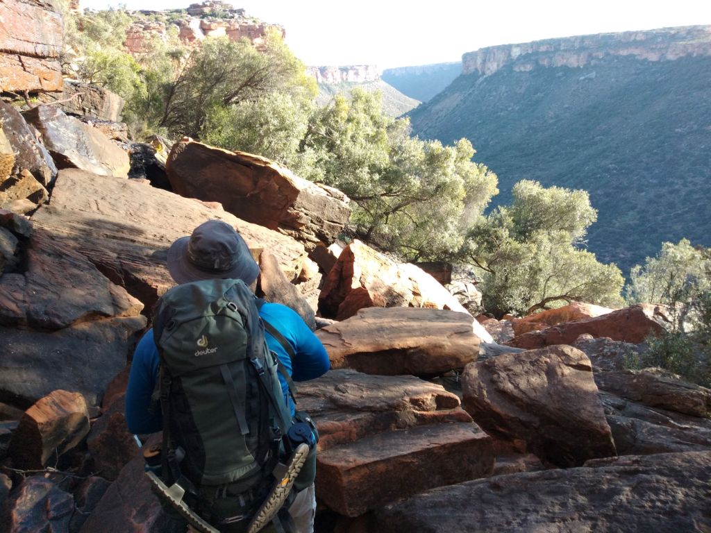
According to our map, we were on our way to the river … however, we first had to walk all the way to the plateau before descending down to the river.
Close to the plateau, we had to find our way through low lying tree trunks and (of course) over a few more rocks.

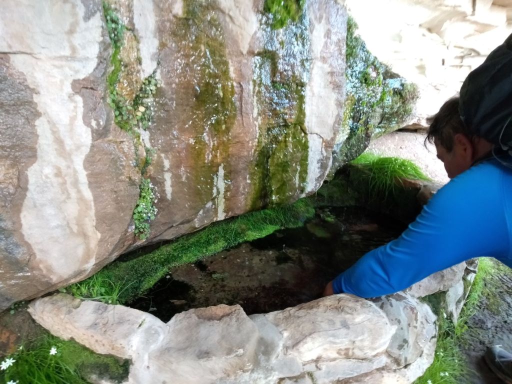
Shortly after the 2km mark, we found a seep in the rocks where we could taste the cold mountain water … and it was really refreshing!
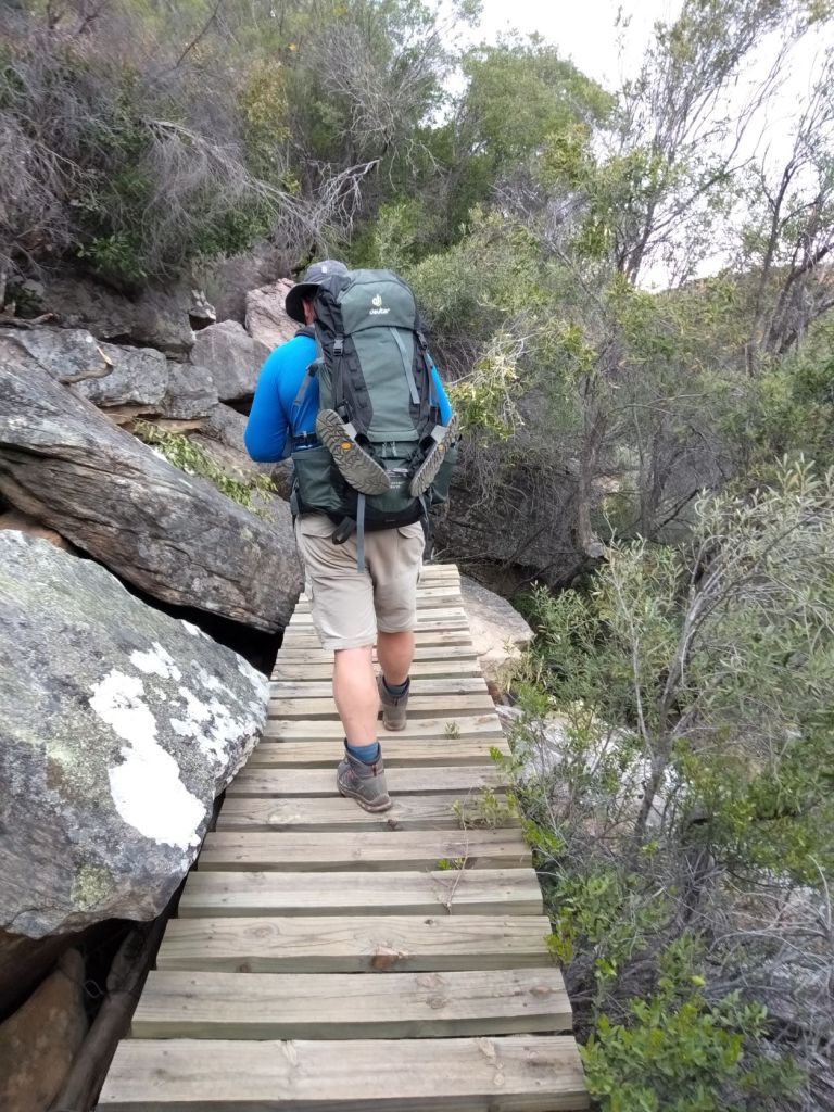
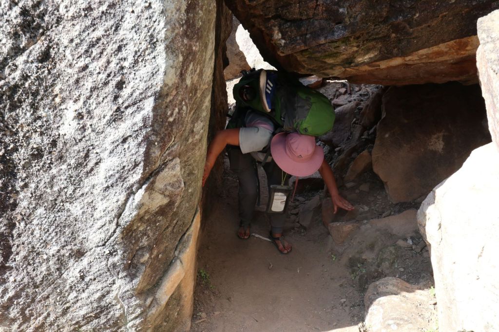
We then had to choose our steps carefully as we walked on a very narrow path close to the rocks to get to the plateau.
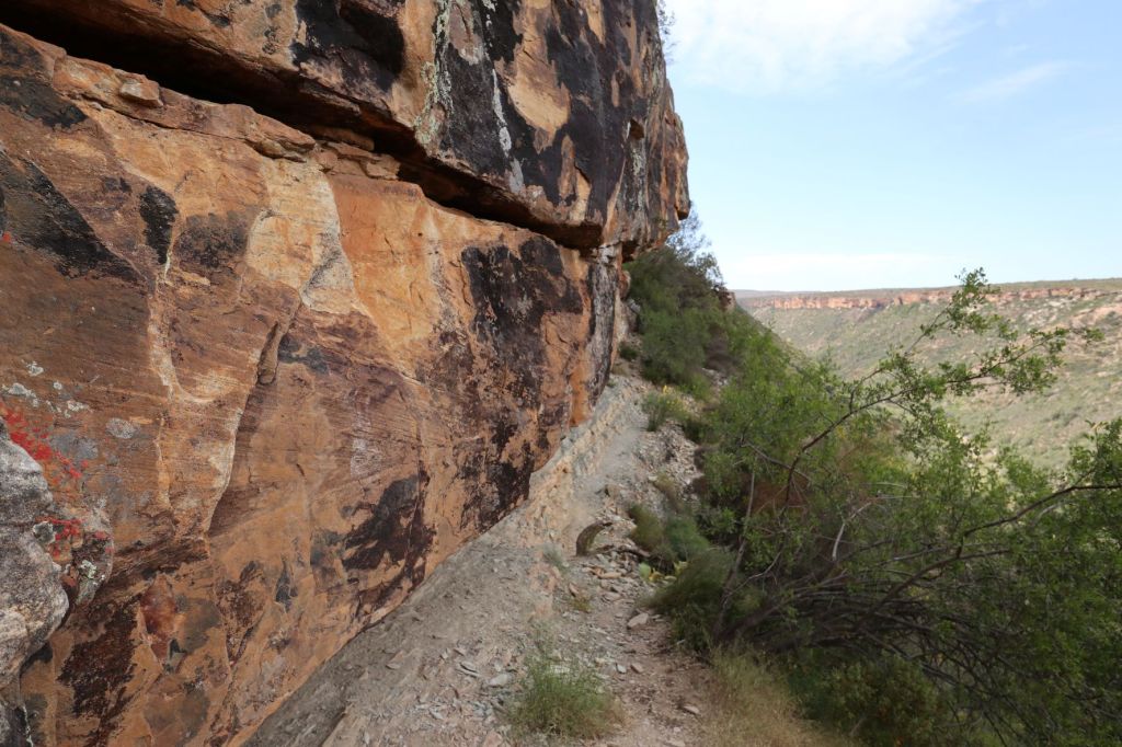
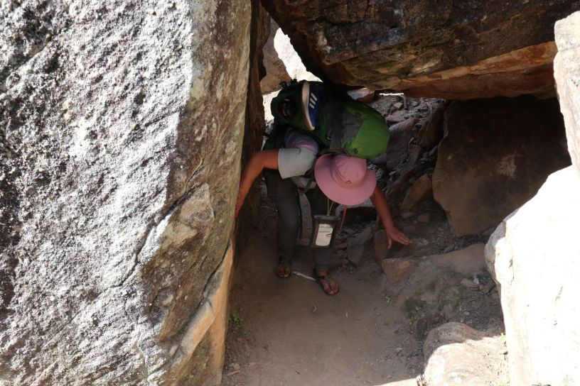
Then our first ladder, rope and chain awaited us! We had to use these to get on top of the plateau. I can’t remember … did I tell you about my fear of heights …
Anyway, after taking off my backpack (Berto climbed up first and used a rope to get my backpack on top) … I took a deep breath and grabbed the ladder, rope and chain to get myself to the top of the plateau.
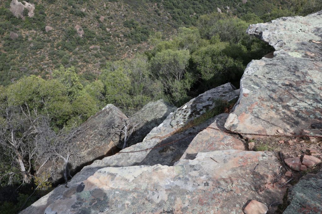


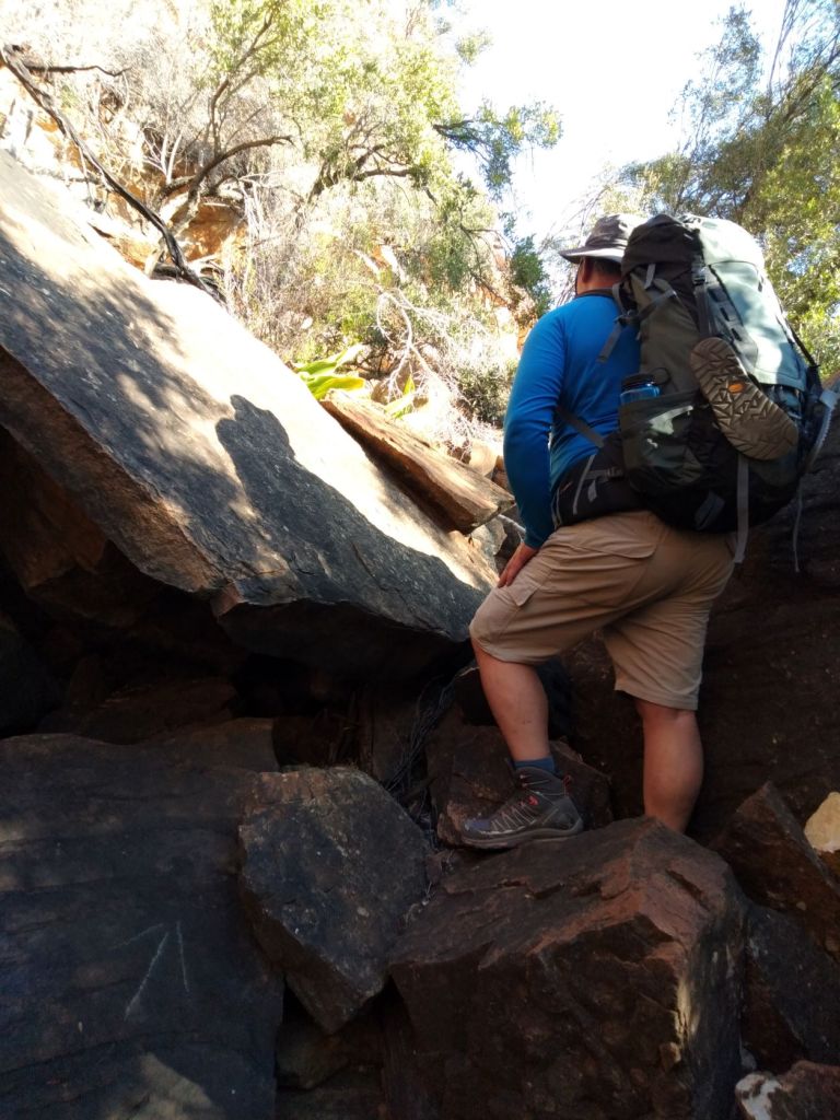
Now it was time to get down to the river, which included a 3-minute detour scramble down to below the cliffs again and then a steep descent to the river (we had to negotiate a section with quite loose shale here).
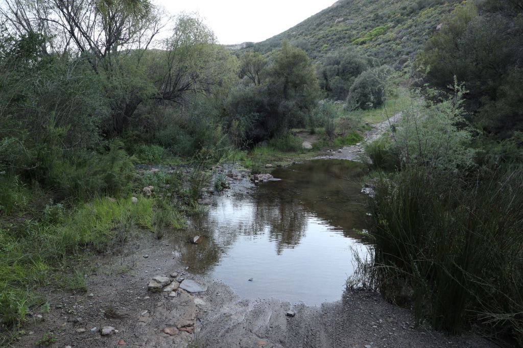
When we reached the river, it was time for a well-deserved coffee break! There were some lovely pools and we were looking forward walking along the river … if we only knew – this is not the river path as we know it!

Once we packed up and got back on the road, we soon realised we will not enjoy a stroll on a well-laid out pathway … no, it was steep up hills, a scramble over rocks (again and again) and narrow spaces … did I mention up hills?


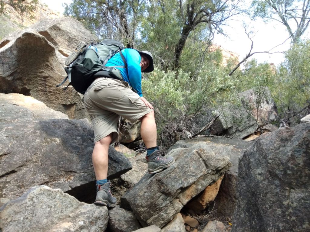
After walking for almost 5km close to the river, we emerged from the riverine bush and were now ascending a VERY steep uphill towards the cliff base … this continue for 1km (doesn’t sound like much, but it was probably the longest 1km of my life)!

It took us more than an hour to complete this 1km uphill pathway to the top!
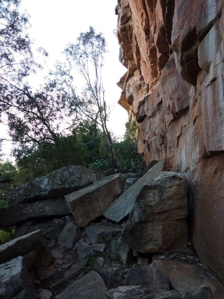
At the 8km mark, we reached the cliff base – finally! After walking in the sun for more than an hour, I was just so glad to sit down in the shade of the cliffs and trees!
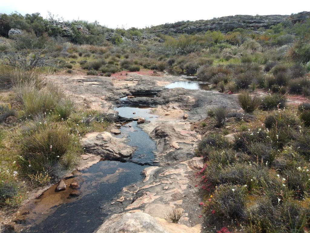
We have now reached the Driefontein Waterfall, but since we’re already in spring, there is just a small stream of water flowing down the rocks.
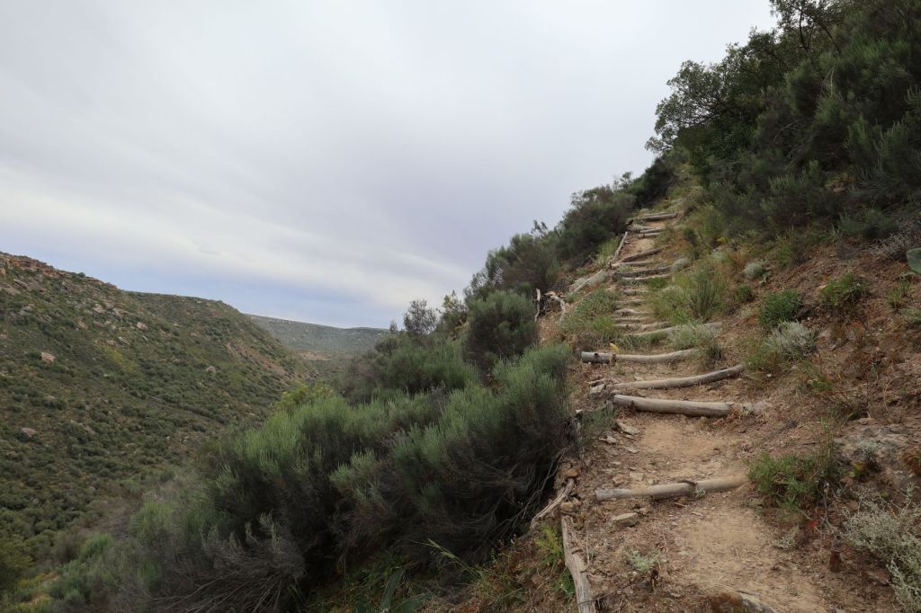
With the sun now starting to set, it was quite concerning to see that the path leading down to our hut, is not really a path!

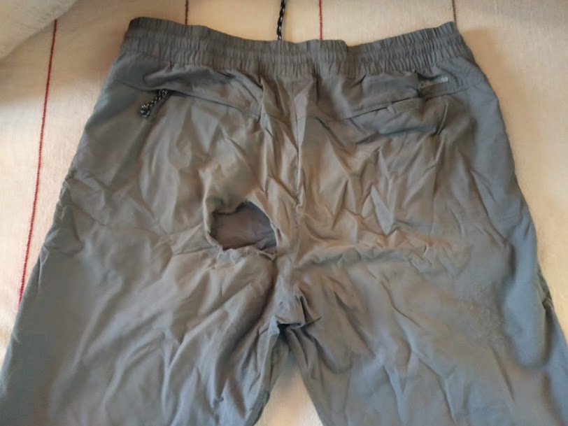
The route now descends steeply to the Oorlogskloof River, where we will find our hut. At times we had to literally went down on our bums to get down some of the big boulders. The sun has now set and it was getting dangerous to walk on these big rocks … that’s when I decided the best way of getting (safely) down to the hut, was to stay on my bum and use my hands, arms and feet to negotiate my way down! Not surprisingly, we have no pictures of getting down … no free hands!
It took us again more than an hour to walk (or crawl in my case) down to get to our hut!

After more than 11 hours since we started earlier this morning, we fell into the hut … tired and exhausted!
Only to realise there was no water in the hut! We saw a sign close to the hut that indicated we could find some water in a small stream and we walked down to fill a bucket. (Each hut has one bucket – presumably to collet water).
We barely had energy for anything else! Berto prepared our dinner, while I wobbled around in the hut to make our beds.

Hygiene time:
Berto mentioned that the only way we will feel better, is if we wash the dirt of the day off our bodies … but how?
I can tell you this … we realised during this hike that you can get clean with just a little bit of water! We each used one cup of lukewarm water to wash our hair (of course outside on the hut’s balcony). Berto then boiled water in our little pot. We applied some of the eco-friendly soap on our bodies and using our washcloths to rub it in. Then we soaked the cloths in the pot of water to wipe ourselves off! How does that sound for a bath?
Oh, and there is one more picture I would like to share with you … the evidence of a difficult descend down the mountain!
And once again, here are the maps of the day:

After barely sleeping 3 hours the previous night and more than 11 hours on today’s trail, we were totally and utterly drained and hoping for a good night’s sleep.
Tomorrow … tomorrow is the tipping point for me on this trail! We will tell you all about this in the next post!
You can read about Day 3 here

Great job completing that hike, actually I’d call it more of a trek! Sleep was no problem that evening I’m sure.
LikeLiked by 2 people
You’ve got it John … this trail should be called a trek!! Absolutely, slept like babies (no mice, though we did hear some baboons, but at least they were outside somewhere in the mountains 😀).
LikeLike
Wow! What a wonderful accomplishment! Love the photos!
LikeLiked by 2 people
Thank you Stacy 🌸. This surely was a difficult day (as was the very next day – I will soon post that one) … but looking back, I’m astonished at what I was able to do. I’m glad you love the photos – wish we took more! Thanks for always reading our posts – much appreciated. Take care, Corna.
LikeLike
Those narrow ledges, ladders with ropes and huge boulders you needed to get over must have been so challenging, I would never have managed it and would have resorted to sliding along on my bottom too. Hope you slept well that night and your calf muscles didn’t feel so stiff the next morning.
LikeLiked by 2 people
Marion, if someone told me before this hike that I would do all of these things, I would also said ‘never’! But turning around wasn’t an option … so, then one do things you never thought was possible! We had indeed a great night’s sleep (though my dreams were filled with rocks, ladders and ropes ☺️) … but it was needed after the previous night and especially for the next day’s challenges!
We will be “off the grid” again for a couple of days as we’re going camping, but will be back soon. Take care, Corna.
LikeLike
Have a great time both of you and speak soon. Marion
LikeLiked by 1 person
Wow 11 hours on your feet is such a long time!!! You guys are amazing for doing this 🙂
LikeLiked by 2 people
For us, this was the longest day ever spent on a hiking trail (with such a short distance)! Thanks Hannah – maybe amazing and dumb are similar words in this case 😅.
LikeLike
The path is so narrow and quite rough in places, it is sure to tax the average hiker, especially constantly scrambling over large boulders. But then again, the views are stunning and so is the surrounding landscape. Thanks for sharing, and have a nice day 🙂 Aiva xx
LikeLiked by 2 people
You are so right Aiva … looking back at our photo’s, we only now realised how beautiful our surroundings were! But this second day on the trail was quite exhausting and I don’t think we really appreciated the landscape so much! Hope your day is also a good one. Corna
LikeLiked by 1 person
I love the picture of the shorts – I can really identify with that!
I went rock climbing and was told to keep at least three points of contact. I came back with the knees ripped out of my trousers – I’m not sure that’s what they meant!
LikeLiked by 2 people
Hmm, three points of contact … that sounds about right! There was no way that my trousers would have survived this day!
LikeLiked by 1 person
Well, I heard that lovely, lovely Professor Brian Cox came down Kilimanjaro on his bottom! (He’s a hero of mine; a physicist who’s bit of a TV celeb here in the UK – also a former member of the band D’Ream of ‘Things Can Only Get Better’ fame!)
If Cox can do it, there’s no shame in it!
LikeLiked by 1 person
Oh, I love it! If a professor thinks the best way of getting down a mountain is to do it on your bottom, then I don’t feel bad at all 😁.
LikeLike
This trek is becoming more and more appealing. Love how it’s calling on lots of different skills and is a bit (just a little bit!!!) more than a long walk!!
LikeLiked by 2 people
Well, at least you are entertained with this hike! Yes, this hike test you on so many different levels … but I can see, you will enjoy every moment!
LikeLiked by 1 person
Daai 2 voete se als. 😁💜
LikeLiked by 1 person
Daai twee voete het selfs vir my verbaas 😅 … en die letsels is, na meer as 2 weke, nog nie weg nie!
LikeLike
Eina
LikeLiked by 1 person
OMG, what a day! No way could I do this and I’m full of admiration that you managed it, even though it took you so long – 11 hours, almost all on your feet (or bum!) Well done!!
LikeLiked by 1 person
Thanks Sarah, that was probably the longest 11 hours of my life! The scars on my bum are only healing now (more than 2 weeks after the hike) 😁.
LikeLiked by 1 person
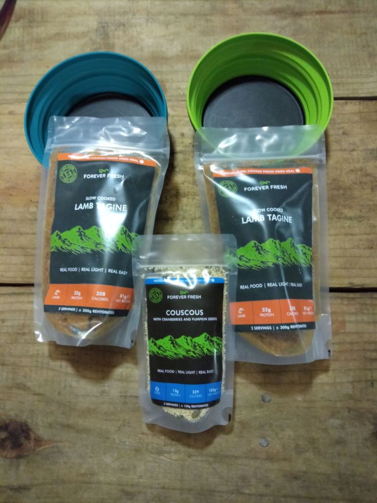
Wow, hats off to you both for completing this challenging trek. Never before, I imagine, has a Lamb Tagine been so well earned!
LikeLiked by 1 person
Leighton, it was THE best Lamb Tagine ever (and I said it about every dish after the day’s walk) 😁. And you’re right, it was very challenging … but the next day … oh, that was bad 😳.
LikeLiked by 1 person
Wow Corna! Jy en Barto het dit sowaar net betyds gemaak voordat dit te donker was. Sjoe, dit was regtig ‘n moeilike roete wat julle moes loop. Julle bene het seker soos jellie gevoel! 😀 Soos ek al gese het my ou beentjies sou dit beslis nie gemaak het nie. Ek sal nog hoede moet afhaal en nog baie gaan soek! Welgedaan! Kan nie wag vir die volgende aflewering nie!
LikeLiked by 1 person
Aletta, my bene het min of meer die hele tyd soos jellie gevoel 😉! Ja, ek dink nie ‘n mens wil graag in die donkerte teen daardie rotse afklim nie – ons was inderdaad baie verlig om net-net betyds by die hut op te daag. Jy gaan ‘n GROOT hoed moet gaan haal vir dag 3 se storie …
LikeLike
O my genade! Sal so lank begin soek😀😅
LikeLiked by 1 person
🎩😂
LikeLike
Tough day but awesome views. I love the narrow leader. Good for you to do it with a fear of heights! Maggie
LikeLiked by 1 person
Maggie, I’m glad you loved it … for me, it was really challenging! But it’s exactly like you’ve said, those views were quite amazing!
LikeLike
How very proud you must be that you accomplished this! My toes curl up just reading and seeing the pictures. Those steep slopes…no way I could have done that at my fittest!
LikeLiked by 1 person
Extremely proud of myself (and my husband even more so 😊). Yes, those steep slopes came back in my dreams …
LikeLiked by 1 person
This sounds like such a challenging trail even without a heavy backpack! Glad to hear that you made it to your hut before it got too dark outside. I’m always worried about getting stuck on the trail after the sun sets.
LikeLiked by 1 person
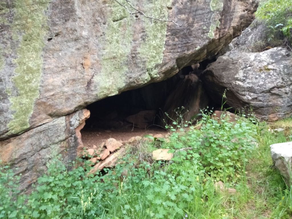
Exactly … with or without a backpack, it’s a challenging route. And you are absolutely right … our biggest fear (during this trail) was to end the day’s stage in the dark! If that happened, I would probably have just slept in a small cave 😉.
LikeLiked by 1 person
Seems like an amazing hike through wonderful terrain. (Why aren’t you wearing hiking shoes/boots?)
LikeLiked by 1 person
Rough terrain, but amazing views. After we’ve done many hikes, I realised the only shoes that gives me no blisters (well, almost), is my trusty Bedrock sandals!
And yes, I know the right shoe for this kind of hike is most likely boots … but I have a lot of confidence in these sandals! We’ve imported it from the USA and many hikers there use these sandals to complete long trails (such as the Appalachian and Pacific Crest Trail) … and so far, they have not disappointed me!
LikeLike
Wow, you guys are amazing, Corna! Looks like such fun – I would love the ascending & scrambling! (Descending, I wouldn’t love so much.) I’ll be tuning in for the rest of the story! 🌞
LikeLiked by 1 person
Thank you Lisa! ‘Fun’ is not necessarily the word I’ve used much on this trail 😉. And yes, I don’t like descending either. We’ll have day 3 shortly on the blog (and it was quite a day)! Thanks for continue to follow our Oorlogskloof hiking series – much appreciated!
LikeLiked by 1 person
No way I could do that!
LikeLiked by 1 person
If I knew this route before we started it, I would’ve said exactly the same Diane!
LikeLike
Lack of sleep, rough terrain, plus facing your fear of heights, wow, that’s amazing. Well done in completing such a tough hike and for an incredible share, thank you ❤
LikeLiked by 1 person
Ah, thank you so much Henrietta … I’m glad you enjoyed our post. Yes, facing my fear of heights was definitely one of the toughest things I had to do on this hike (don’t miss our next day 😉)! I will see you again on day 3 – thank you so much for reading) 💌.
LikeLiked by 1 person
Okayyyyyy so that is one trail I will not attempt. It sounds horrendous. The scenery is stunning but 1 km uphill and over rocks is not quite the same as 1 km on the flat.
LikeLiked by 1 person
That 1km uphill was probably the most difficult part of the trail (as well as the 1km downhill on the same day)! Rather give me 800km on the Camino in Spain before I do Oorlogskloof again!
LikeLiked by 1 person
Yeah, I kinda got the impression you’re not a fan of this particular trail 🤪🤪
LikeLiked by 1 person
Don’t get me wrong … nature was amazing (those rock formations on Day 4 was out of this world!), but it was really hard and challenging. But hey, it’s done and dusted … no need to do this one again!!
LikeLiked by 1 person
Looks like a quiet, remote area, a tough hike though. The cool mountain water must have been so refreshing and welcome.
LikeLiked by 1 person
Definitely a VERY remote area (and you are right that it was a tough hike 😬). The mountain water was always a highlight of every day – I never knew water could taste so sweet!
LikeLiked by 1 person