September 2020
Day 7
The Growcery → Ramansdrift
We are now approaching the last section of our journey on the Namakwa-4×4 Eco Trail. The surroundings will start to change, and we will encounter more flat and sandy areas – although there will still be small(er) rocky areas that we will drive through.
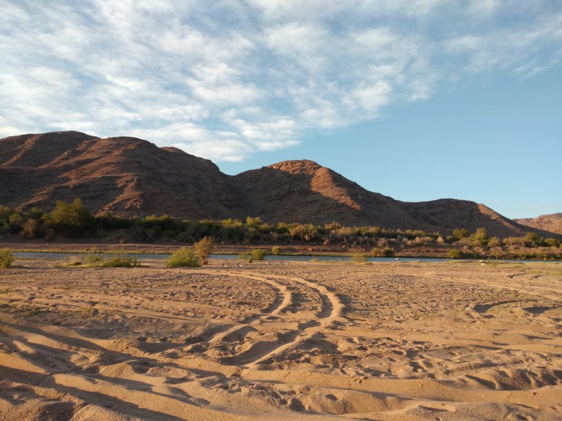
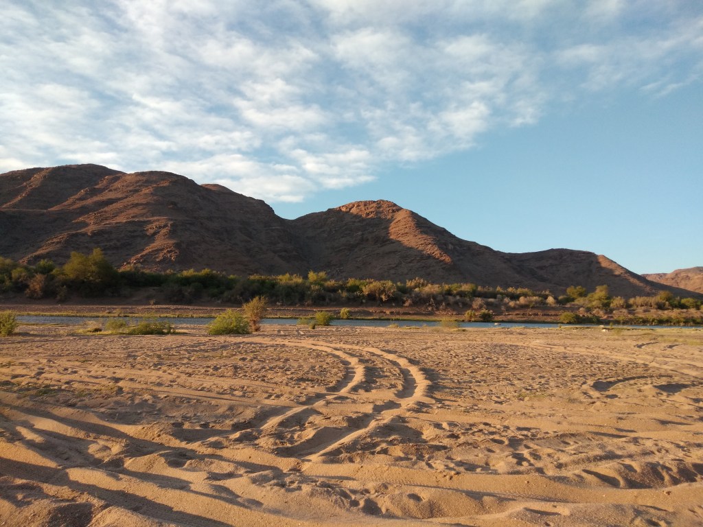
The drive towards Vioolsdrift (official border post between South Africa and Namibia), runs along the bank of the Orange River. There are many river camps on this stretch and river rafting is one of the biggest attractions here.
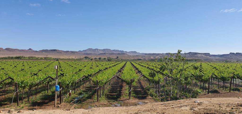
The fertile alluvial soil along the bank of the Orange River makes Vioolsdrift an agricultural community and we saw beautiful green fields on our way.
There is a tiny shop in Vioolsdrift, where we stopped. We were hoping to get some hotdog rolls there for lunch, but none was to be found. Instead, Estelle bought us each a generous portion of freshly baked ‘slap chips’ (otherwise known as French fries). Now, that’s what I call a fine-fine breakfast.
We were driving for approximately 25km on a tarred road, before we’ve turned left on more gravel roads. At first, we were not sure whether we were on the right track. One has to remember that we were actually doing the Namakwa-4×4 Eco Trail backwards! Normally 4×4 adventurers will start this trail from Pofadder and end in Alexander Bay – while we will end our journey in Pofadder.
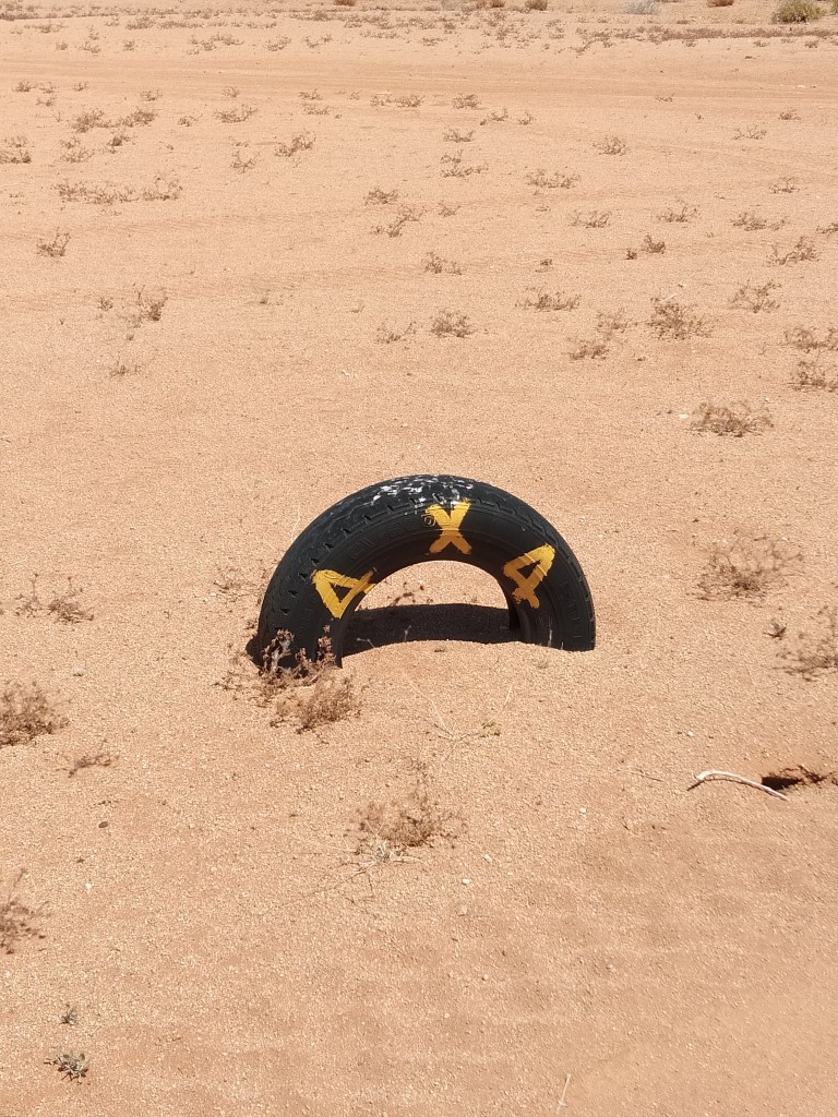
Fortunately, there are some way markers (every now and then) in the form of a tyre with yellow paint on it, indicating we are on the Namakwa-4×4 Eco Trail.
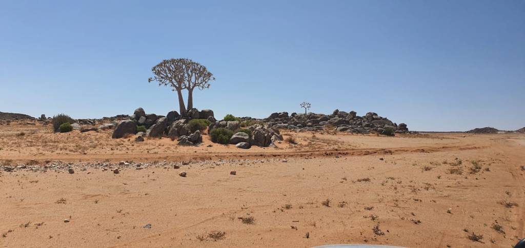
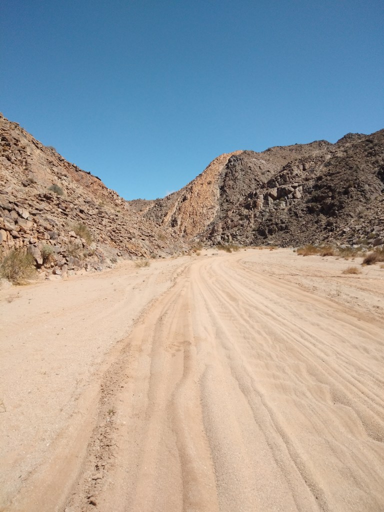
After driving on a flat sandy stretch for some time, we once again got to rocky areas, where we had beautiful views of more quiver trees. These trees are really a stunning sight in nature.

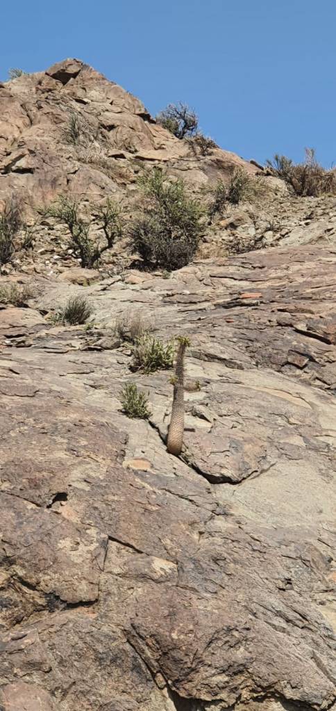
And then, to our surprise, we saw the endangered ‘Halfmens’ plant … and not just one, but plenty, growing in a rocky area. Directly translated, it would be ‘Half human’ plants and I remembered that we saw these back at Sendelingsdrift that were stolen. To see these now in their natural habitat, filled me with joy.

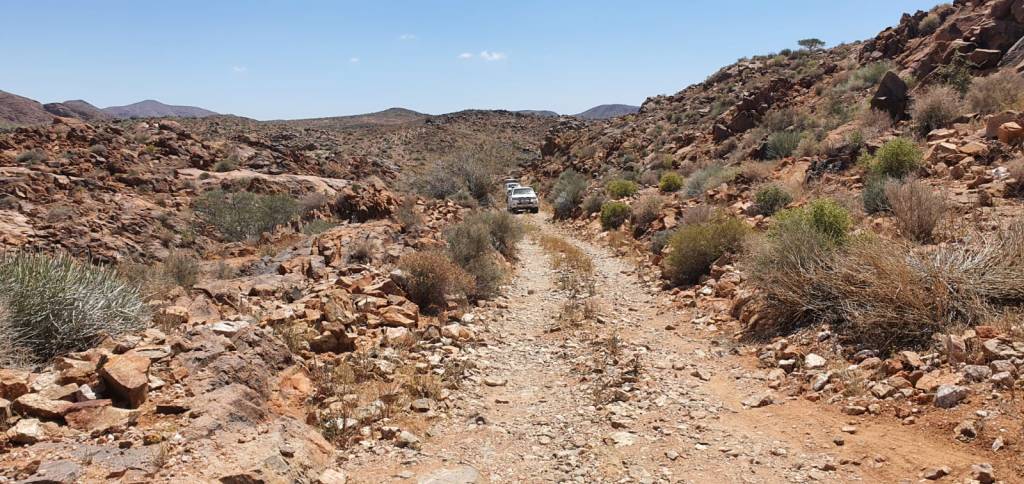
It may be confusing to find so many dirt tracks on this trail – I presume they are all going in the same direction – but we were trying to stay on just one and not creating more roads.

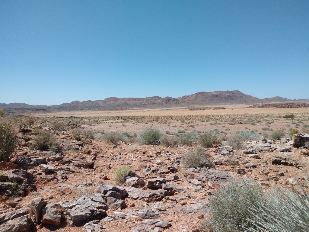
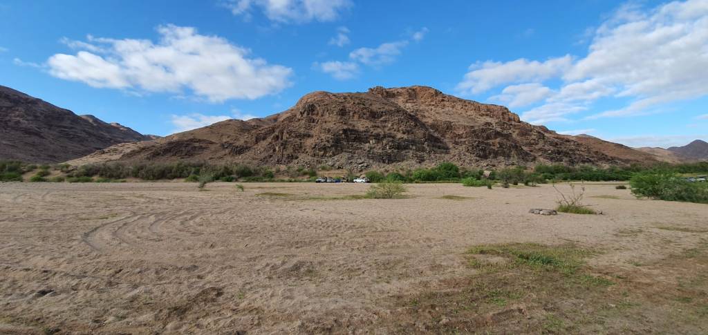
It was quite astonishing to see how the landscape was now changing. We would drive on sandy roads for quite some time and then the area would suddenly change into a rockier terrain with green bushes and plants.

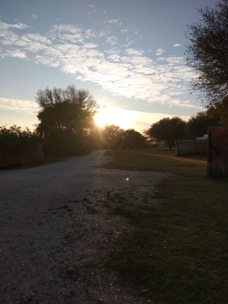
Around lunchtime, we found a small riverbed (with a tree for shade) and decided to stop here for a while. It was such a peaceful place – no noises, just the sound of nature!


We were expecting to meet more friends today. Jacques and Anel live close to this area, and they will enjoy the weekend with us. Since there is no cellphone reception, we’ve agreed beforehand to meet each other somewhere on the road or at our camp site, Ramansdrift later that afternoon.

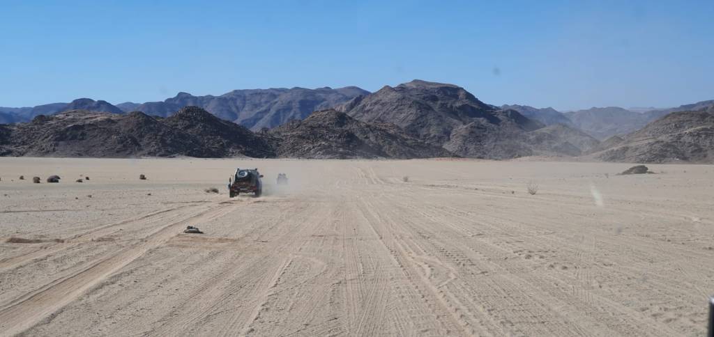
After driving through flat valleys, but also some rough patches for most of the day, we came to a wide gravel road – this is the main road used by everyone.
This road continues for about 20km before we got to the Henkries pump station. Here you need to make sure your vehicle’s roof rack (or rooftop tent) is not that high that you struggle to get underneath the pipes that runs over the road.

After the pump station, we were back on the gravel tracks and close again to the Orange River.

We were now on our way towards a very small hamlet, called Goodhouse. I’ve read before our trip (in the magazine “Weg! Ry en Sleep”) that there is a graveyard at Goodhouse where we will find the graves of Carl and Caroline Weidner. This couple was the founders of Goodhouse in 1913.
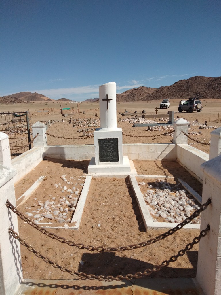
Close to the Weidner’s graves, were also some graves of a couple of British soldiers who died in 1914 and 1915.

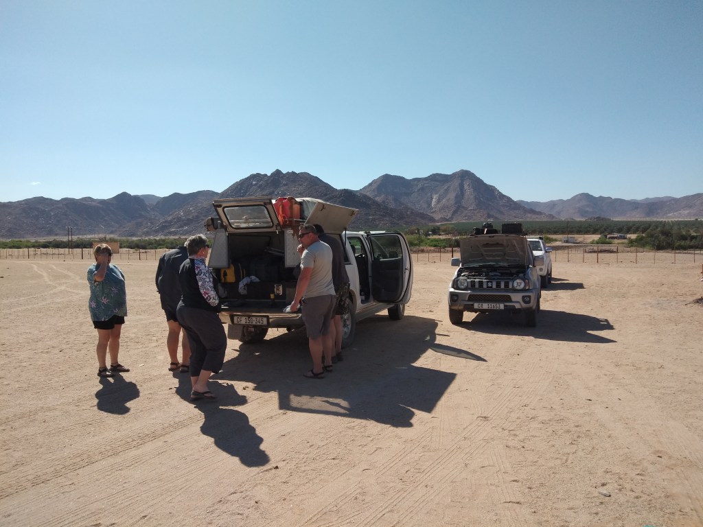
While we’ve stopped here for a moment, Berto and Frans inspected their vehicles. From all the travelling on the corrugated roads, some parts on the vehicles came loose. Fortunately, nothing serious on closer inspection (well, nothing that a cable tie could not repair anyway!) and we continue on our trip.
And then, as we drove through more valleys (with many roads), we were quite surprised to find our friends (that we’ve agreed to meet “somewhere on the road”) – speaking of luck.

It was already late afternoon and fortunately just a short drive now to our overnight spot, Ramansdrift. We took a wide stretch down to the river – it almost looked like an airfield strip.

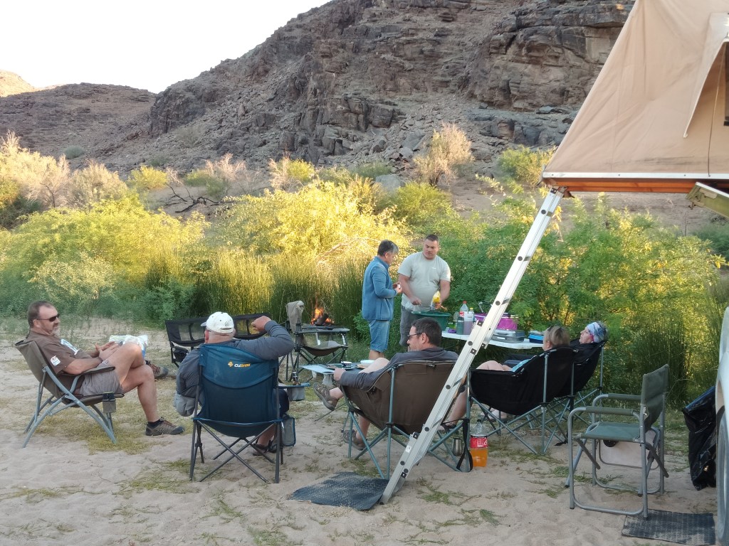
Ramansdrift is a beautiful camping spot and many other 4×4 adventurers had the same idea than us. There were already plenty of tents along the bank of the river when we arrived. There are no ablution facilities here, but I can promise you, this is the closest you’ll get to nature! The only sounds you’ll hear, is that of the river and maybe a call from a baboon.

It was another long day on the road – we’ve covered 165km – but what a stunning day! The Namakwa-4×4 Eco Trail is definitely diverse in landscape and beautiful to drive.
After we’ve started the fire, Anel brought out the most delicious appetizers. There were different cheeses, biscuits, olives and pancetta. We’ve enjoyed these with a crisp glass of white wine and beer – the perfect way to end another day.
To read about Day 8, click here …

This is absolutely stunning, what an amazing trip.. Did you come across other wildlife.. Like leopards or snakes… Do you find the big 5 there?
LikeLiked by 1 person
No, this is not Big 5 territory … but mind you, there might be leopards (and yes, for sure snakes), but we’ve never encountered any. A donkey here and a few sheep there is basically the animals we’ve seen … but I presume the trip in this area is more about the scenery than wildlife.
LikeLike
Yes. I would rather it that way. I have a friend who was attacked by a leopard while she was in her tent and she literally almost had her foot bitten off. The leopard dragged her out of the tent and her husband attacked the leopard but she had to be airlifted and taken to hospital. She over time have several, if not 5 operations, metal plates to build up her foot and skin grafts so I have much respect for living with the wild life around me. 😬
LikeLiked by 1 person
Oh dear 😳, that sounds awful! Where did this happen? I’m glad she’s doing ok, but that must have been a terrifying situation.
We have a standing rule: When it’s getting dark, everyone stays around the fire and then you must try and stay in your tent for the night … but nature is unpredictable and we should always be considerate and careful.
LikeLike
Good rules for the Bush are important 👍… I think it was the Kgalagadi … Not sure if that’s the right spelling.
LikeLiked by 1 person