
McGregor to Greyton (1 Day)
Greyton to McGregor (1 Day)
14km one way (28km over two days)
SEPTEMBER 2017
In September 2017, a few months after our first Camino in Spain, a hike in the mountains were calling us again.
A long weekend in South Africa seemed like the ideal opportunity for such a hike and this time we invited our long-time friends, Frans and Fiela to join us on the trail.
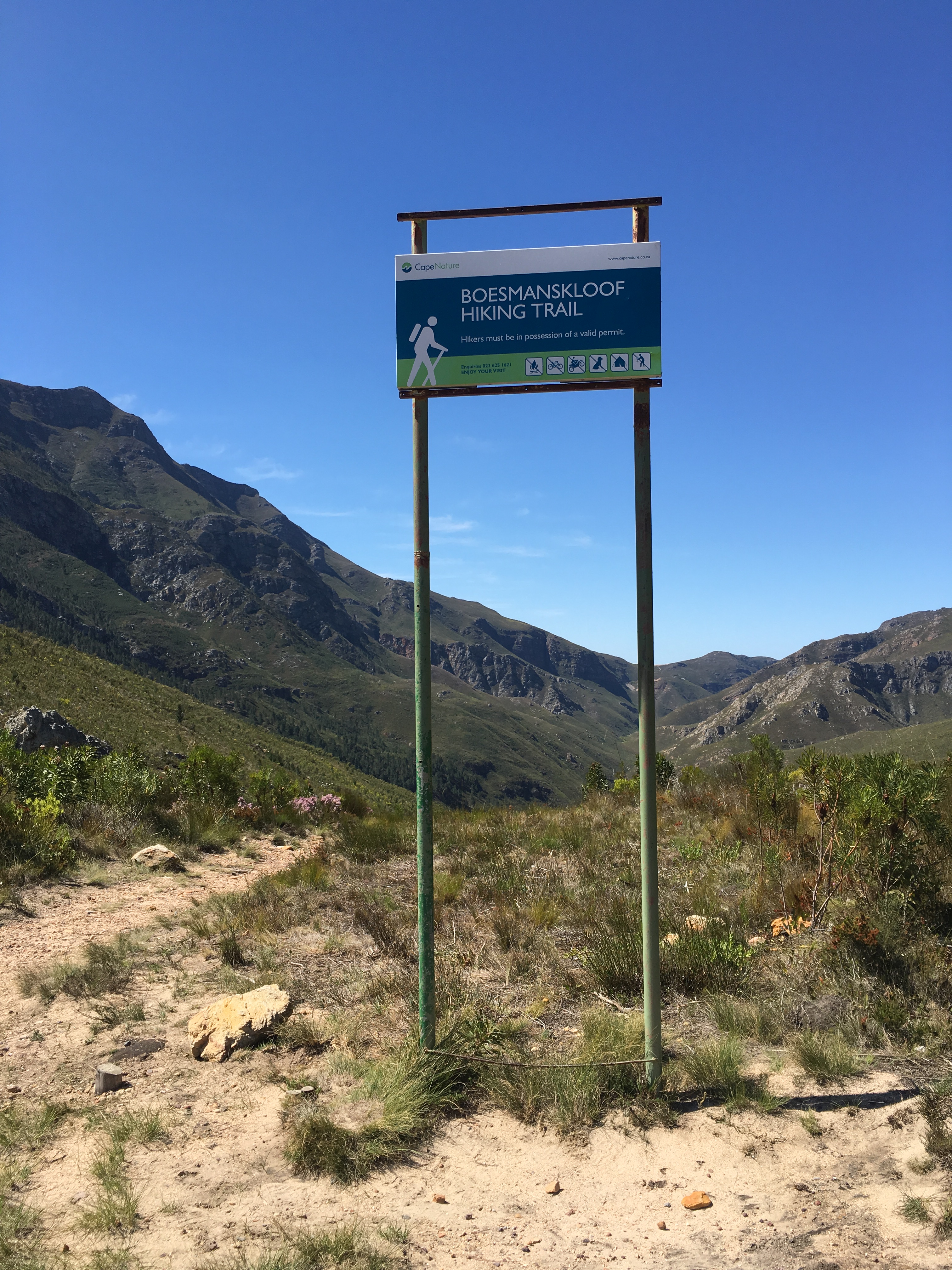
The Boesmanskloof Hiking Trail is in the Western Cape Province. It is quite popular and will take you through the majestic mountains between McGregor and Greyton with stunning views. The distance is approximately 14km and although it can be hiked in one day, from either McGregor or Greyton, a popular option is a 2-day hike there and back.
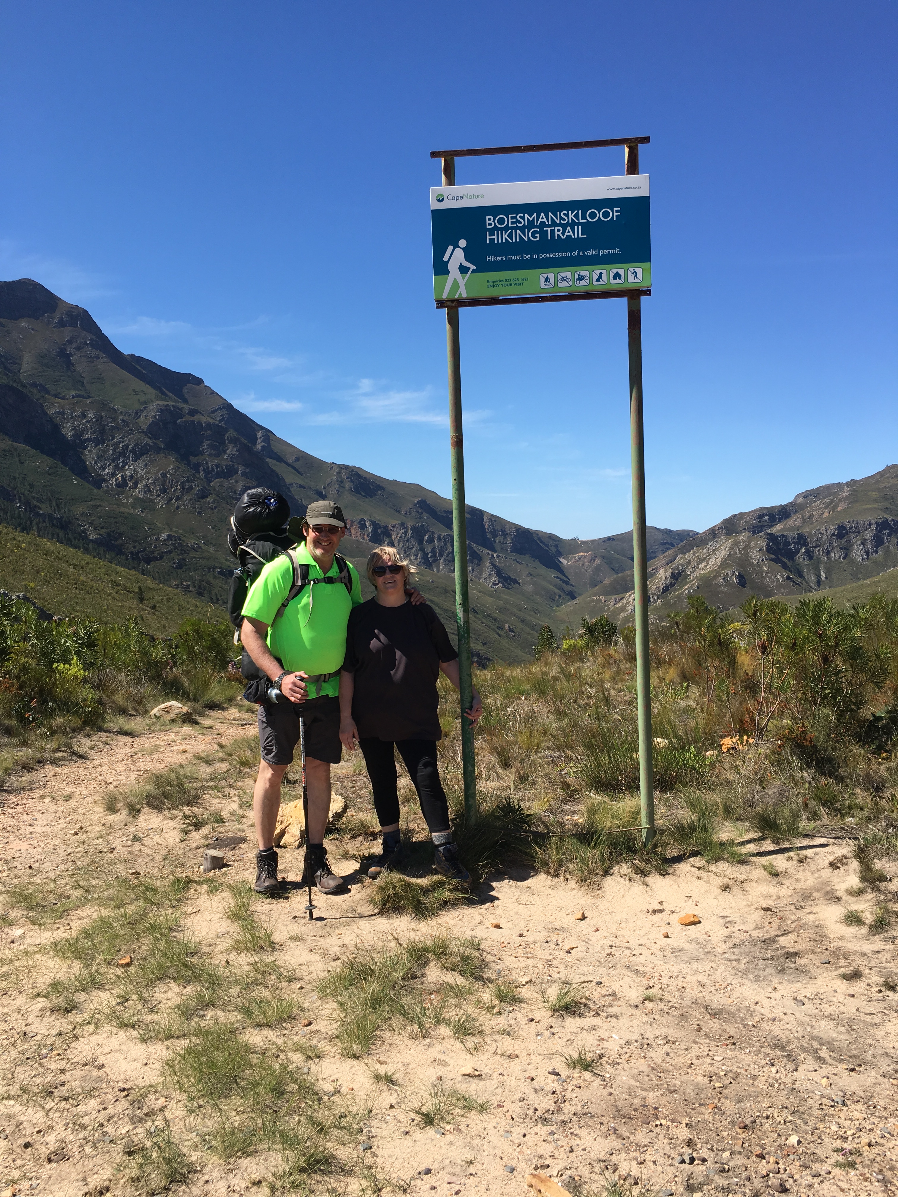
We decided on the 2-day hike from McGregor to Greyton, which meant we had to park the car at the beginning point of the trail in McGregor and then walk with all of our camping gear to Greyton. We would then camp in Greyton, before walking back to McGregor the next day.
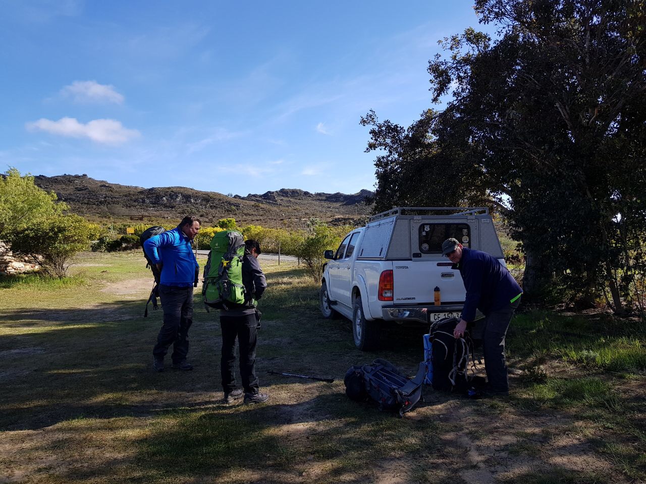
Getting ready for a hike in the beautiful mountains between McGregor and Greyton
You need to obtain a hiking permit for the Boesmanskloof Hiking Trail, which we have done on-line. At the same time, we have also booked a camping spot in Greyton to overnight.
Once we saw Eagle’s Nest Accommodation in front of us, we knew we were at the starting point of the hiking trail from McGregor’s side.
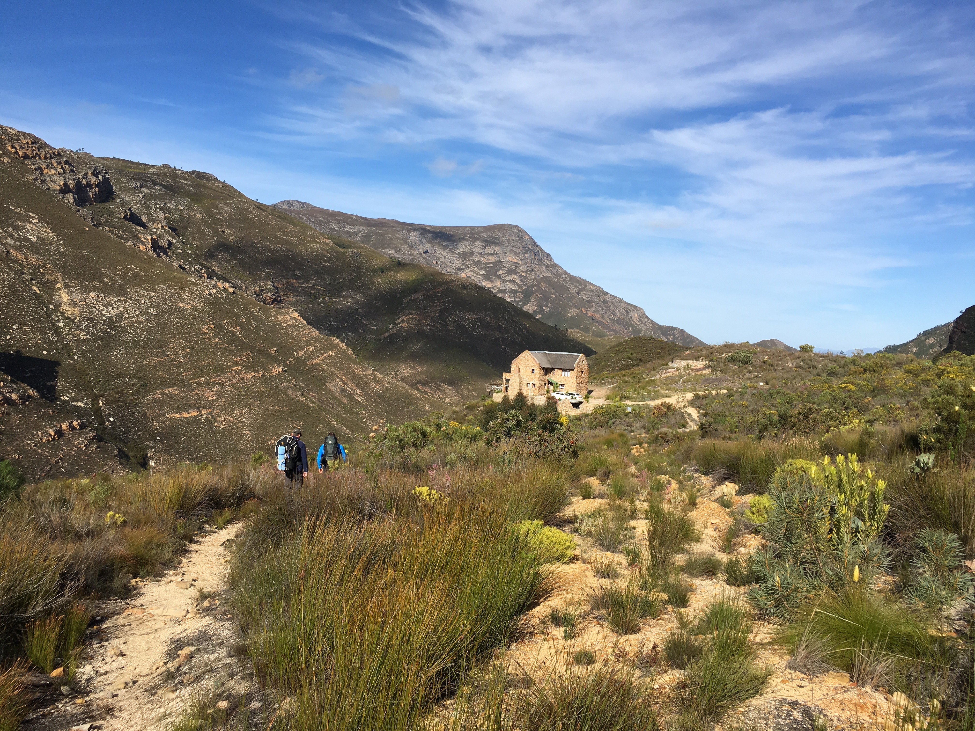
The start of the Boesmanskloof Hiking Trail from McGregor
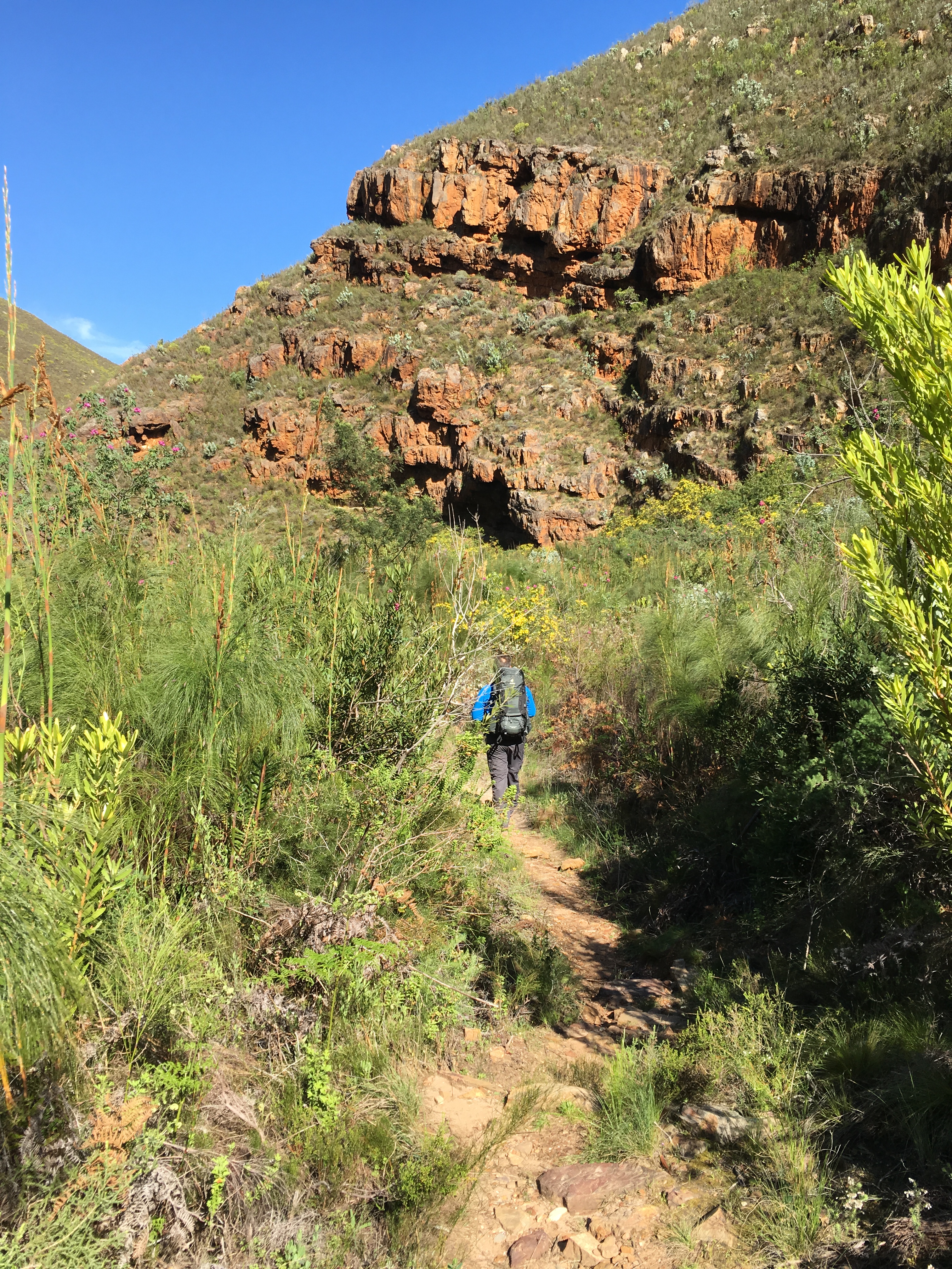
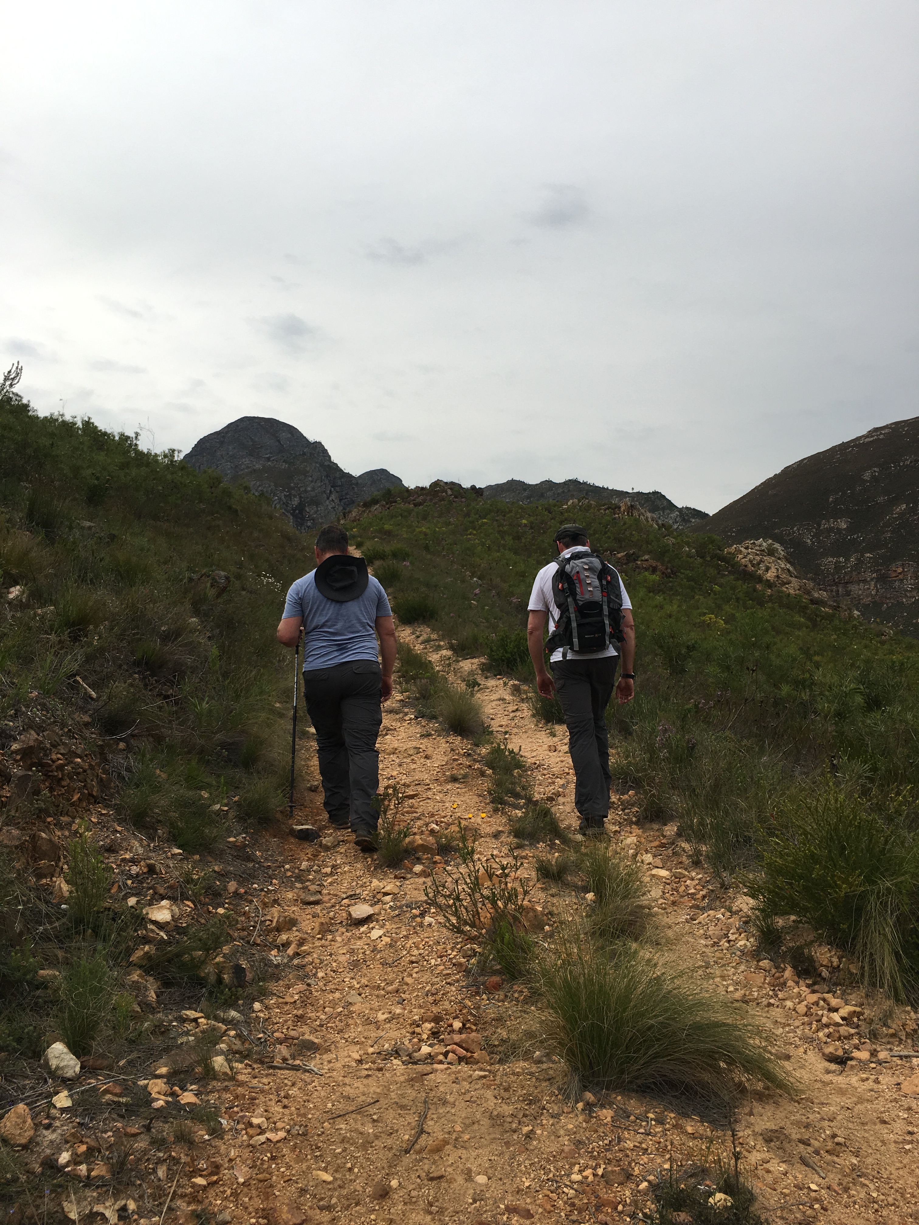
We had the perfect spring day – sunny, but not hot, with only a slight breeze. The trail begins downhill to the river and with an uneven pathway, it is a good idea to keep your eyes on the track.

Downhill from McGregor’s side with spectacular views

I’m finding my way carefully between the loose rocks. Frans and Fiela follows closely behind me
I can just imagine that during the peak of summer, it could be very hot in these gorges, so be prepared in bringing enough water to stay hydrated.


Spectacular views of the Riversonderend Mountains
It was great to walk in nature and with a dry winter behind us, it was wonderful to see that the mountains still had shades of green and the river was flowing.

Happy to be in our hiking gear and enjoying nature
On the way down to the river, Fiela had to stop, because of a toe ring that bothered her. She wore the toe ring for many years and Frans almost had to cut it off her toe 😬… and then it got lost in the process. We still believe a very happy baboon is running in the mountains with a toe ring clutched to his/her toes!
The last stage before we reach the river
In the river valley and now it was a great hike towards the rock pools which are fed by waterfalls
As we were right in the middle of spring, we were fortunate to see many fynbos species.


Diversity of flora on the hiking trail
We had to cross a few streams on our way, thanks to a few rainy days a couple of weeks before our hike. We did not complain, since the Western Cape area experienced a very dry winter and we were in great need of water.
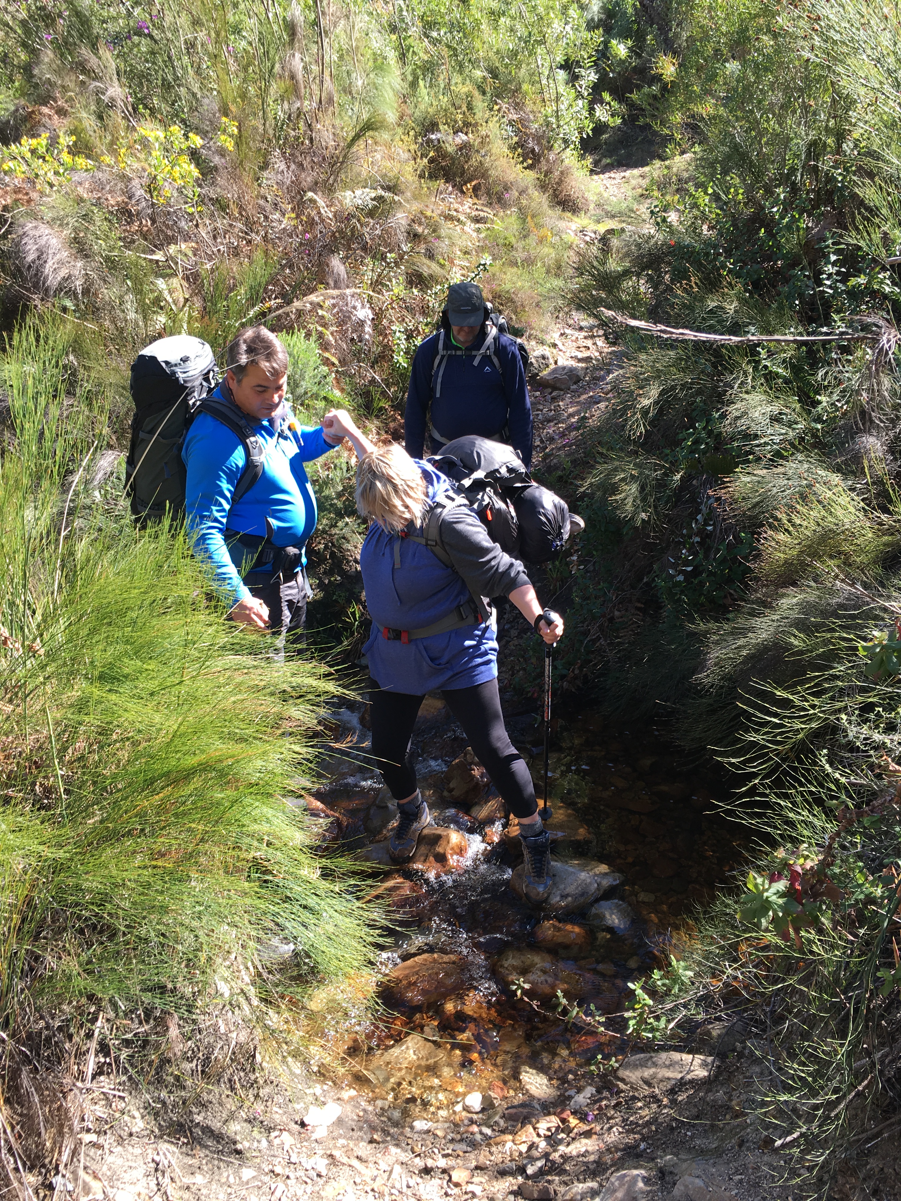
Berto and Frans assisting Fiela over a couple of loose rocks in a stream
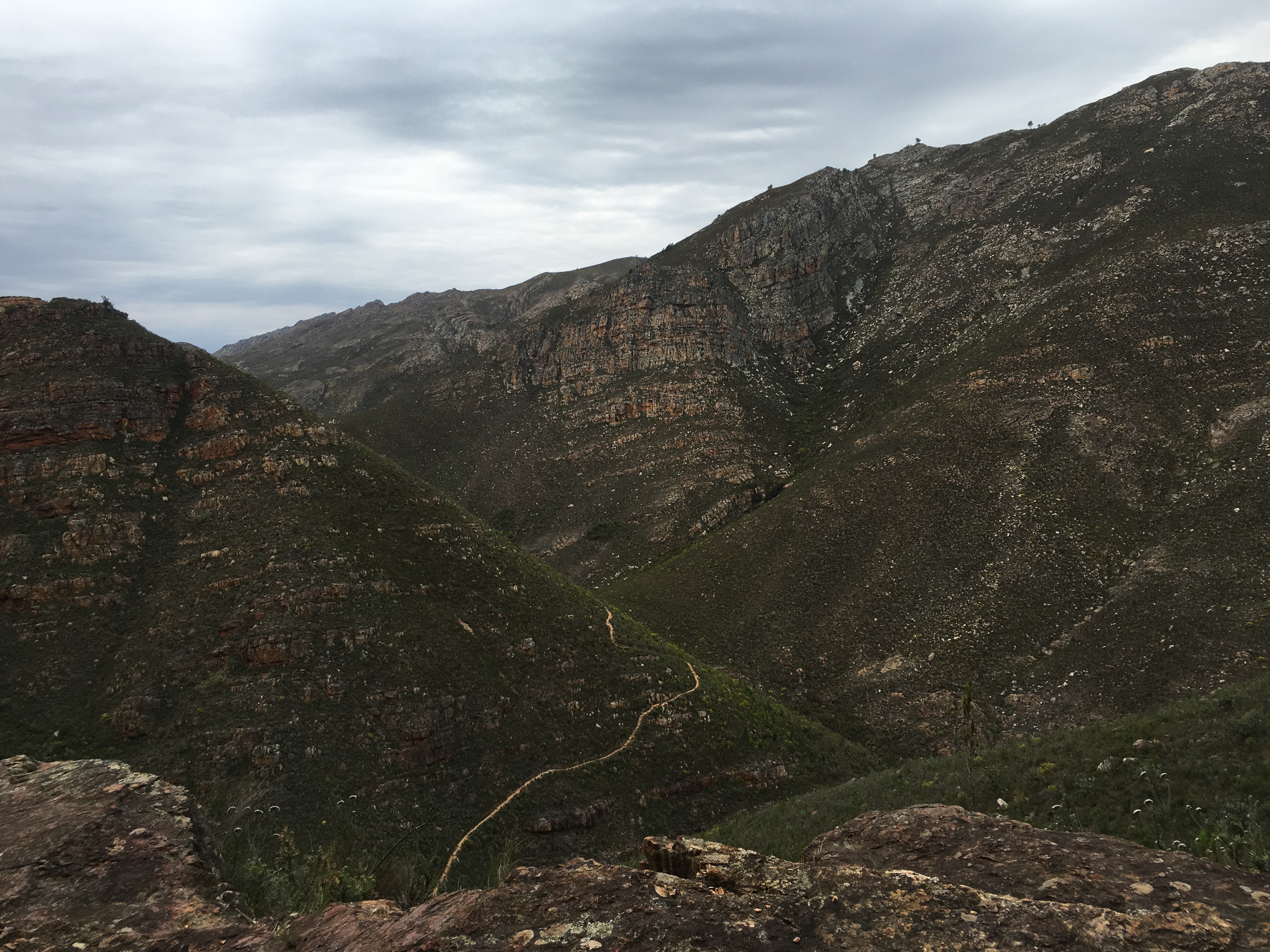
We now walked in between the mountains and it was wonderful to hear only the sounds of nature, coming from the big variety of birds and also the river that flowed close by.
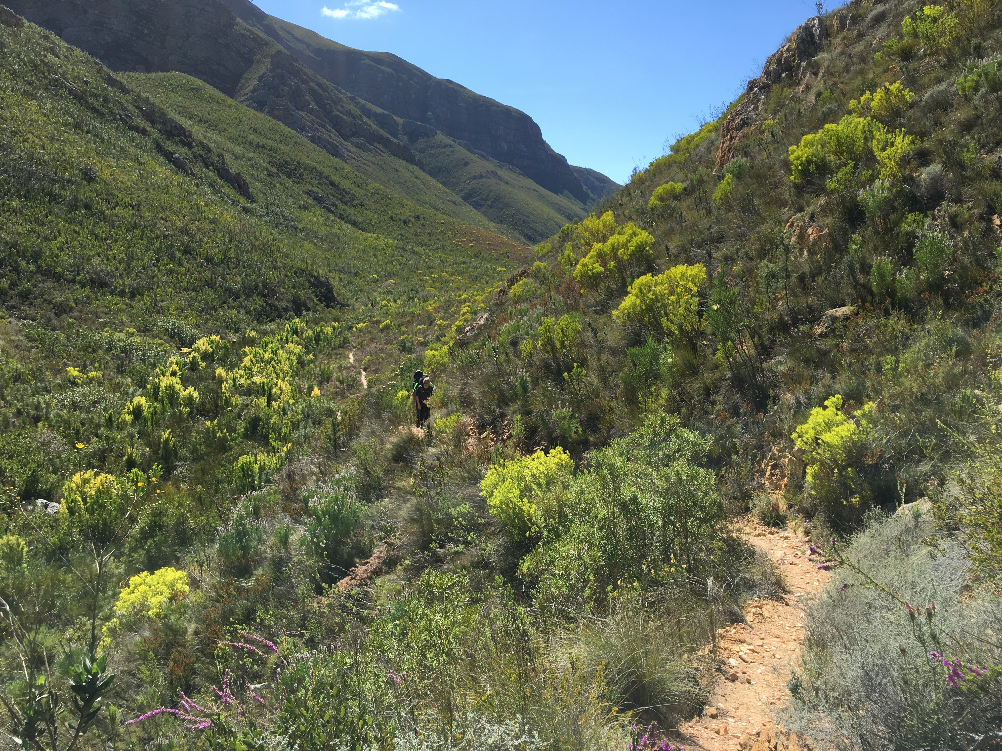
In the valley between the gorgeous mountains
We then got sight of the promised rock pools and waterfalls. We could hear the water from a distance echoing in the mountain valleys.


Waterfall and rock pools
We made lunch the previous evening and it was great to sit on the rocks and enjoy our tuna salad and fruit. There were a couple of other hikers as well – most of them coming from Greyton’s side. It was not that hot and we didn’t need to cool off in the rock pools (although there were two or three brave hikers that took a quick dip in the ice-cold water)!
Berto, Fiela and Frans enjoying nature after a well-deserved lunch
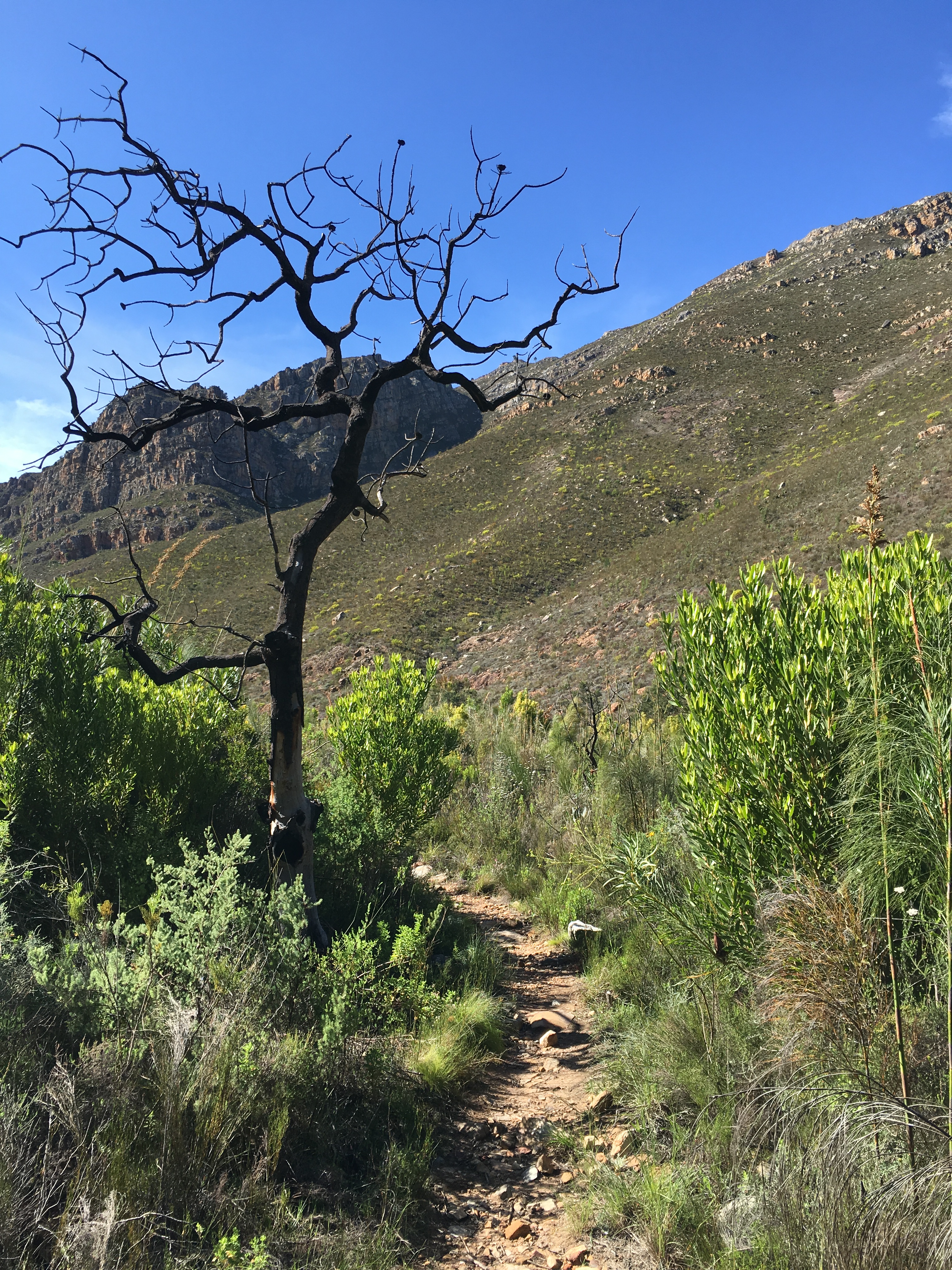
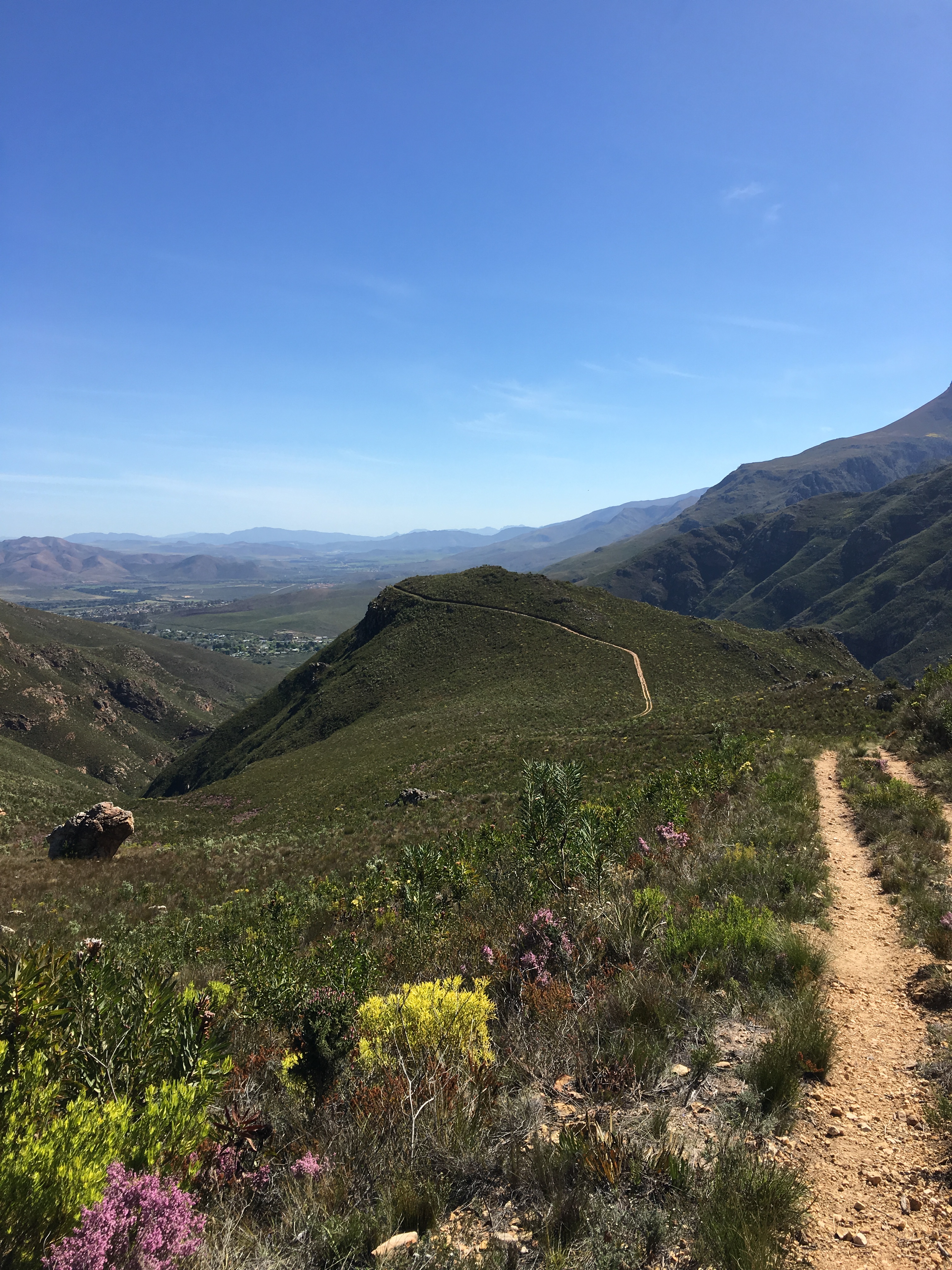
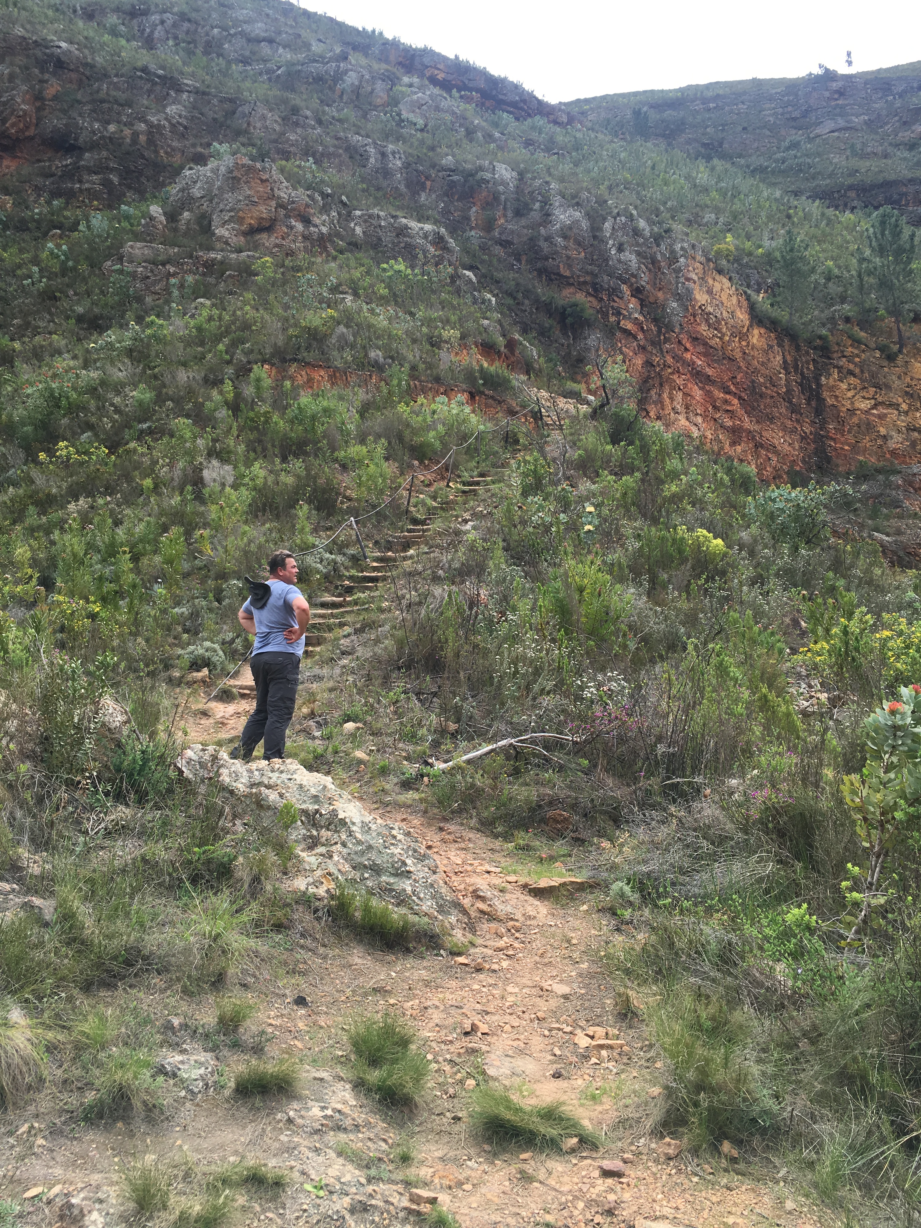
After resting for a while, we tackled the last few kilometers to Greyton. I would say, that physically, the trail requires a reasonable degree of fitness as it continuously ascends, descends and contours the slopes of Boesmanskloof.
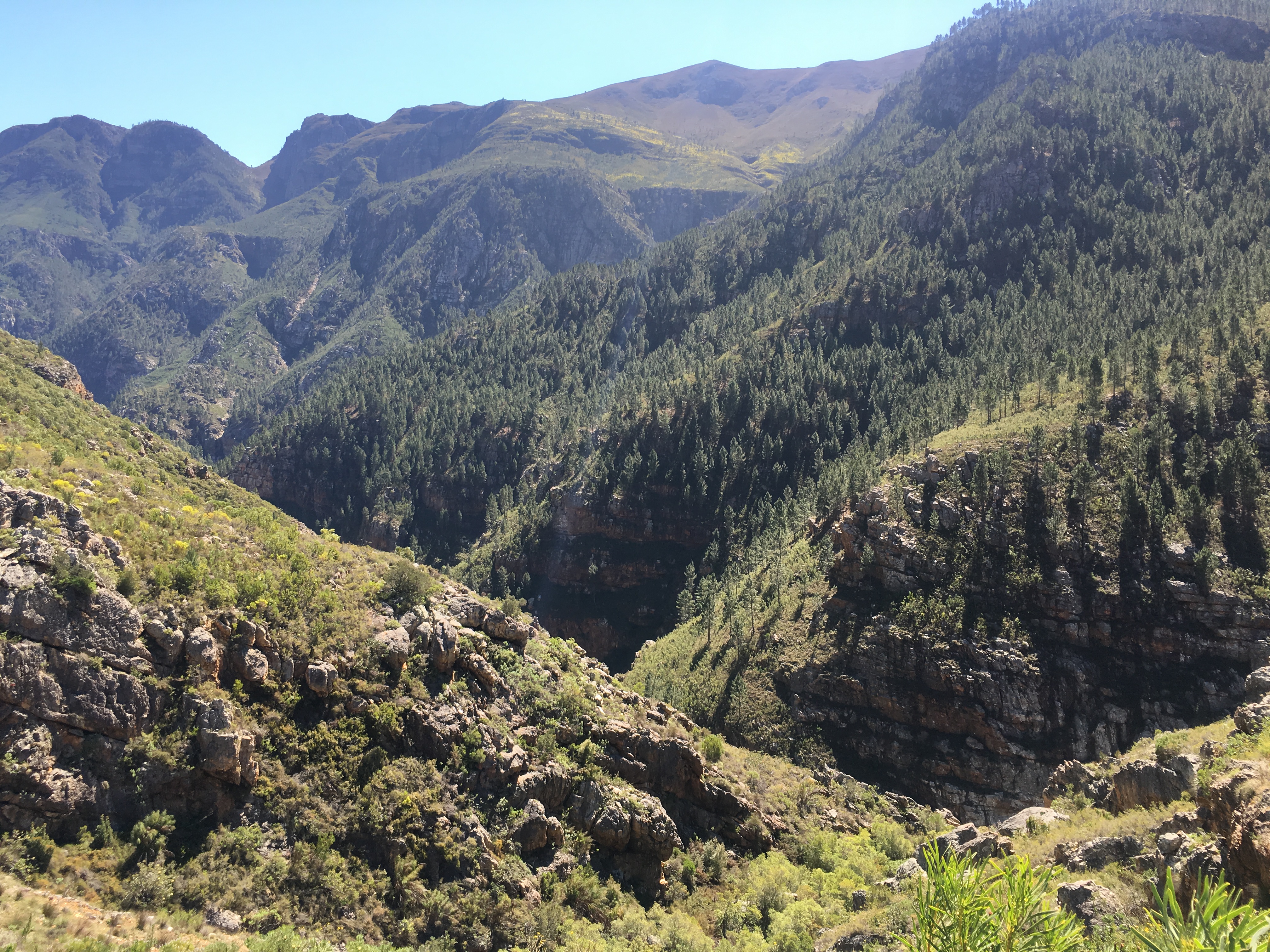
Steep gorges on the Boesmanskloof Hiking Trail
The last part of the trail, takes you up a steep hill to the top from where one can see Greyton in the distance. It required some energy to reach the top, especially with a backpack that is filled with camping equipment (which includes a tent)!


A short, but steep uphill to the top of Boesmanskloof Hiking Trail
At the top of Boesmanskloof from McGregor’s side
Frans and Fiela took the last stage a bit more relaxed and we agreed to wait for them at the top. Berto used the time to take a quick nap before the long descend to Greyton!

Time for a quick nap after a steep climb
Frans and Fiela at the top of the Boesmanskloof Hiking Trail
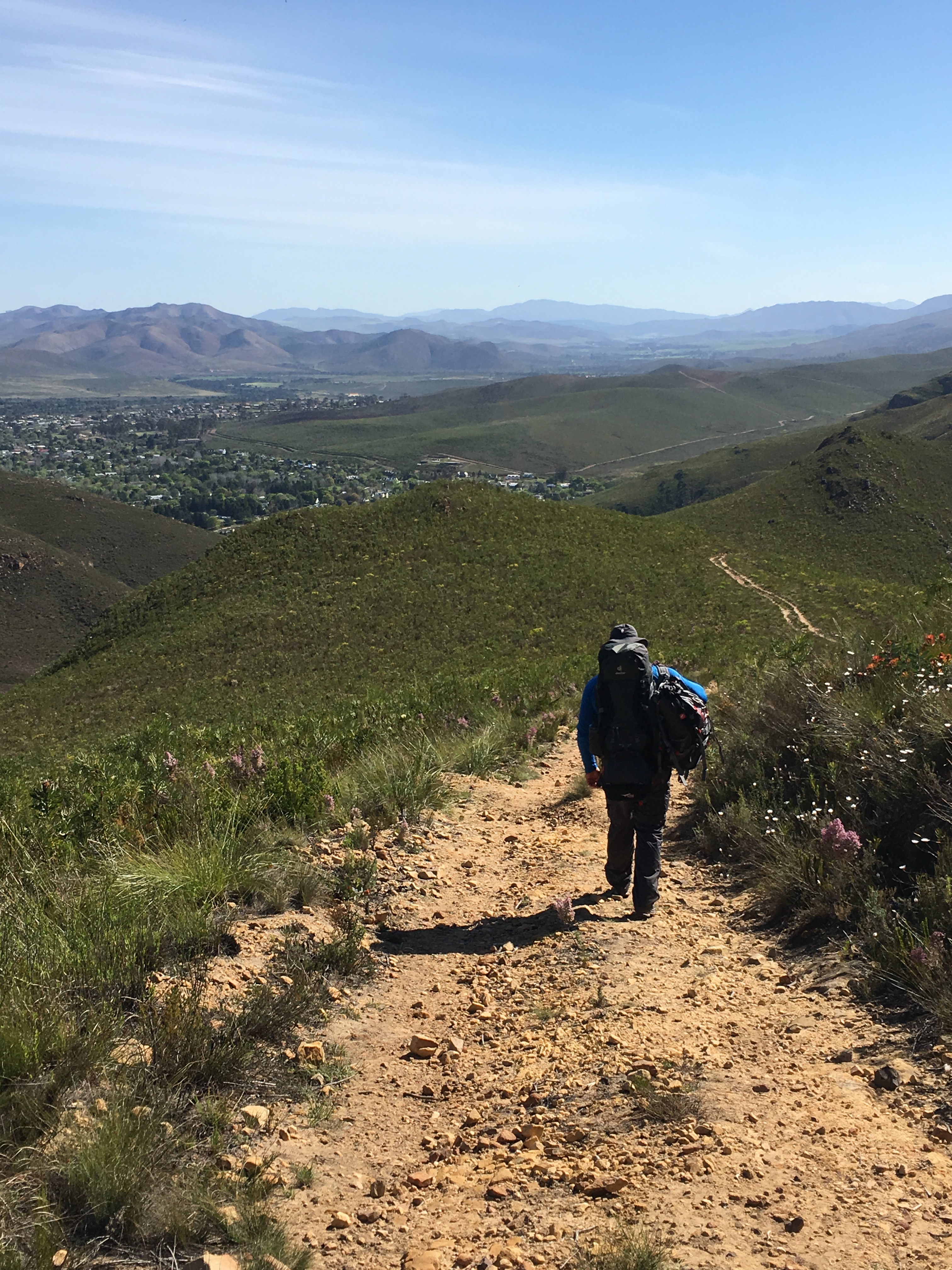
Greyton was in the distance and it was a relief to see that it was now all the way downhill!
The path winds down towards Greyton
Although uphill requires a lot of energy, downhill could also be a tricky part of hiking, because it is quite strenuous on one’s knees. Berto offered to carry Fiela’s backpack on the steep part of the downhill in order for her to negotiate her way down easier.
Berto walking on the steep downhill with Fiela’s backpack – that’s what friends are for
The prospects of a relaxing camping fire were something to look forward to and we walked into Greyton with great satisfaction after completing the first leg of our hike.
Since the campsite is quite some distance out of town, the supervisor of the campsite offered beforehand to collect us in Greyton, which was such a nice gesture, since our bodies were ready to call it a day!


The campsite in Greyton where we relaxed around a camp fire
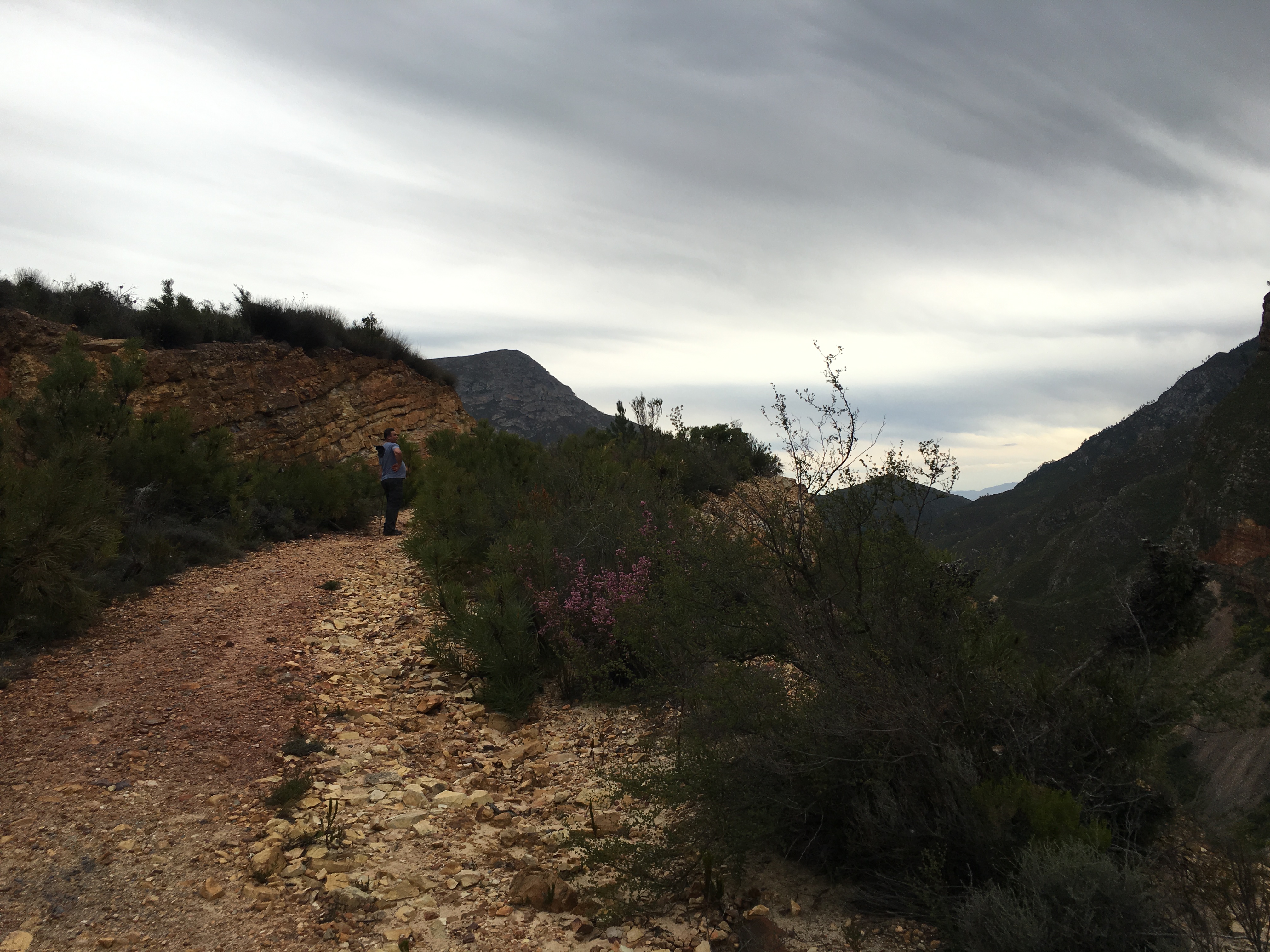
The next morning was overcast and misty. Fiela mentioned the previous evening that it felt as if she might have hurt her leg on the steep downhill and we (almost happily) agreed that she will stay at the campsite, while the three of us walk all the way back to get the vehicle. That meant we only had the bare minimum in our backpacks to hike back to McGregor (thanks Fiela) … because that downhill of yesterday, is today a very long and steep uphill!
The three of us left early and started our hike back to McGregor in cold and misty conditions.
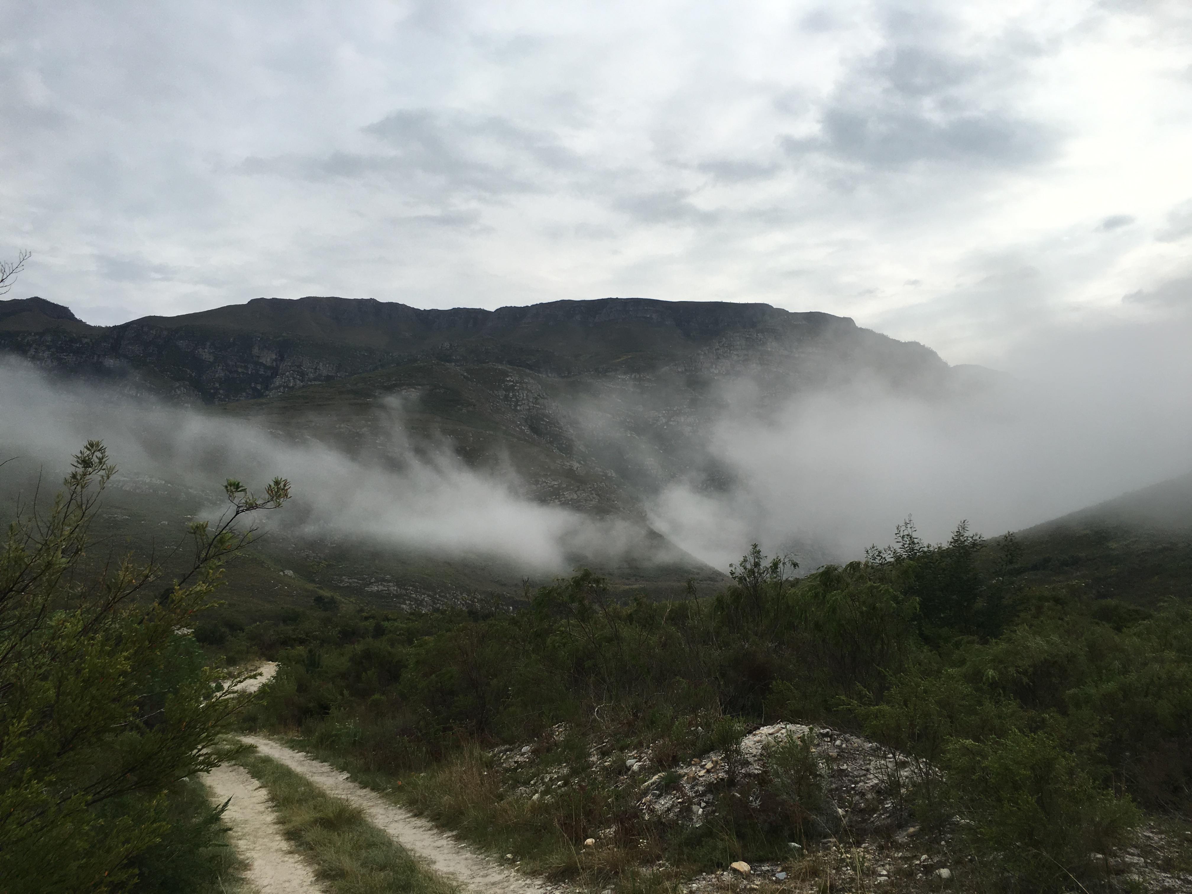
The mist was low in the mountains as we started our ascent to the top
We zig-zagged over the river from the camp site, before we reached the the same track of yesterday, now winding up and around the mountain.
Berto and Frans walking the steep uphill from Greyton’s side
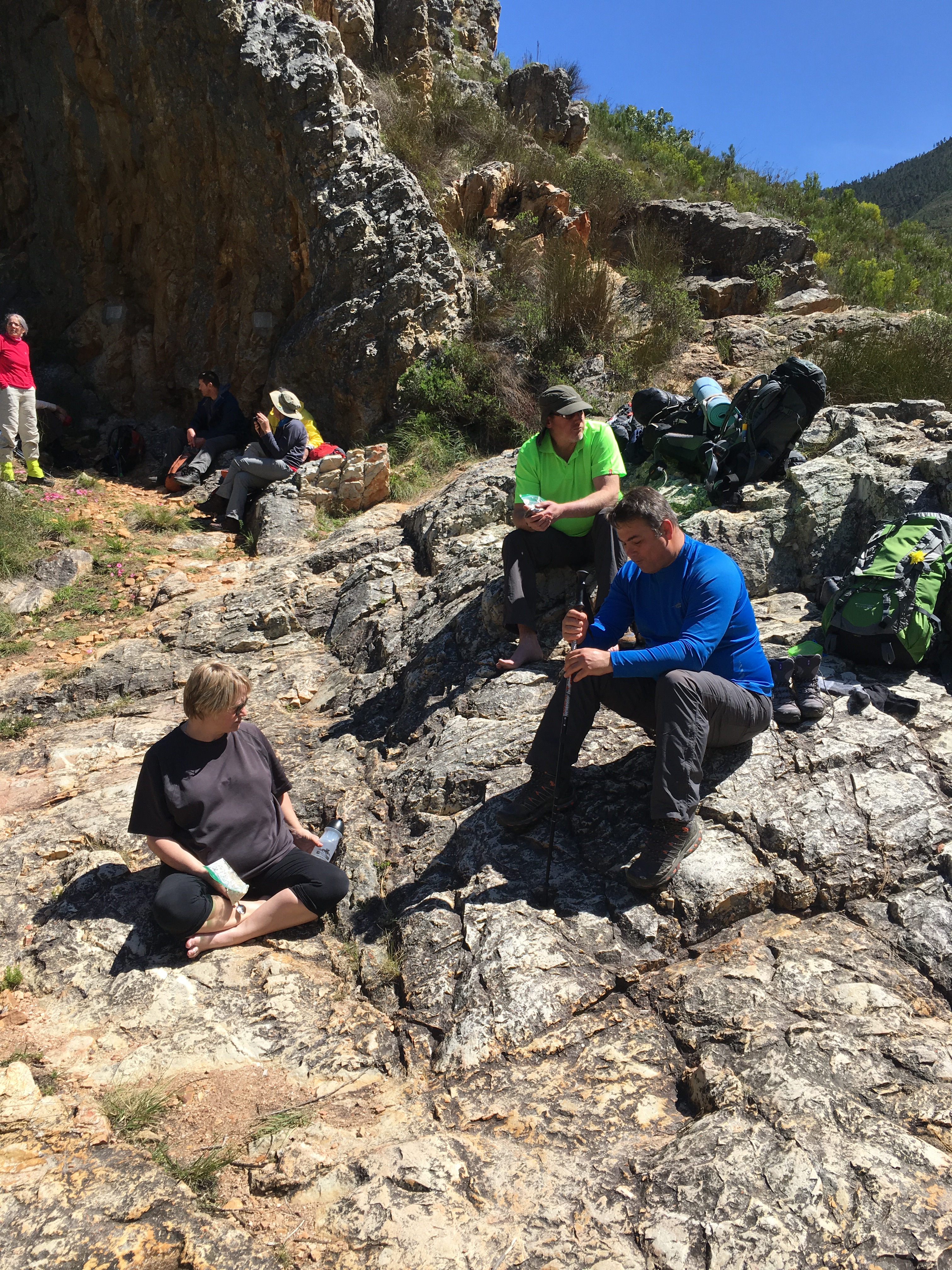
When we reached Breakfast Rock, that was a clear indication for us to relax and enjoy something to eat.
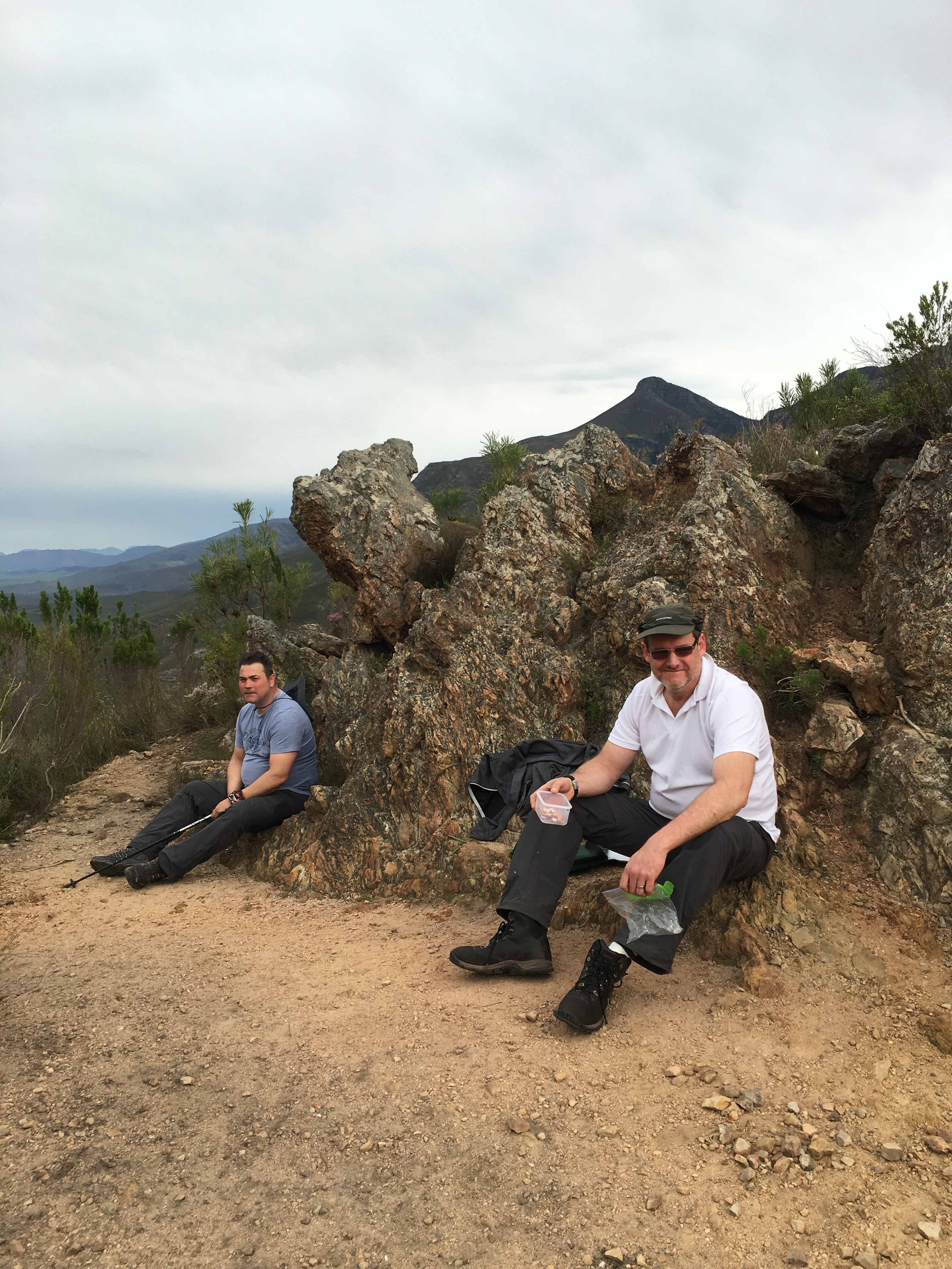
Berto and Frans relaxing at Breakfast Rock after the first steep climb
Back at the official entrance to the Cape Nature Boesmanskloof Hiking Trail, we took a couple of photo’s before the steep descend into the valley starts.

The steep uphill is done and we are leaving Greyton behind
From here onwards we did not take any photo’s, because we have walked these tracks yesterday … and we were now in a hurry to get back to McGregor!
Today we did not see any swimmers at the rock pools – the overcast conditions were not really inviting for a cold swim!
Towards the end of the hiking trail, we came to a sign indicating two options:
- Left – Historical pass or
- Right – Natural beauty
Since we came down the “Natural beauty” pathway yesterday, we chose the “Historical pass”.
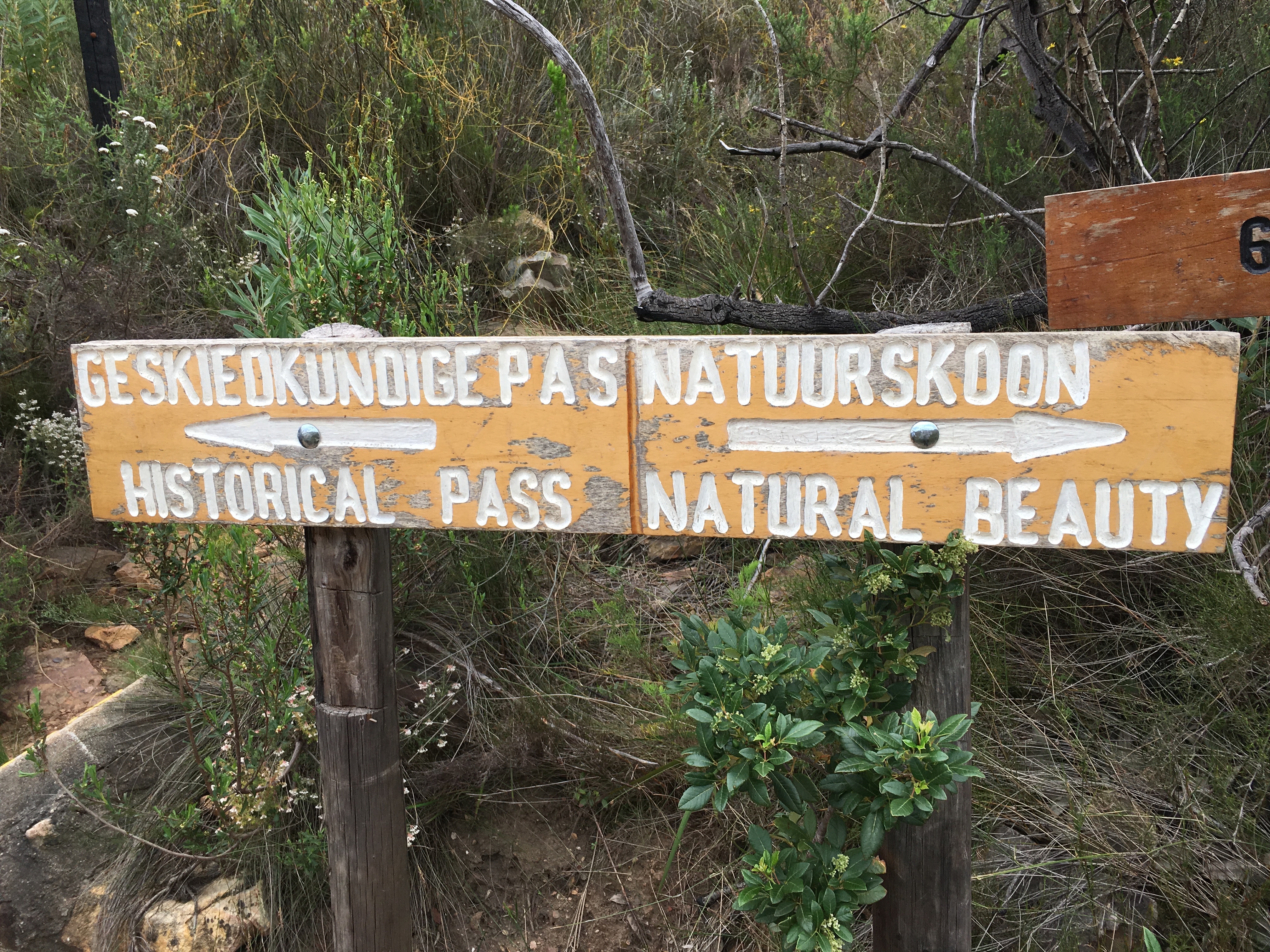
Historical pass to the left
This was a very steep uphill towards the end of the trail. Small rock steps took us up towards the unfinished historical pass.
Up and up towards the top of the unfished historical pass
The pathway down in the valley which we walked yesterday
According to Dr John Mortimer, who extensively researched the history of the historical pass, the first attempt to build this pass was made between 1865 and 1880. McGregor and Greyton tried to collect enough money to build the pass, but never succeeded and this is unfortunately why the pass is today only an attempt to connect the two towns.
This means, that these days, you have to almost drive 100km with your car between the two towns. Or you could hike 14km with a backpack!
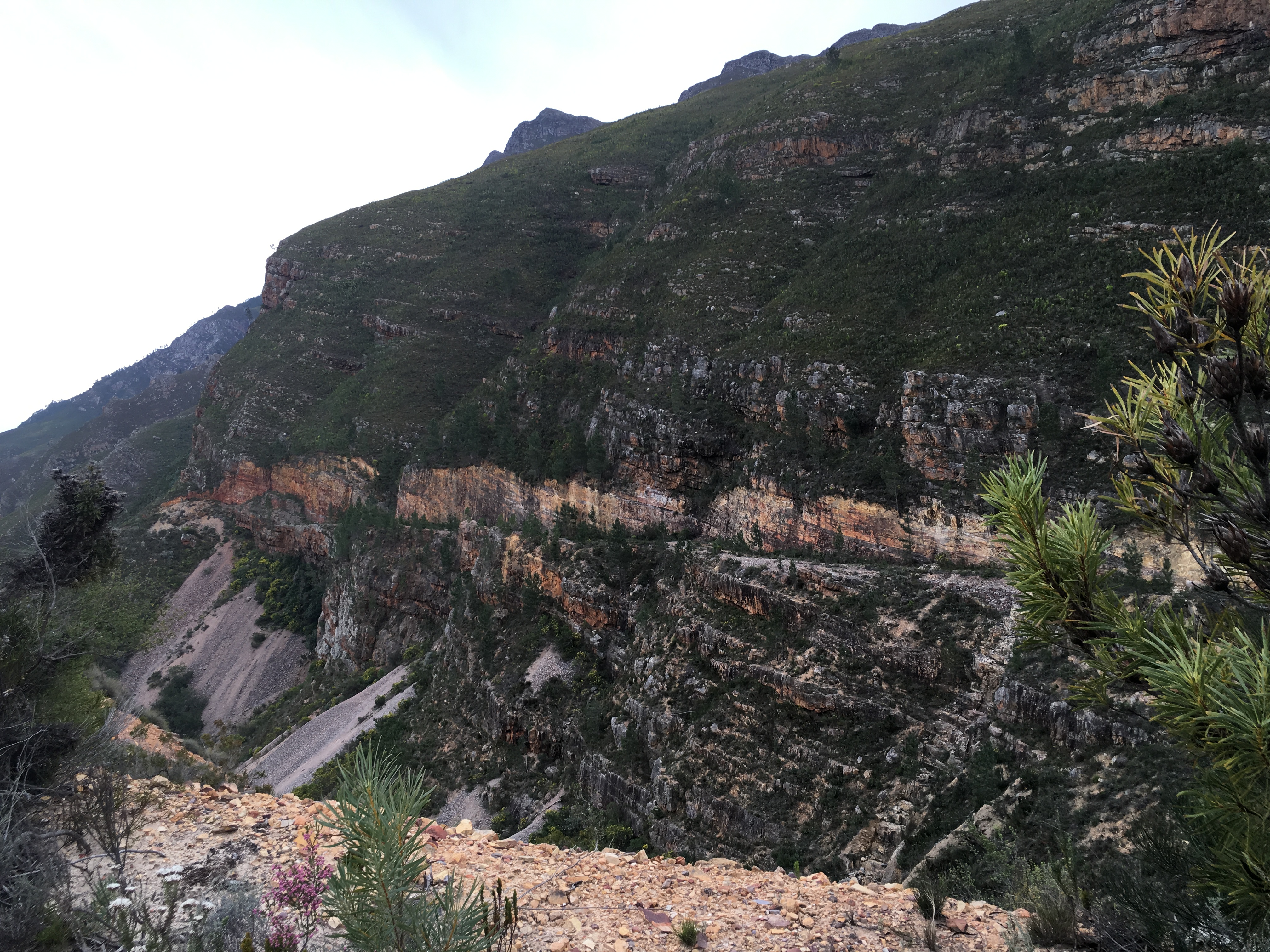
Here you can see the road on the edge of the historical pass which we followed towards the end of the trail
It was an absolute joy to walk this popular hiking trail. The magnificent mountains and stunning views are worth the challenging ascents and descents!
Berto at the top (and the end) of the Boesmanskloof Hiking trail back at the McGregor side
Don’t miss the opportunity to pack your backpack and experience this hiking trail – you will be stunned by the beauty!
