February 2026
Visiting the most south-western point of Africa
How many times can you use the word ‘Cape’ in a headline? Well, we were at CAPE Point and the CAPE of Good Hope, near CAPE Town – so, three times sounds about right.
Cape Point and The Cape of Good Hope are located in Table Mountain National Park. The area has been a nature reserve since 1938 and in 1998 incorporated into the Cape Peninsula National Park. In 2004 the name changed to Table Mountain National Park. And that is where we are taking you today.
We got up early on a Saturday morning to drive to the most south-western point of Africa. The day could not have started better than with a view of Table Mountain. And with the rising sun over the ocean, we were more than ready to enjoy the breathtaking views at Cape Point and Cape of Good Hope.
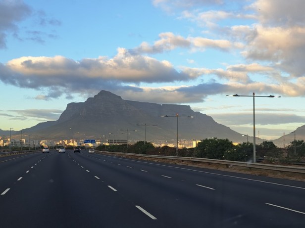
View of Table Mountain early in the morning
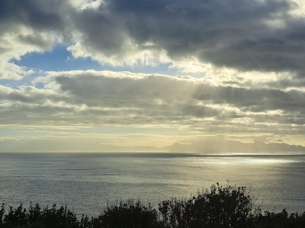
Sun rays over the ocean
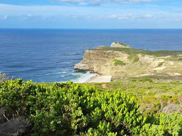
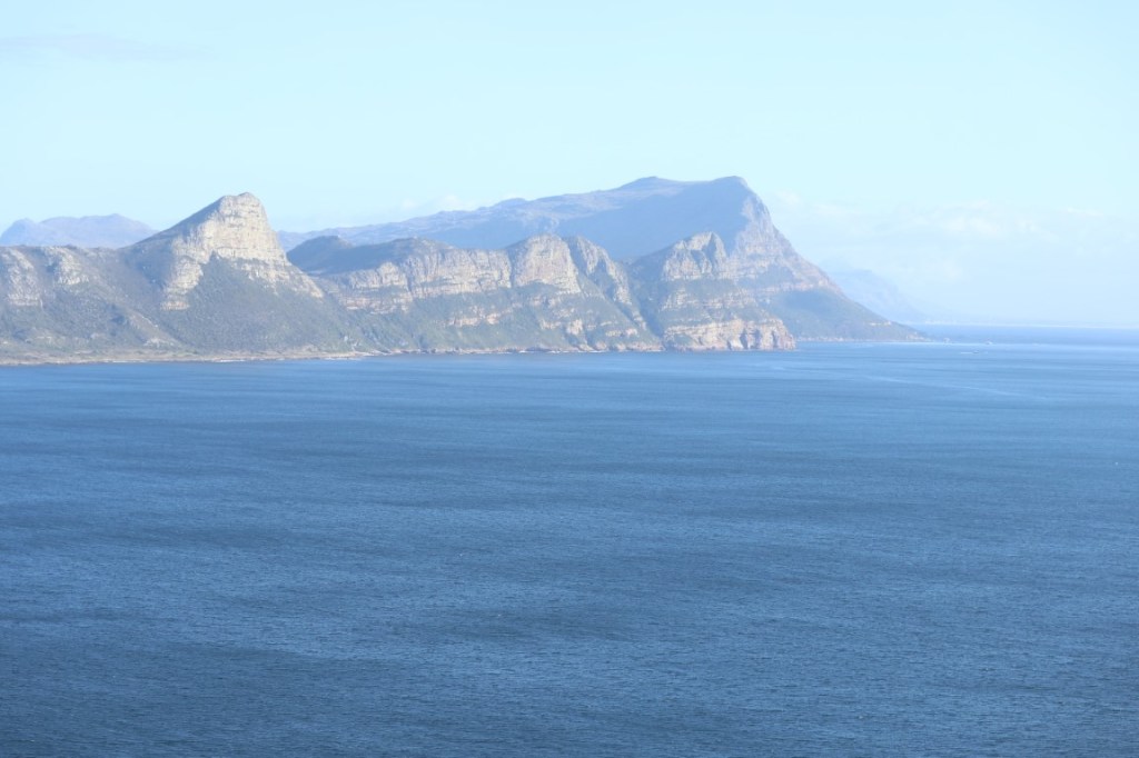
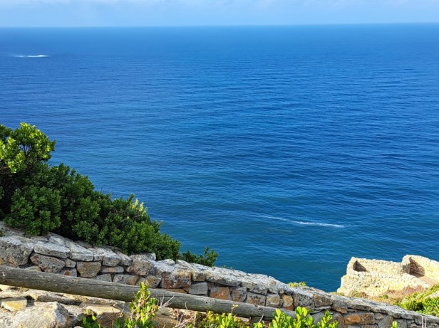
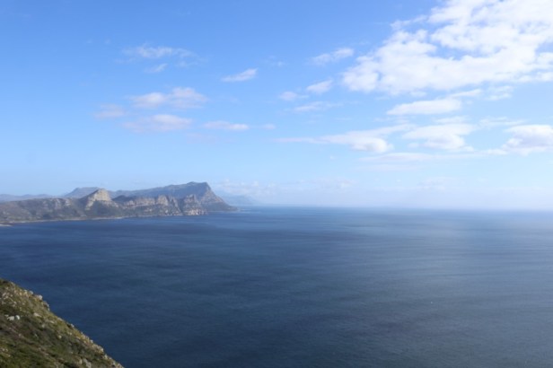
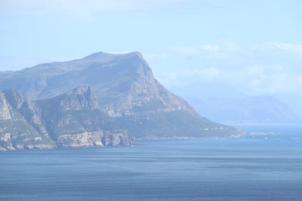
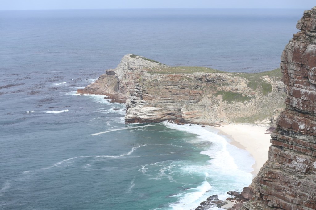
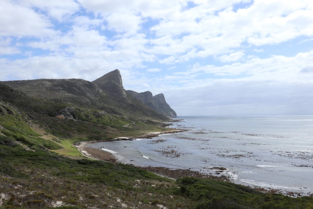
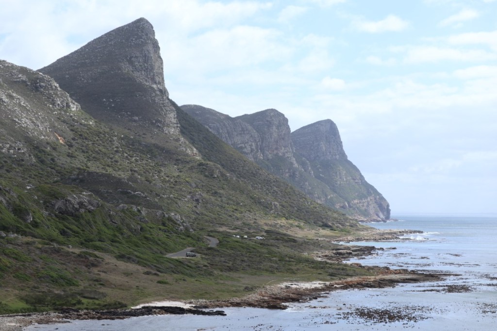
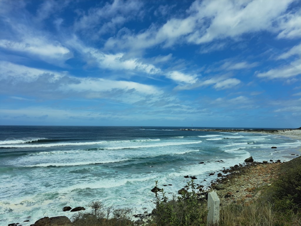
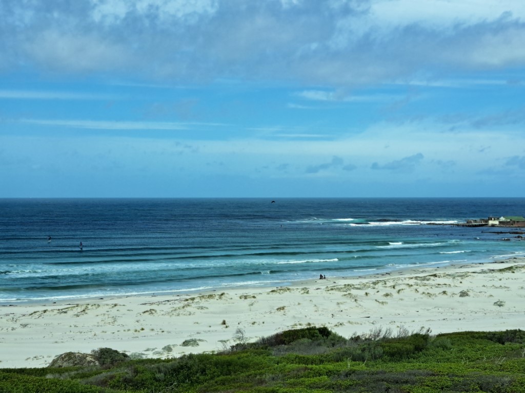
Just after we entered the park, we stopped at the first viewpoint. From here, there is a stunning view not only of Smitswinkel Bay, but of the entire False Bay.
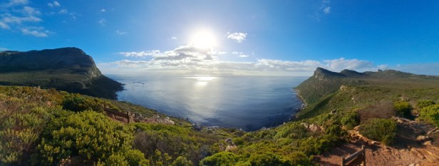
Panoramic view of Smitswinkel Bay and False Bay
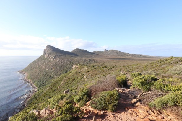
View towards Judas Peak
We were in a hurry to get to the Cape Point lighthouse, but opposite the Buffelsfontein Visitor Centre we saw a beautiful old building where we made a quick stop. Skaife’s Barn is a tribute to Sydney Harold Skaife, an entomologist and naturalist.
Among his many achievements, his greatest was probably his leading role in the creation of the old Table Mountain Nature Reserve in 1938. (Source: Wikipedia). It just felt right to start our visit here.
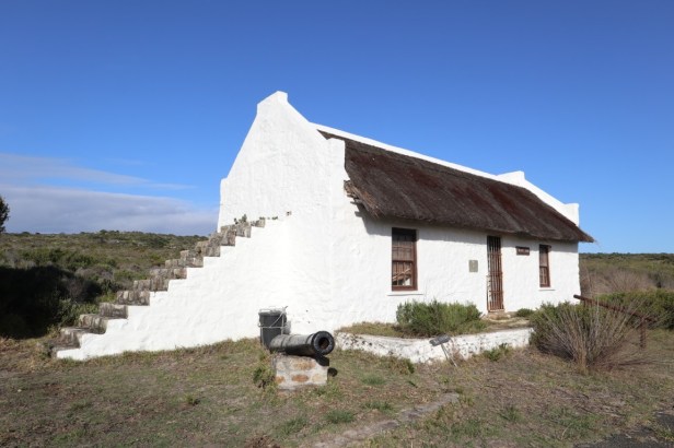
Skaife’s Barn
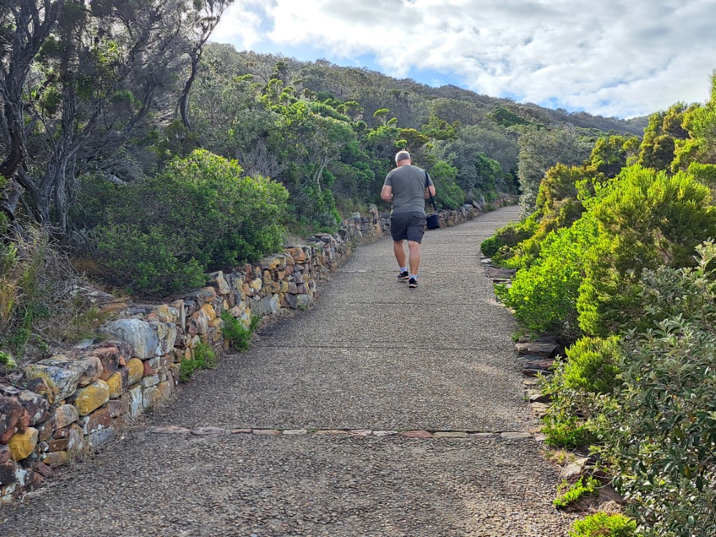
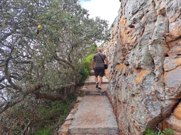
This national park is one of the most popular places to visit (especially by overseas tourists). That is why we had already entered the park before 8:00am – to avoid the crowds. As a result, we were able to walk to the lighthouse without coming across a single person. (When we left the park a few hours later, we saw quite a few buses loaded with tourists).
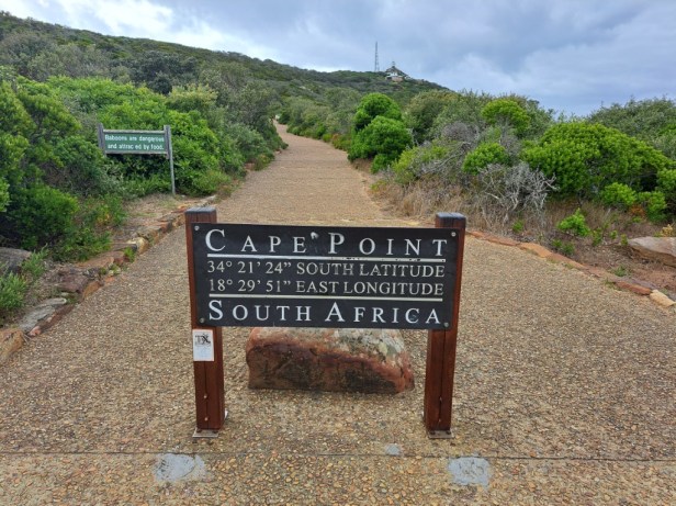
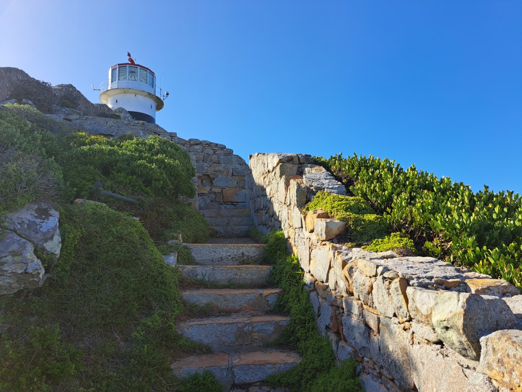
At the start of the footpath leading to the lighthouse
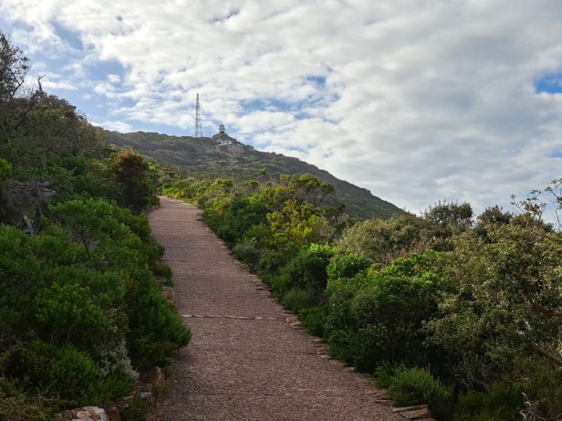
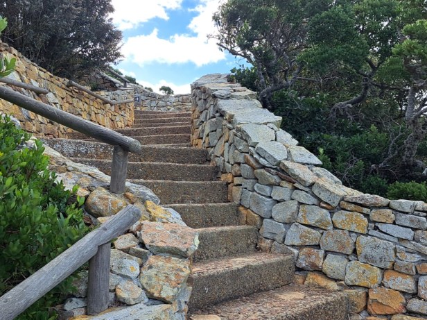
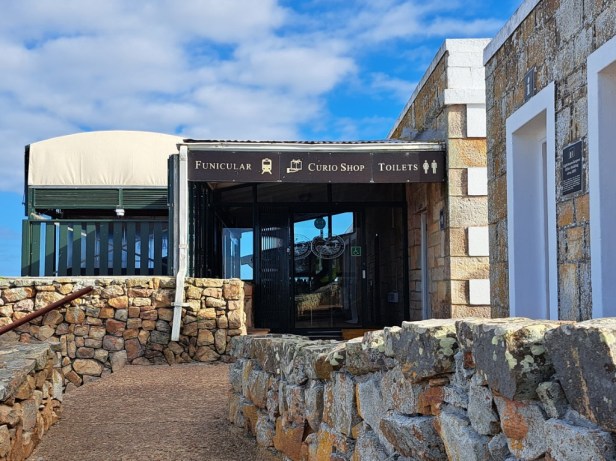
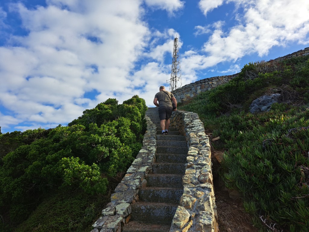
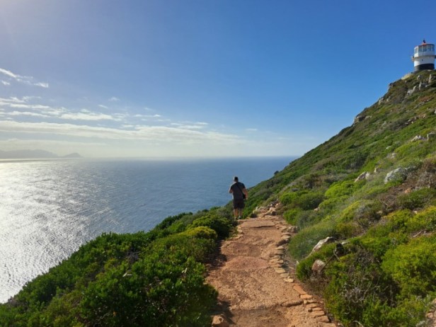
There are two ways to get to the lighthouse. The Flying Dutchman funicular offers a three-minute ride to the top, or you can follow the walking trail to the lighthouse. It’s a scenic path, though you’ll encounter plenty of steps along the way. However, there are benches and spots along the way to rest a bit while enjoying the views.
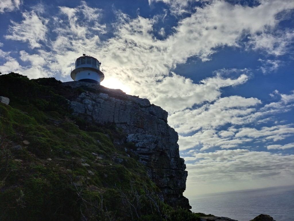
Steep path to the lighthouse (visible in the distance)
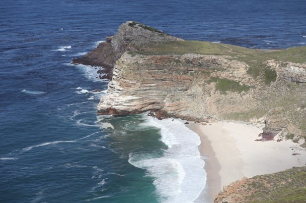
In my opinion, it is not necessarily the lighthouse that is photographed the most, but rather Cape Maclear with its secluded beach that you can see from both the walking trail and the lighthouse (between the two of us we easily took 20 or more photos just of Cape Maclear). Maclear Beach is characterised by its white sandy shores and clear waters and therefore a very popular spot for swimming, diving and fishing.
Halfway up, we could see Cape Maclear
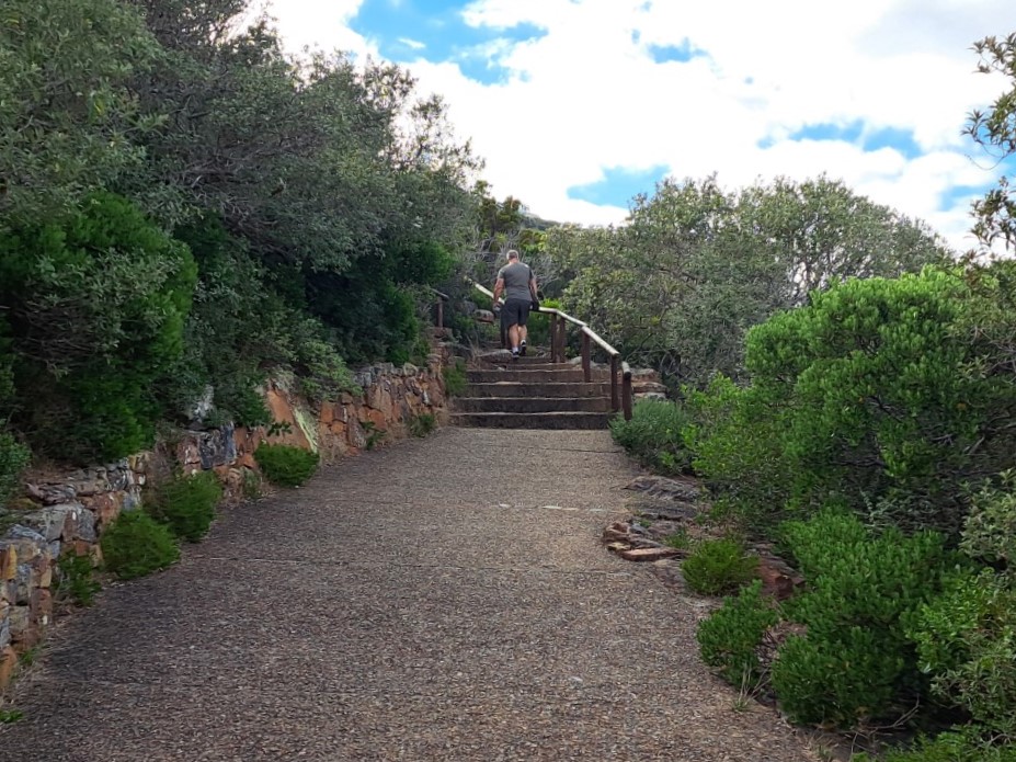
Steep path and plenty of steps
Looking back at the parking area (where we started)
Incredible views (and we’re not even at the top yet)
The last few steps to where the funicular stops
When you finally reach the top – where the funicular stops – there are a few viewpoints where you can catch your breath while looking over the vast Atlantic Ocean. But at this point you are not yet at the lighthouse. Nope, there are still quite a few steep steps to go.
Funicular station at the top
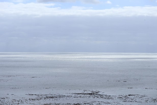
Stunning view over the blue ocean
Maclear Beach (again)
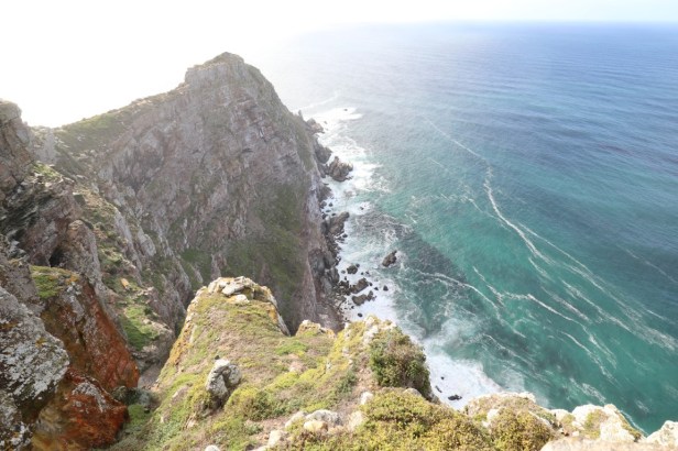
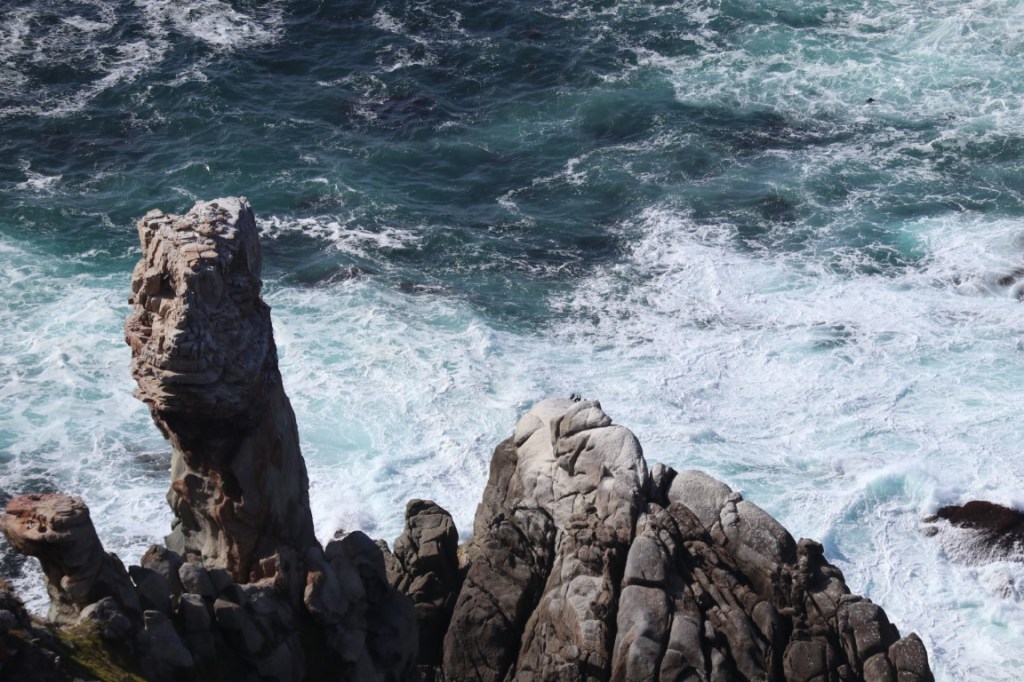
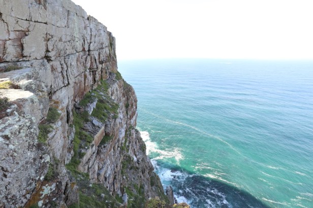
Cliffs towering more than 200m above the sea
More steps to the lighthouse
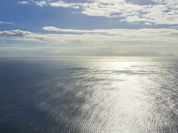
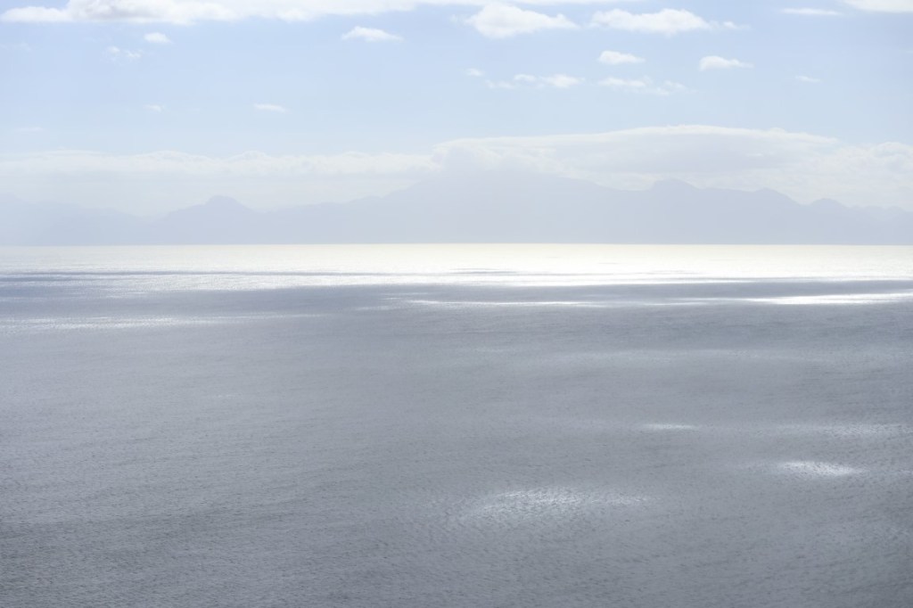
The rising sun over False Bay
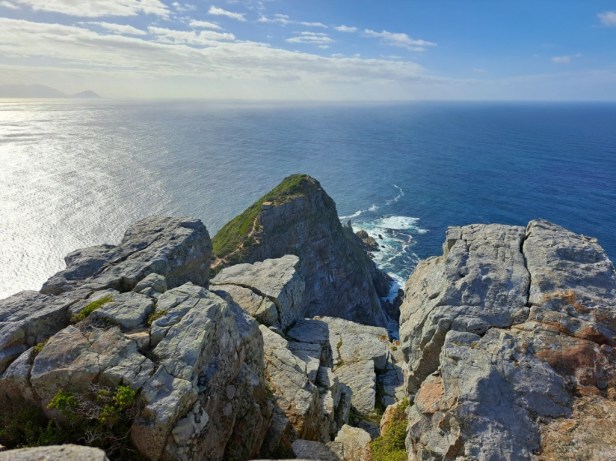
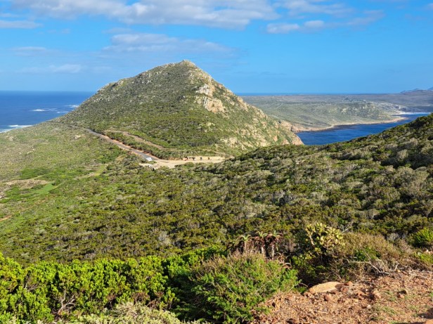
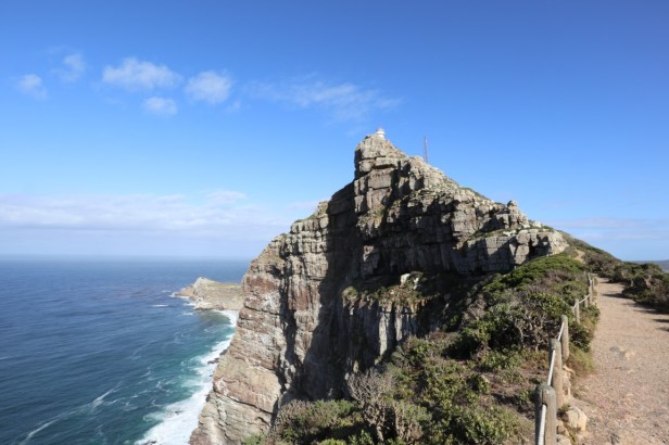
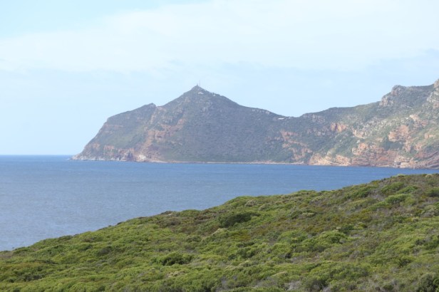
View towards Cape Point
Almost there
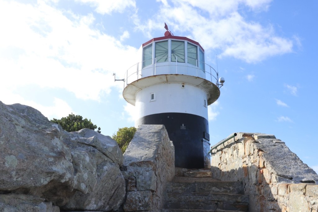
The lighthouse was erected in 1860 and is 249m above sea level. The flashing light could be seen by ships 67km out to sea. Unfortunately, it later proved to be ineffective as it was often covered by cloud and mist. After the wreck of the Portuguese liner ‘Lusitania’ in 1911, it was decided to erect the present lighthouse (below this one) on Dias Point at 87m above sea level.
View of Smitswinkel Bay and False Bay
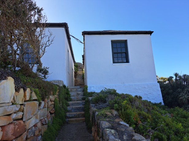
After we read about the other lighthouse that was further down at Dias Point, we decided to take a walk down to where this lighthouse is situated. On the way, we walked past the Historical Lighthouse Cottages. These buildings were built around 1860 and originally provided free accommodation for visitors to the lighthouse.
Historical Lighthouse Cottages
We found the Lighthouse Keepers Trail which will take half an hour round trip to walk. The path is in good condition, but keep in mind that it is a steep downhill – and that you will have to walk back up again.
Walking path to lighthouse at Dias Point
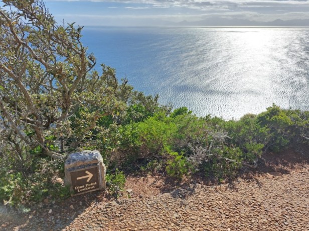
Signage to the Dias Point Lookout
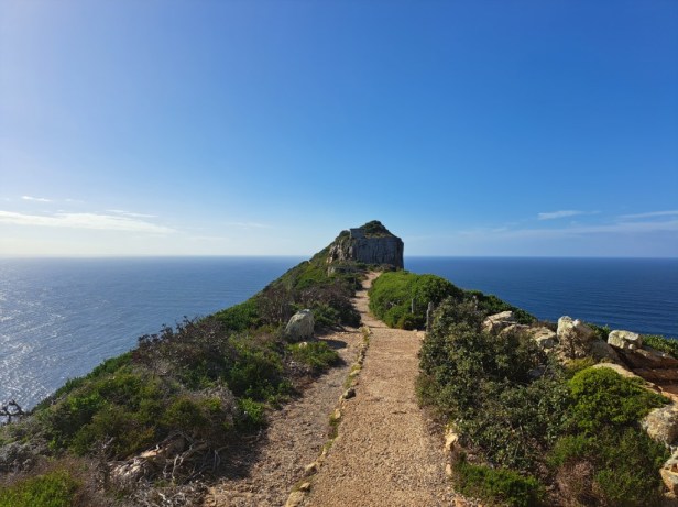
Walking towards the end of Cape Point
The hiking trail stops at the Dias Point Lookout. There is a locked gate with a sign indicating that the road is too dangerous to walk to the lighthouse. We could see the lighthouse from the lookout point, which is literally built on the farthest rocks of Cape Point.
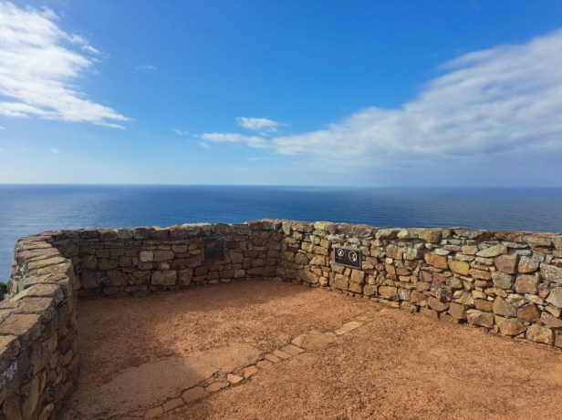
Dias Point Lookout
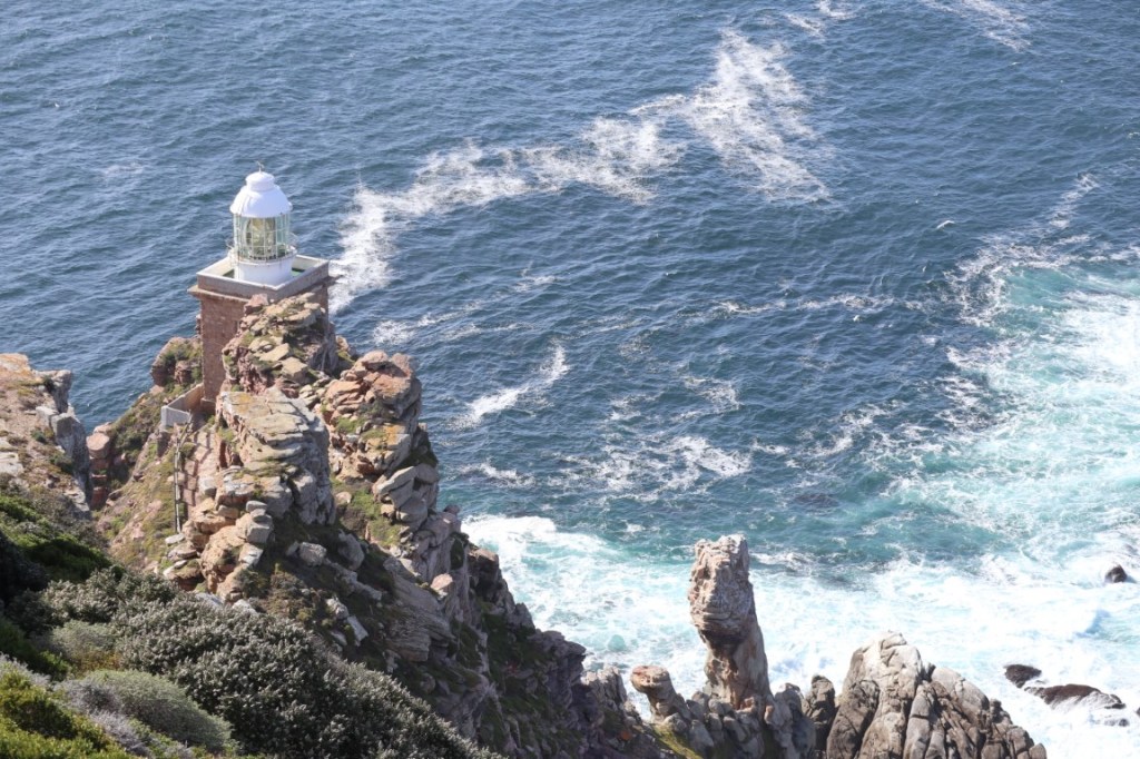
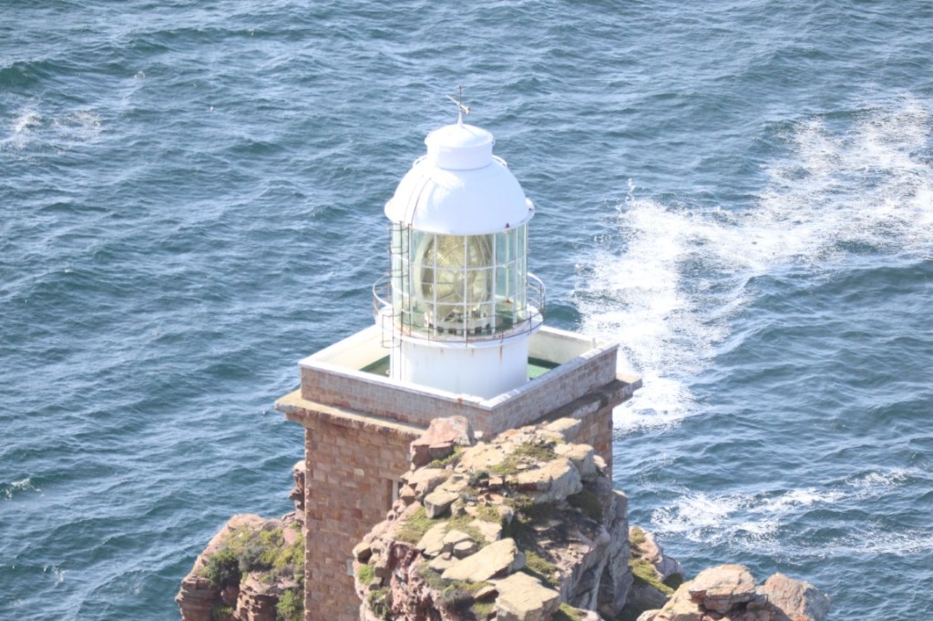
Lighthouse at Dias Point
High cliffs at Dias Point
The original lighthouse
There was a very strong wind that almost blew us off our feet and we decided to rather head back. Along the road, we saw a WWII pillbox (a type of blockhouse or concrete lookout post) with loopholes through which defenders could fire weapons. We could vaguely make out the date 1942 on the rock in front of the pillbox.
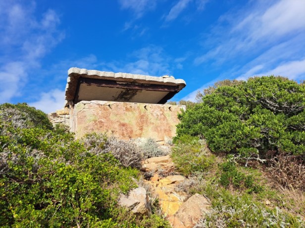
World War II pillbox
Another view towards Smitswinkel Bay
We now had to walk back up to the original lighthouse
We were lucky to see the Black Girdled Lizard on a rock next to the footpath. This is a unique species found in the Table Mountain National Park. This lizard is characterised by its spiny, flat, and pitch-black coloration, which helps it absorb heat from the sun.
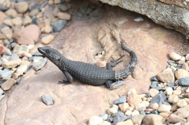
Black Girdled Lizard
After we got back to the original lighthouse, we took a few last photos before we descended to the restaurant – all this walking made us very hungry.
Our favourite views at the top
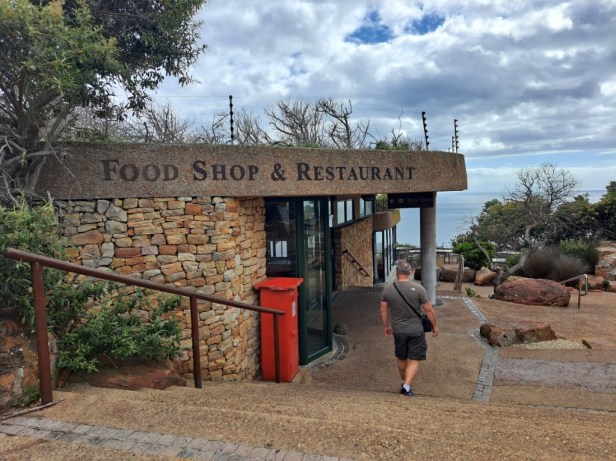
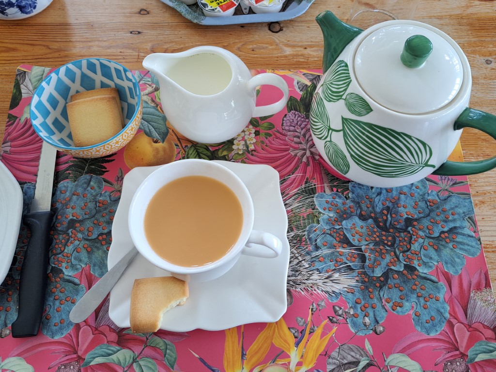
We walked straight to the Two Oceans Restaurant to have the breakfast we had been looking forward to all morning. On the brochure we received at the entrance gate of the park, it’s indicated that the restaurant is open from Monday to Sunday, 9:00am to 5:00pm. To our dismay they informed us that they only open at 11:00am (and it was now just after 10:00am). She suggested that we go to the Food Shop, but alas, that was also closed ‘due to stocktaking.’ What a disappointment!
Time for breakfast … NOT
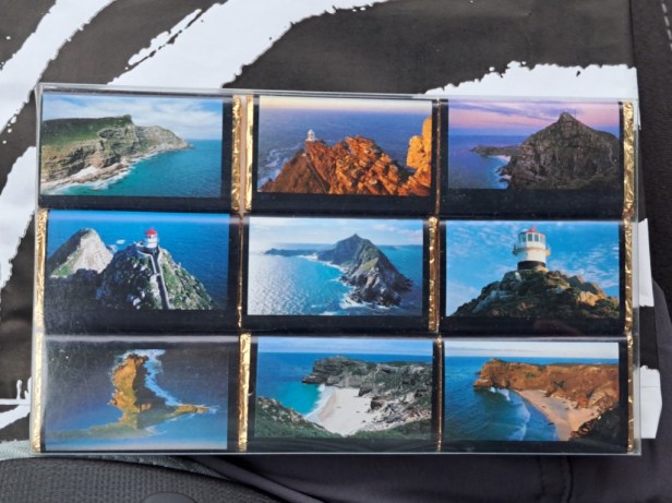
I decided to walk over to the Curio Shop to see if there was anything to eat or drink but could only find very expensive chocolates. I was so desperate to just eat something that I bought it – I guess tourists buy these chocolates for the lovely pictures rather than for the taste of it.
Breakfast … NOT
We still wanted to visit quite a few places in the park, but all we could think about now was how hungry and thirsty we were! The only thing we felt like doing was to drive to the most south-western point of Africa, take a photo, find our way out of the park, and look for a place to eat.
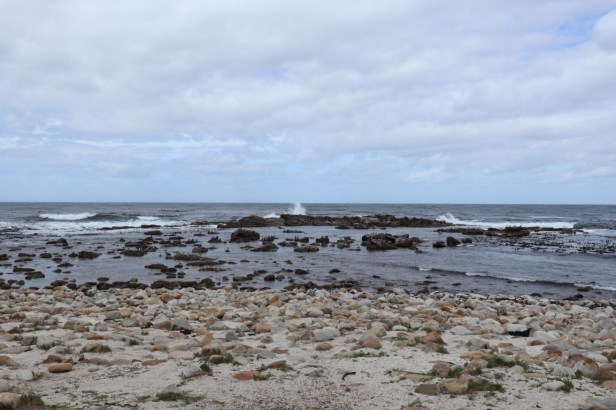
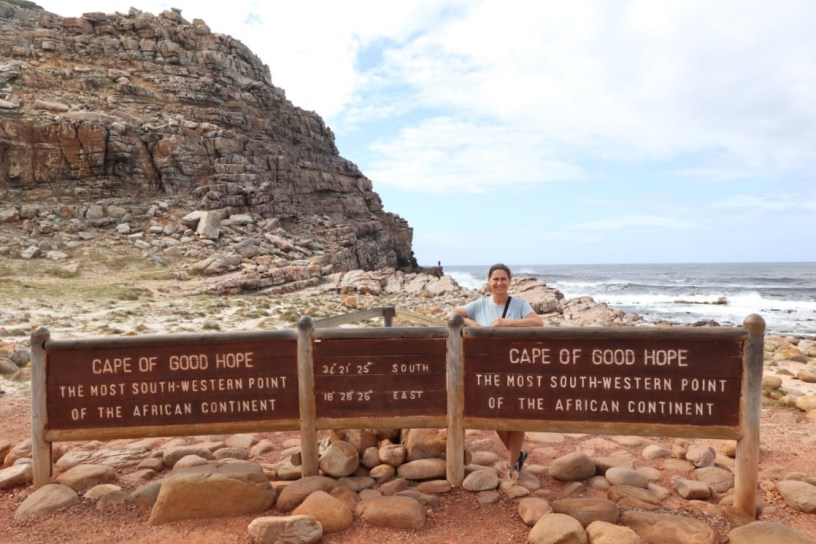
Rocky beach at the most south-western point of Africa
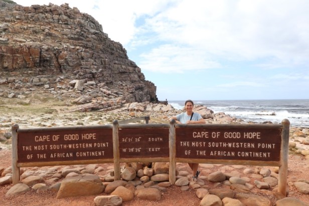
Officially at the most south-western point of Africa (and hungry)
On the way out of the park, we saw two crosses a few kilometers apart. The Dias Cross and Da Gama Cross were erected to commemorate the explorers Bartolomeu Dias and Vasco da Gama, who were the first to reach the Cape of Good Hope.
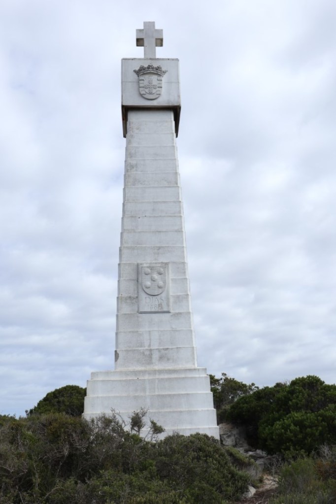
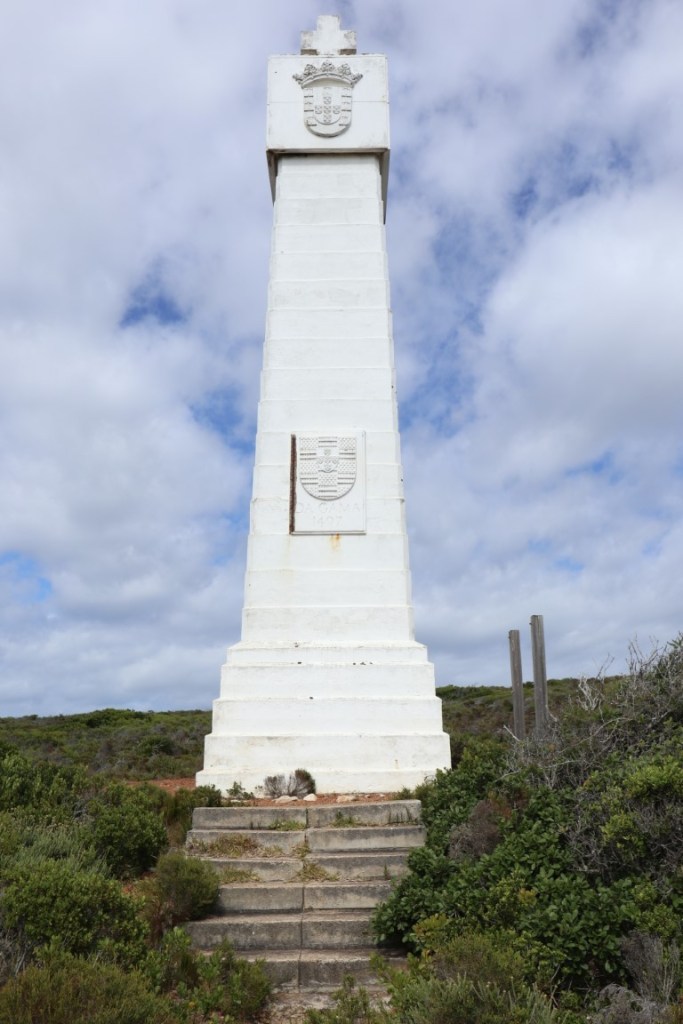
Dias Cross (left) and Da Gama Cross (right)
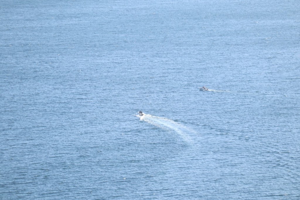
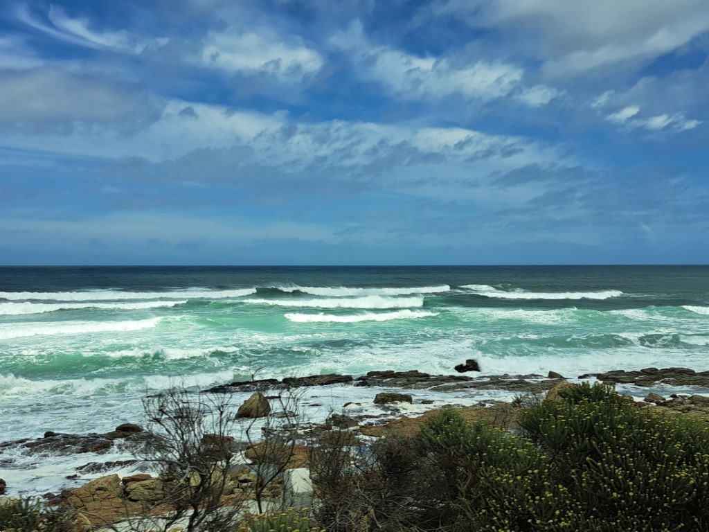
At the Da Gama Cross we took a few photos of the rocky coastline and looked at the pretty picture of the sun glittering over the sea. We then looked at each other and said simultaneously: ‘Let’s find a place to eat!’
Spectacular coastline
One last look at the lighthouse
One of the most beautiful scenes on this day
On the way out of the park, we remembered a place we had always driven past, and I said to Berto I’m pretty sure there’s a restaurant. Cape Point Ostrich Farm was like an oasis – there was food and lots to drink (oh, and ostriches to look at on the way to the restaurant).
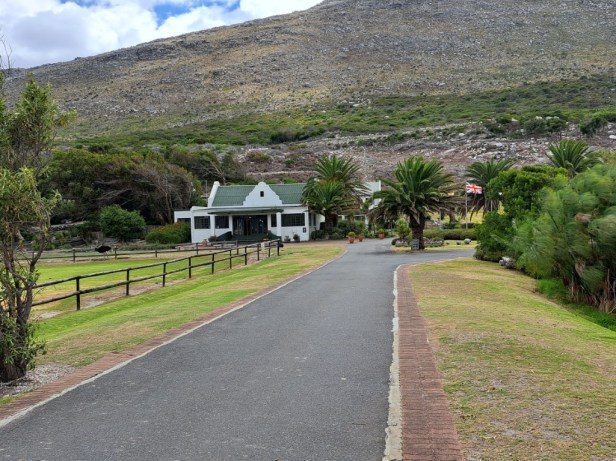
Cape Point Ostrich Farm
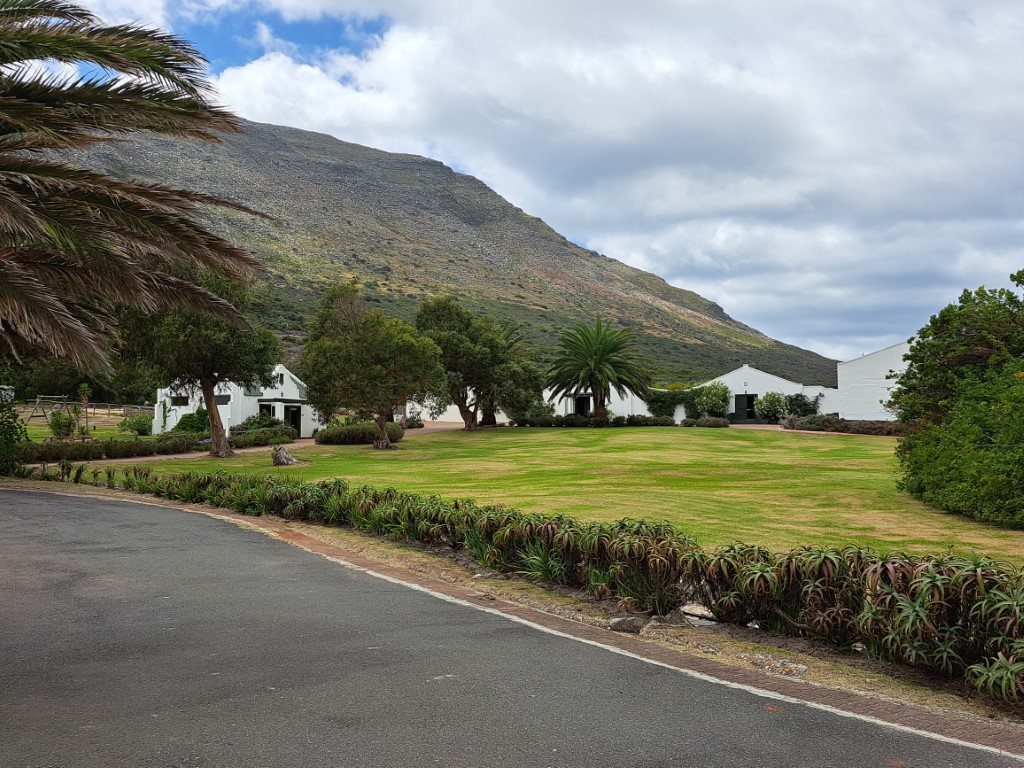
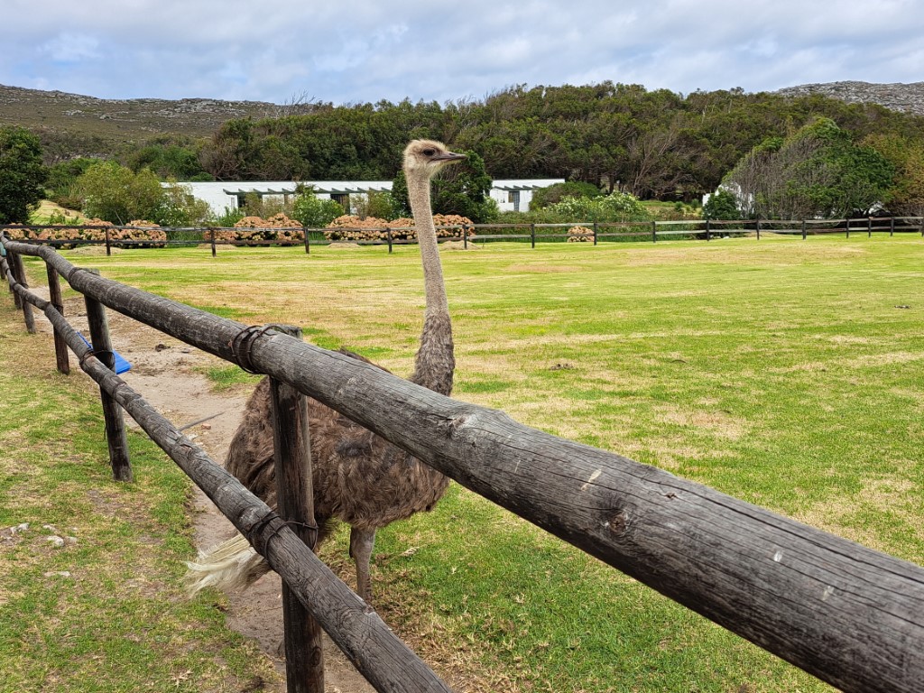
Beautiful ostrich farm
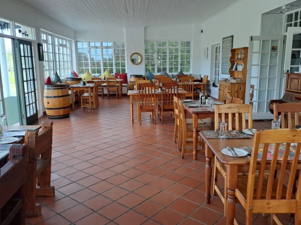
Inside the restaurant
The waitress must have wondered what was wrong with us. We ordered water, juice, and two cups of tea and coffee – all at once. The toasties and salad were the best – and so were the cold drinks we ordered afterwards!
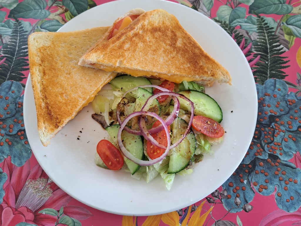
Food and drinks – yeah
After a wonderful meal, we chose the scenic route back home. We drove through the beautiful seaside towns of Scarborough, Misty Cliffs and Kommetjie.
Scenic drive
After we spent most of the morning at lighthouses, it was nice to end our day with yet another lighthouse. Slangkop Lighthouse near Kommetjie was inaugurated on 4 March 1919 and is always a beautiful sight to see along this stretch of the coastline.
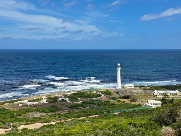
Slangkop Lighthouse
Cape Point and the Cape of Good Hope gave us sweeping views, lovely lighthouses, and postcard-perfect cliffs … but not a single sandwich or water. Next time, we’ll pack our coffee box and snacks.
