
August 2023
If you read our previous post, you may remember that we mentioned we would have to drive from Langebaan to East London. Berto bought a new ‘bakkie’ (also called a truck/pickup truck in other countries) while we were in Langebaan and we therefore had to save our plane tickets for another day.
So, if you feel like a long and scenic road trip, hop into our new bakkie and enjoy the ride. We will name all the towns and cities on our way (indicated with a ✿) … a fun way of learning more of a country.
✿ Langebaan

A spectacular sunrise to start the road trip
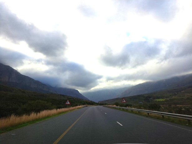
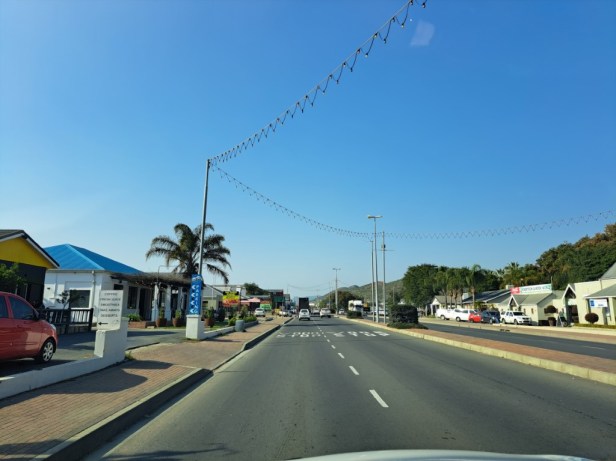
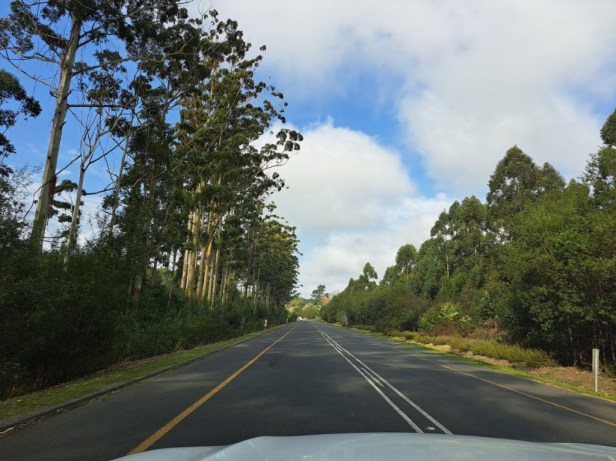
Normally, when we go on a road trip, we don’t drive on the highways, but rather stick to the back roads. But as we had about 1,100km (683 miles) to cover (and time was limited) we headed for the N2 highway which would take us all the way to East London.
✿ Hopefield (32km/20 miles)

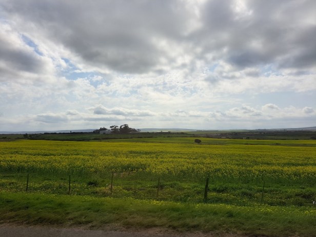
The canola fields with its yellow flowers were lovely
About 40km after we left Langebaan, it started to rain lightly. We talked about how lucky we were with the weather while visiting Langebaan. It was sunny all the time and perfect for admiring the colourful wildflowers.
✿ Malmesbury (93km/58 miles)
✿ Paarl (137km/85 miles)
We apologise in advance for the quality of the photos. I took most of them while Berto was driving, so some of them may be a little out of focus.
It was great to see that the Western Cape Province had a good rainy season. The fields were green and dams and rivers full.
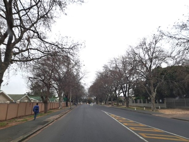
Bare trees in the main street of Paarl
The Huguenot Tunnel is a toll tunnel between Paarl and Worcester and offers a route that is safer, faster and shorter than the old Du Toitskloof Pass which travels over the mountain. This tunnel was officially opened in March 1988.
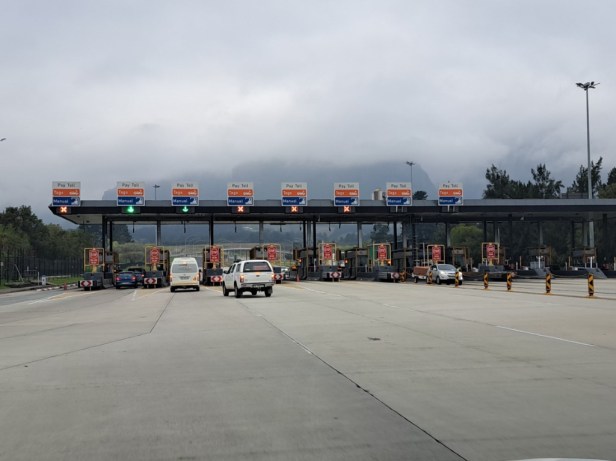
At the toll gate of the Huguenot Tunnel

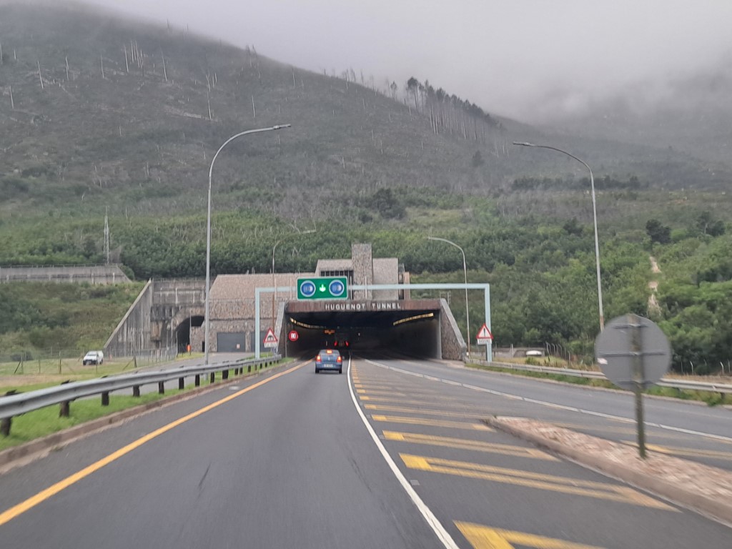
About to enter the tunnel
The tunnel is 3,9km (2,4 miles) long
✿ Worcester (195km/121 miles)
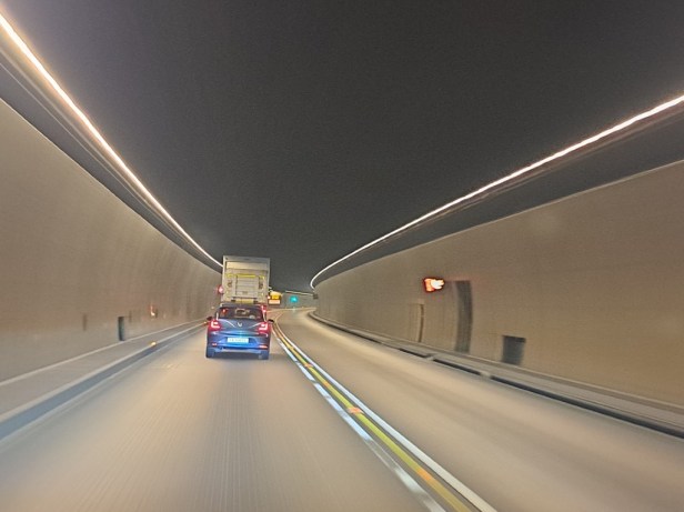
When we drove out the other side of the tunnel, it was still cloudy. But soon we could see more blue skies and even some sunshine.
Still cloudy after we left the tunnel
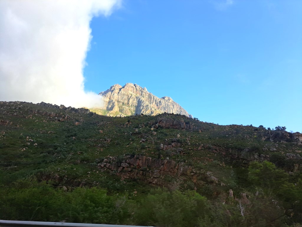

Blue sky on the other side of the mountain
Just after I told Berto that I wouldn’t mind a hot cup of coffee (and maybe something to eat too), a slipway to a petrol station appeared. After stretching our legs and enjoying our coffee and toastie, we hit the road again.
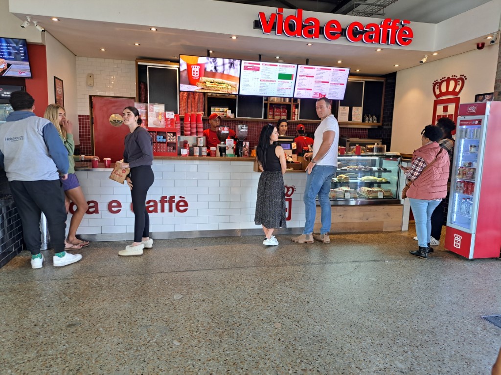
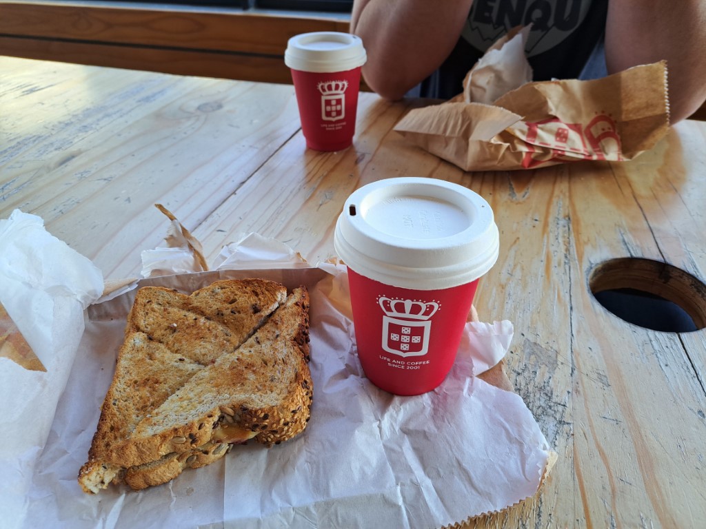
Time for a pit stop
✿ Robertson (241km/150 miles)
Just before we reached Robertson, we saw an old train in the field by the side of the road. We don’t think the train is running anymore, but nearby wine farms (Van Loveren and Four Cousins) have taken advantage of this by advertising their wine and restaurant on the carriages of the train.

Train in the field next to the road
The town of Robertson
Oh, wait! Did we just talk about wine? Although we still had a considerable distance to cover for the day, we definitely had time to stop at Robertson Winery to purchase a few of our favourite bottles of wine to take with us to East London.
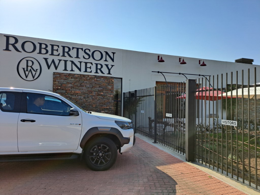

Robertson Winery
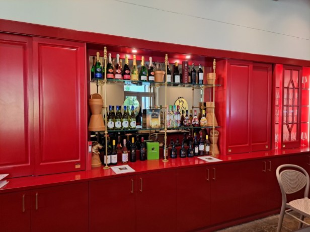
Tasting Room at Robertson Winery
After a quick chat with the staff at the winery, we selected our favourite wines. As Berto walked to the delivery store to pick up our wine, the sales lady asked me if I wanted to see their conference room and underground cellar. It’s such a lovely place – how I wish we had more time (like maybe a week longer)!

I would like to attend a conference here

Stairs leading to the underground cellar


Underground cellar
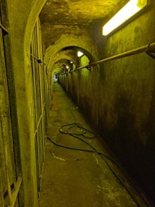
Underground tunnel

Bowen Botha, Managing Director of Robertson Winery (until 2021)

Oom Pon (‘Uncle Pon’) – Robertson Winery’s first winemaker
Robertson Winery was established in 1941 and has become a global brand. They are recognised for the quality and value of its wines.
✿ Ashton (257km/160 miles)
Although we would have liked to stay longer at the Robertson Winery, we had to get back on the road again. The small town of Ashton is just 18km away. One of Ashton’s new landmarks is the Ashton Arch bridge, which was completed in August 2021 after more than seven years of planning and construction.
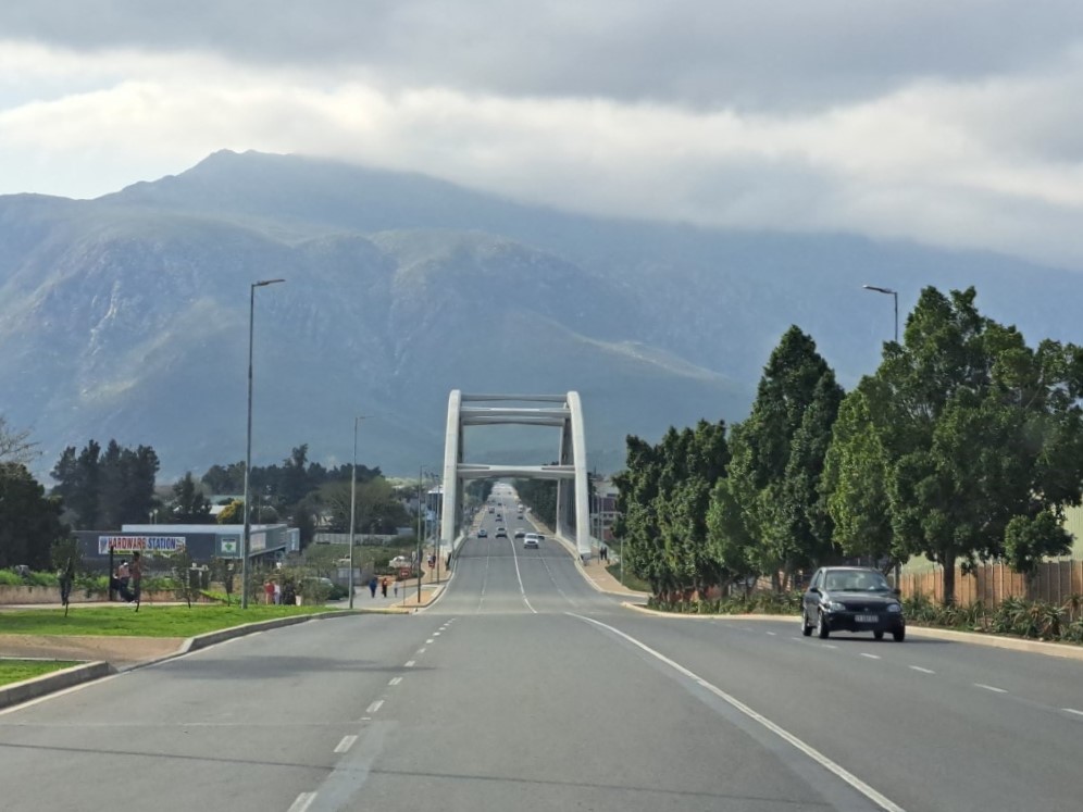
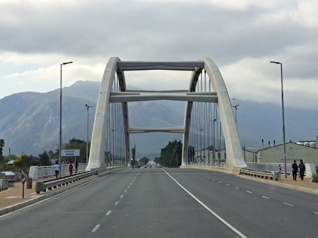
Ashton Arch bridge in Ashton
✿ Swellendam (304km/189 miles)
We loved the views of the beautiful green and yellow canola fields between Ashton and Swellendam. In fact, for the next hundred kilometers we saw these fields continuously. It really was a great time to drive these roads during late winter.
Lovely views on the N2 highway
✿ Heidelberg (360km/224 miles)
✿ Riversdale (395km/245 miles)
✿ Albertinia (428km/266 miles)
✿ Mossel Bay (473km/294 miles)
As we got closer to Mossel Bay, we shared our memories of this harbour town on the Garden Route. Berto was last here in the late 1980s on a school rugby trip and I visited this town with a friend in 1992. The highway does not go through the town and we decided to turn off and drive through the town because we have such fond memories of Mossel Bay.
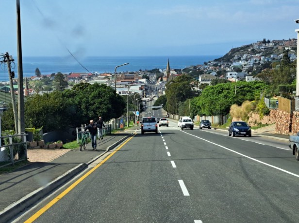
Main street of Mossel Bay

Close to the harbour of Mossel Bay
✿ George (517km/321 miles)
The section we were driving now is called the Garden Route of South Africa. It starts in Mossel Bay and ends in Storms River. This area is known for world-class beaches, lagoons and indigenous forests. It’s such a scenic drive which we thoroughly enjoyed – again we wished we had more time.
Scenic views on the Garden Route
Just outside George, Berto pulled over to stop at a petrol station. While he was filling the bakkie, the smell of freshly baked pancakes lured me to a café. After ordering some pancakes and coffee, we’re back on the road for our last stretch for the day.
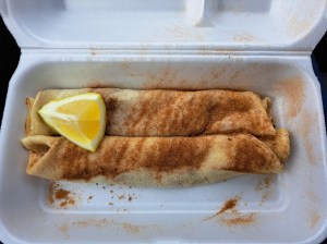
Cinnamon pancakes
✿ Wilderness (529km/329 miles)
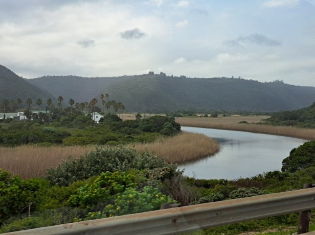
We began to see more and more rivers, lagoons and forests – something this area is so famous for. We also spotted some paragliders above the forest. It was probably the perfect day for this activity as there was no wind. Just think of the amazing views those paragliders had of the beautiful beaches below.

River on the Garden Route
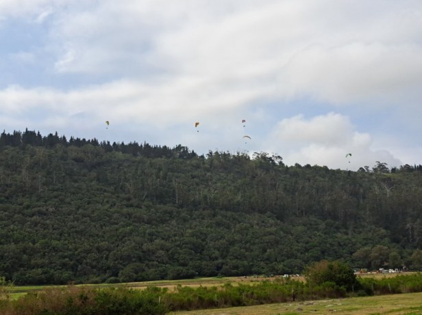
Paragliders above the forest
✿ Knysna (576km/358 miles)
Knysna is a popular holiday town and are described as a true natural wonderland. It’s famous for the Knysna lagoon, or estuary, as well as for its oysters and wooden furniture.

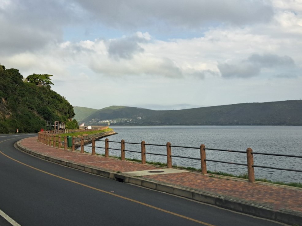
Knysna lagoon
Driving through the forests of Knysna
✿ Plettenberg Bay (609km/378 miles)
The road towards Plettenberg Bay had such scenic views. Plett, as it is popularly known, has sweeping golden beaches, vineyards and towering indigenous forests. If only we had time to stop here …


On the way to Plettenberg Bay
✿ Storms River Mouth (672km/417 miles)
Storms River Mouth is the end of the Garden Route. The river mouth is located in the Tsitsikamma National Park. It is also here where the famous 5-day Otter trail starts – something we still want to do one day.
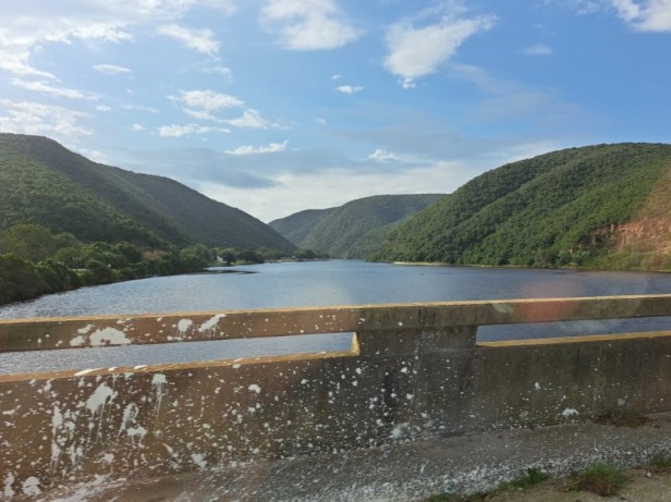
Driving over one of the many rivers close to Storms River Mouth

Storms River Mouth was now behind us


High bridges (Bloukrans Bridge is famously the world’s highest bridge bungy jump)
✿ Humansdorp (760km/472 miles)
With the sun now setting fast, we also got closer to our overnight town.

Beautiful sky just before Humansdorp
✿ Jeffreys Bay (769km/477 miles)
Friends of ours who used to live in East London recently retired and moved to Jeffreys Bay. They invited us to stay with them before continuing the last distance to our home in East London the next day. After driving for 10 hours it was great to just sit on their balcony and enjoy the last light of the day.
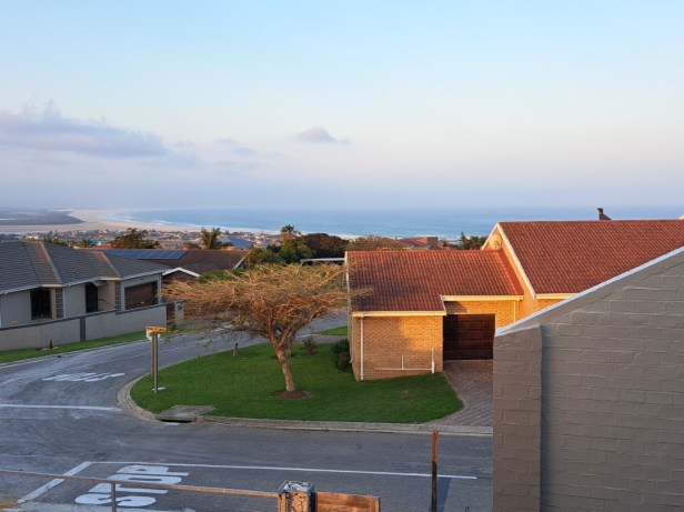
Jeffreys Bay
We hope you enjoyed this beautiful area of South Africa with us. Join us in our next post for the last part of our road trip.
You can read the second (and final) part of our road trip here.

Terwyl ek so saam met julle gery het, het baie onthoue begin terugkom.🤗
LikeLiked by 1 person
Dis lekker, ne? Om so deur bekende plekke te ry en jou eie herinneringe op te diep 💌. Ons het bv. ons eie herinneringe aan ons onderskeie besoeke aan Mosselbaai gehad, maar nou het ons ook ‘memories’ van ons twee saam daar (al was dit nou ook so vlietend).
LikeLiked by 1 person
Thanks. I love road trips. And thanks for the tour of Robertsons. We get that wine here.
And I want a full picture of Berto and his bakkie.
LikeLiked by 1 person
I agree Carl – I think there are a lot of people who like road trips. In my opinion, this is one of the best ways to get to know a country. Oh, it was nice to read that you also get Robertson’s wines (I read that they export to the USA). You know that Berto doesn’t really like to ‘pose’ for photos (but I sneakily took a picture of him while he was washing the bakkie after our road trip) … maybe I’ll put it in our next post 😉.
LikeLike
“Road Trips” bly darem maar lekker, en waar gaan jy n mooier land as Suid-Afrika kry om een te geniet!?
LikeLiked by 1 person
Dis die diversiteit van ons land wat my altyd so verstom! As mens vlieg, is dit soveel vinniger (en dalk ook geriefliker) … maar om te ry en letterlik voor jou oë te sien hoe die landskap verander, is die mooiste vir my!
LikeLiked by 1 person
You certainly livened up your drive with some interesting stops, Corna. But there are places there that you might never want to leave.
LikeLiked by 1 person
Ha Jo 😄, you don’t know how hard it was for us just driving through all these beautiful towns without stopping! It’s a very popular holiday destination in South Africa, but I must admit it was nice to see this beautiful coastal region at a less busy time of the year.
LikeLike
🤗🩷
LikeLiked by 1 person
I just love road trips, and yours looks like it was fabulous! I love the brilliant yellow of the canola plants, they’re so pretty. Lovely post Corna; thanks for taking us along!
LikeLiked by 1 person
Now that I think about it, we really didn’t do this road trip justice. The South Cape and Garden Route is one of the most scenic areas in South Africa and one really has to have a lot of time to enjoy the beauty. But I’m glad we could see the yellow canola fields – it’s such a beautiful sight. Thanks Tricia for stopping by, hope you have a great week.
LikeLiked by 1 person
This looked like a fun, action-packed road trip Corna. I enjoyed the whirlwind of fields, tunnels, coffee stops, wine, bridges, mountains, rivers, lagoons, trains and all the various towns. I was curious to see a place called Worcester, I am assuming there is some British colonial connection there? I am also keen to see a photo of Berto and Bakkie (that should be some kind of TV series). This was a great companion to my morning coffee and pastries.
LikeLiked by 1 person
One could easily spend a day (or more) in each town on this route! There is just so much beauty to see – every town has a history and incredible sights. But we need a year-long road trip on this stretch to cover everything. You are right about your suspicion on Worcester. Lord Charles Somerset (originally from Badminton in the UK) named Worcester after his brother, the Marquis of Worcester. There is a great British colonial history in this area … hopefully we can get there one day and tell more about this region. I will see what we can do about the launch of “Berto & Bakkie” 😁. Pastries on a Monday morning – ah well, the perfect start to a new week!
LikeLiked by 1 person
Wow, what a fantastic and fairly long drive, Corna! As I always like to see a particular route on the map, I had to use Google to see your driving itinerary and I have to admit the more I read about your South African adventures, the more I realize that it has everything I look for in a holiday: diverse landscapes, a vibrant urban scene, great food (and wines) and beautiful accommodations. Not to mention awe-inspiring mountains, fascinating rock formations, sandy beaches, quaint towns, vineyards, whales, penguins and many more natural highlights. Thanks for sharing and inspiring. Cheers, Aiva xx
LikeLiked by 1 person
Yes, it was a very long drive! Normally we would split our road trips into shorter distances, but unfortunately our limited time did not allow it on this journey. I’m glad you used Google maps – then a route might make more sense, right? Oh yes, I think you and I have talked about this on a previous occasion Aiva … South Africa really has landscapes that will be attractive to so many different tastes/tourists. Thank you for travelling with us 🌸.
LikeLike
What a wonderful tour of this stretch of South Africa! I enjoyed the variety of landscapes and scenery.
LikeLiked by 1 person
If you like a beautiful coastline with golden beaches, this part of the country is definitely worth visiting! Forests on one side and beautiful beaches on the other … all that’s missing are those beautiful mountains that you love to explore 😉.
LikeLiked by 1 person
What a lot, all in one day. The canola is beautiful. It reminds me of the rapeseed fields in England. I recognised quite a few of the names from when I took my mum to South Africa c 1977. We rook bus trips from Cape Town. I was confident enough to rent a car! That winery conference room would be a tremendous step up from conference rooms of my experience! I noticed heavy cloud in the Storms River pictures. Is that how it got its name? I hope your friends didn’t keep you up too late talking after your long day!
LikeLiked by 1 person
It was a very long day! But it was such a beautiful drive that I only realised how tired I was when we arrived in Jeffreys Bay. Wow, you were pretty brave renting a car in those days … but it’s the best way to see places. Ha, that conference room: Just think if you get tired of a meeting in there – you can just lean back and take a bottle from the shelf for some excitement 😁. There is a short (but very interesting) story on the internet about Storms River (if you have some time, you can read it here: https://www.tsitsikamma.info/page/the_story_of_storms_river_village).
Oh, we didn’t get to bed until after midnight … luckily the next day wasn’t that far to drive.
LikeLike
Wow, that was a long drive. I did half that from Cape Town to Knysna via the wine route. I like to break road trips up by having 2 night stopovers so we can explore a bit in each place. You might enjoy this post Corna.
LikeLiked by 1 person
A very long ride indeed. If we weren’t pressed for time it would have taken us at least a week to drive back to East London.
Oh Jude, I really enjoyed your write-up on Route 62, thanks for sharing it! It’s a great road to drive (we drove almost the same road two years ago). Perhaps, sometime in the future, when we drive to Langebaan again, we will take this route back to the West Coast. Your photos look so familiar (and beautiful). Oh yes, and these days we can also pay with cards at a filling station 🙂 … I can’t imagine driving with so much cash to fill up that new bakkie’s fuel tank!
LikeLiked by 1 person
Good to know about the use of cards now. I imagine it takes a few rands to fill up a tank.
LikeLiked by 1 person
Beautiful Corna. I would love to drive the Garden Route one day. The winery conference room looks wonderful as did many places you drove through. Does your pick-up truck have a cover over the back to keep things safe and dry? Hope you have many years of enjoyment with your new vehicle.
LikeLiked by 1 person
I’m glad you enjoyed the drive through our beautiful Garden Route – I hope one day you can also see with your own eyes how beautiful it truly is (and hopefully have much more time than we had 😉). No, the bakkie/pick-up truck does not (yet) have a canopy – when you buy it new, it comes without that. But Berto has already ordered a canopy and we should be able to put it up in the next few weeks … then we can go camping! Thank you Marion, we are already enjoying our new vehicle so much.
LikeLiked by 1 person
Oops…I left the important word out there…I was NOT confident enough to drive in south Africa!
LikeLiked by 1 person
Haha 😅 … if you didn’t say anything, no one would know!
LikeLike
That’s some drive through some changing and diverse landscapes, Corna
LikeLiked by 1 person
When you fly it’s obviously so much faster, but you don’t see how the landscape changes from the West Coast to the South Coast and then finally to the Southeast Coast. That’s what makes a road trip so much fun!
LikeLiked by 1 person
Absolutely!
LikeLiked by 1 person
Wow, that’s a long drive for one day! When we go to Newcastle it’s about 300 miles and we consider that enough 🙂 And we share the driving – did Berto really do all this and not get too tired?! But what lovely scenery for you to enjoy along the way!
LikeLiked by 1 person
We are quite used to driving long distances, but now that we are getting older 😉, we prefer to do such long distances over a few days (unfortunately, on this drive we were pressed for time). Berto always drives (I’ll step in now and then if he gets really tired, but that’s rare). And you’re right, it is one of the most beautiful areas in our country – then you hardly feel how long you’ve been driving (until you stop at the end of the day and get out of the car).
LikeLiked by 1 person
And I expect your roads are quieter than our busy motorways
LikeLiked by 1 person
You are probably right Sarah. Although this road we drove (N2) is one of our busiest motorways in the country during Easter weekends and the December school holidays, we were very lucky to have little traffic when we drove along it (and it was on a Saturday). I’m no fan of traffic and if we can avoid it I’m very happy 😊.
LikeLiked by 1 person
What better way to test out your new truck than by going on a road trip. Even though your drive started off overcast and rainy, at least it was scenic and you got to enjoy some blue skies and sunshine for parts of it.
LikeLiked by 1 person
We also thought it was a good test run … of course it would have been even better if it could have been a dirt road (according to Berto) 😁. I was a little worried when it started to rain and that we couldn’t fully enjoy the beautiful surroundings, but in the end the trip turned out well.
LikeLiked by 1 person
I love a good road trip and you’re certainly in an area where you can take long road trips.
Love the cellar and tunnel photos.
LikeLiked by 1 person
It’s true … and with the ever-changing landscape, it makes for a great road trip! I wouldn’t mind having a birthday party in that cellar one night 😉.
LikeLiked by 1 person
That would be fantastic!
LikeLiked by 1 person
What a wonderful trip and such beautiful pictures Corna! I have never seen canola flowers before! How nice to see your friends and have a relaxing stop before heading home with your new truck! I never knew South Africa was so beautiful until I started following you.
LikeLiked by 1 person
Oh yes, the canola fields are so beautiful this time of year … in some places they literally stretch as far as the eye can see. It was great to see our friends again – they have such a beautiful house overlooking the sea (perfect place for retirement I think 😉). I’m glad you see through our posts how beautiful South Africa is. Sometimes you only read the negative things in the news and then forget how beautiful a country really is.
LikeLike
Sjoe, wye verskeidenheid pragtige plekke. As jy volgende keer deur Riversdal gaan, kan julle by Bali stop, net voor mens in die diopr inry. Daar is ‘n petie wynwinkeltjie, skaars twee rye bottels, maar met heerlike verskeidenheid wyne beskikbaar. En die koffiewinkel langsaan is oulik, die een in Bali ook. Dan moet jy ook nie by Stilbaai se afdraai verby gaan as ons daar is nie …
LikeLiked by 1 person
O, ek het die plekkie voor Riversdal raak gesien … maar daar was nie tyd vir stop nie (tot my ontsteltenis)! Maar nou maak ek ‘n lysie vir volgende keer se tog Langebaan toe 😉. As ons weer so langs ry, gaan ek jou laat weet sodat jy solank die ketel kan aansit …
LikeLiked by 1 person
Ons gaan so ‘n kuiertjie baie waardeer, sal selfs slaapplek aanbied vir al die stories.
LikeLiked by 1 person
Baie dankie 😍
LikeLike
Another beautiful trip Corna – and those Cinnamon pancakes look absolutely delicious 🙂 I couldn’t do that much driving in one day, but the views are gorgeous.
LikeLiked by 1 person
I love pancakes (and these were a lovely surprise along the way). Yes, if you are not used to driving so much, it can be quite a challenge … but as you say, at least the scenery was lovely – I wish we could overnight in each little town as they are truly beautiful.
LikeLike
Oh yeah, all the familiar little old towns ❤️💕
LikeLiked by 1 person
And you will know them all Morag … each beautiful in their own unique way 💌.
LikeLiked by 1 person
💖🙋♀️
LikeLiked by 1 person
Love the sunrise, would rather look at canola than consume it, and yay… a tunnel!! I love tunnels!
LikeLiked by 1 person
There’s just something special about a colourful sunrise, right? Yes, we don’t have many tunnels in South Africa, but I’m always excited when we drive through one 😊.
LikeLiked by 1 person
I love wine too! The next time I order, I’ll try some from South Africa. Beautiful post!
LikeLiked by 1 person
There are so many good wine farms in the Western Cape province of South Africa … I don’t think we will ever be able to taste all the wine (even if we try very hard 😉). Thank you.
LikeLiked by 1 person
I’d love to know your favorite brands.
LikeLiked by 1 person
Robertson’s wines are one of our favourites (especially their Sauvignon Blanc). And our top red wine is definitely Beyerskloof Pinotage – I think it’s probably the most popular pinotage in the country. But my favourite-favourite wine is definitely Van Loveren’s blend of Chardonnay and Pinot Noir. Oh, maybe I should rather stop … there are just too many to mention 😉.
LikeLiked by 1 person
Ooh, thank you, I will look for these. I am sharing your blog post tomorrow morning too.
LikeLiked by 1 person
Great to read and see photos of my favourite road trip route.
We often drive to Robertson to get wine from our preferred wine estate. Never been to Robertson winery. Looks like it’s worth a visit.
LikeLiked by 1 person
Yes, I can quite imagine that this is a favourite route for you – it’s so scenic. And there are so many wine estates around Robertson, you actually need a week to stay there if you want to get to most of them 😉.
LikeLiked by 1 person
The winery looks like a great stop. Good that you took some with you!
LikeLiked by 1 person
We live so far from wineries at the moment, that we take the opportunity when we drive past one! I wish we had more time … but I’m sure we’ll get there again 😉.
LikeLiked by 1 person
Nothing is better than a road trip! And yours certainly was scenic. I would’ve run my phone’s battery down by taking so many pictures of the gorgeous mountains, rivers, and canola fields. Mossel Bay looks like a place that we would love to visit, and I am envious of your friends’ view from their balcony.
LikeLiked by 1 person
Yes, I know you love road trips as much as we do! I had two cell phones and a camera handy – and the batteries of all of them were almost dead by the time we got home 😄. Mossel Bay is a beautiful coastal town – packed with so much history. We will have to go back to show you the beauty of this town! You’re right Kellye – that view from our friends’ balcony over the sea is incredibly beautiful.
LikeLike