
Hottentots Holland Nature Reserve, Grabouw
As we prepare for our next adventure starting soon, we’d like to take you to more of the beautiful places in and around Cape Town … trips we’ve enjoyed in the past.
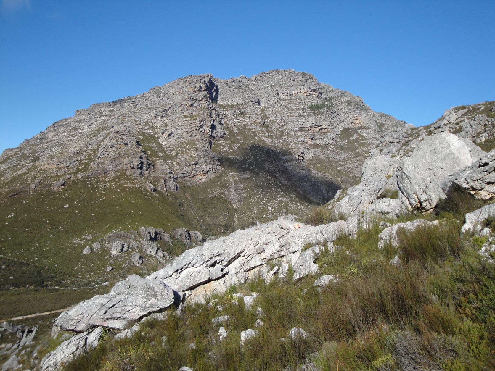
It will probably come as no surprise to our regular blog readers if we want to tell you about another hike! In May 2015 we ventured on the overnight Sphinx Route in the Hottentots Holland nature reserve near Grabouw (70km from Cape Town).

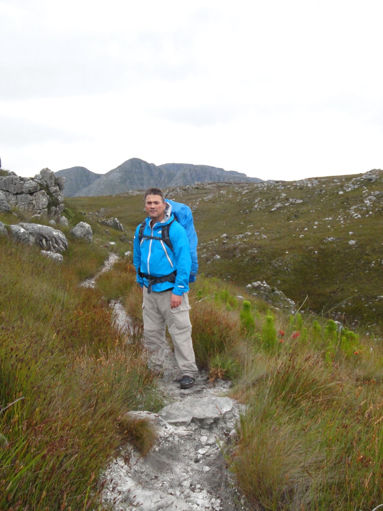
We left our car at the parking area by the main gate to start our walk at Nuweberg. The route winds up and down along rugged and mountainous terrain and then ends at Shamrock Hut where we spent the night – 12km (7.4 miles). The next morning we enjoyed walking back down the mountain on a jeep track to end our hike again at Nuweberg – 10km (6.2 miles).


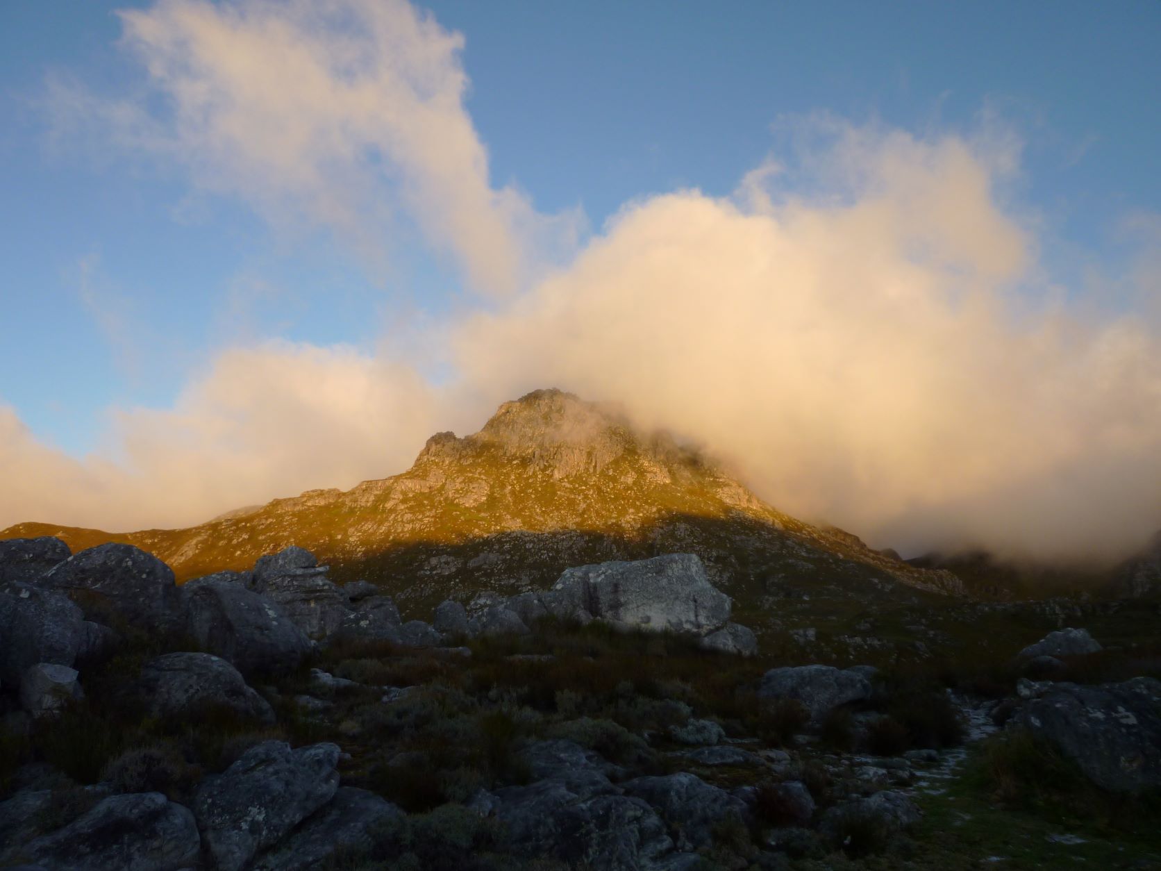
There was a forecast of rain and the presence of heavy clouds made it clear that we would get rain somewhere along the route.
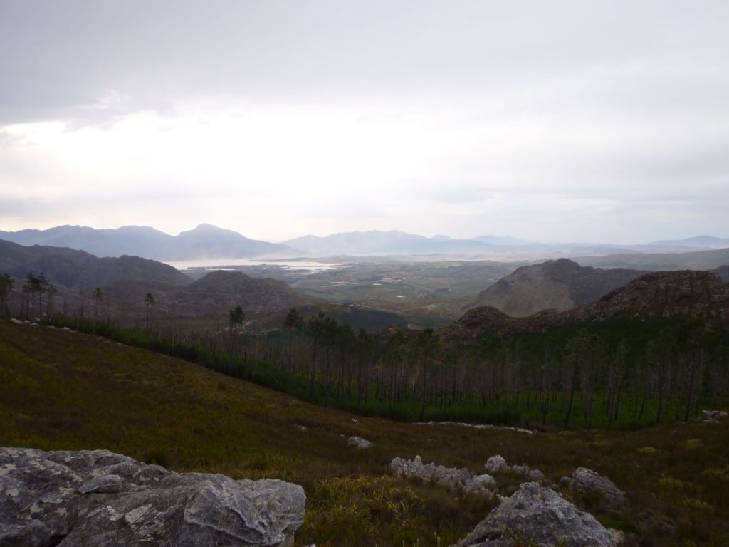


About an hour and a half after we started walking, the wind suddenly started blowing stronger and we could see the rain moving down the valley towards the mountain. It was a good indication for us to quickly make a cup of coffee before the rain reached us.


We were quite surprised to see how green the mountains were, because it was only the beginning of the winter and rainy season.

After we put our coffee mugs back in our backpacks, the rain started to fall and we had to quickly put on our rain jackets. It rained hard for a while and then luckily it was just a light drizzle until we got to our hut.


We could see our cabin from quite a distance. But when we came around a corner (and thought we were almost there), the trail took us deep into the valley and then back up the mountain. We didn’t reach our cabin until about 40 minutes later.
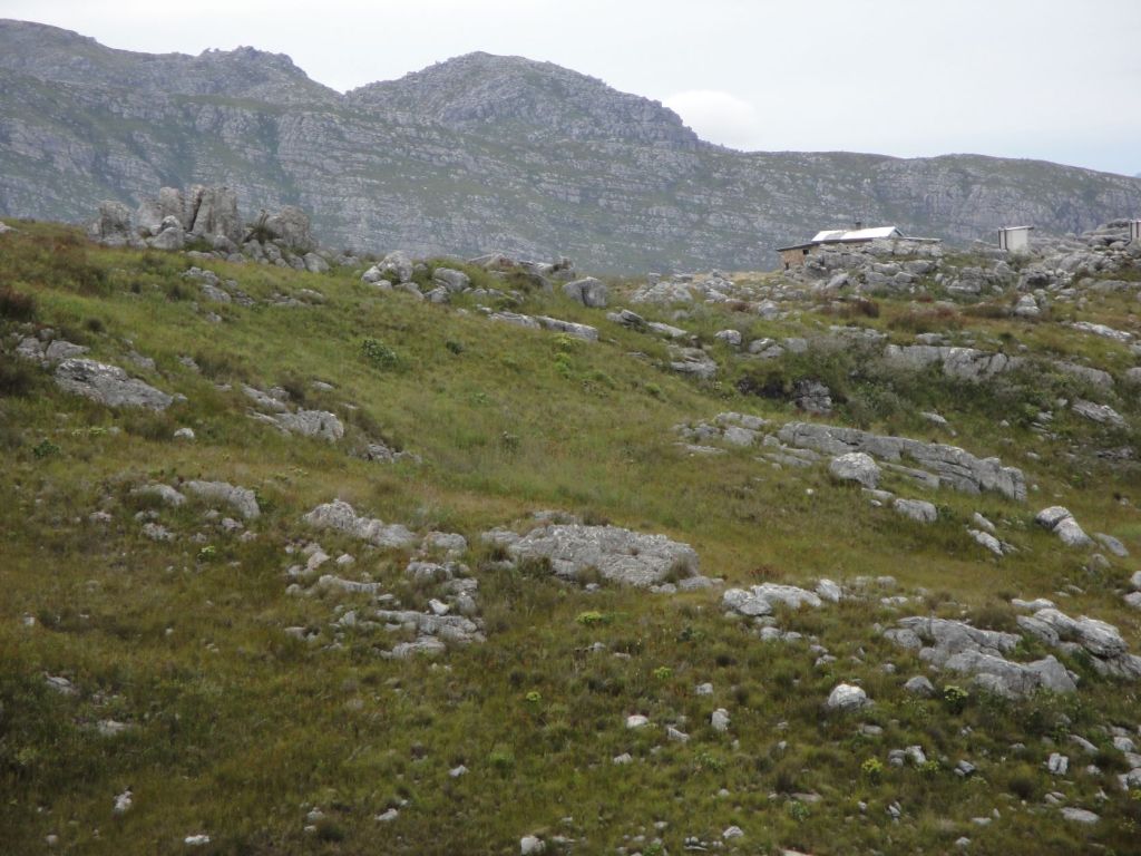

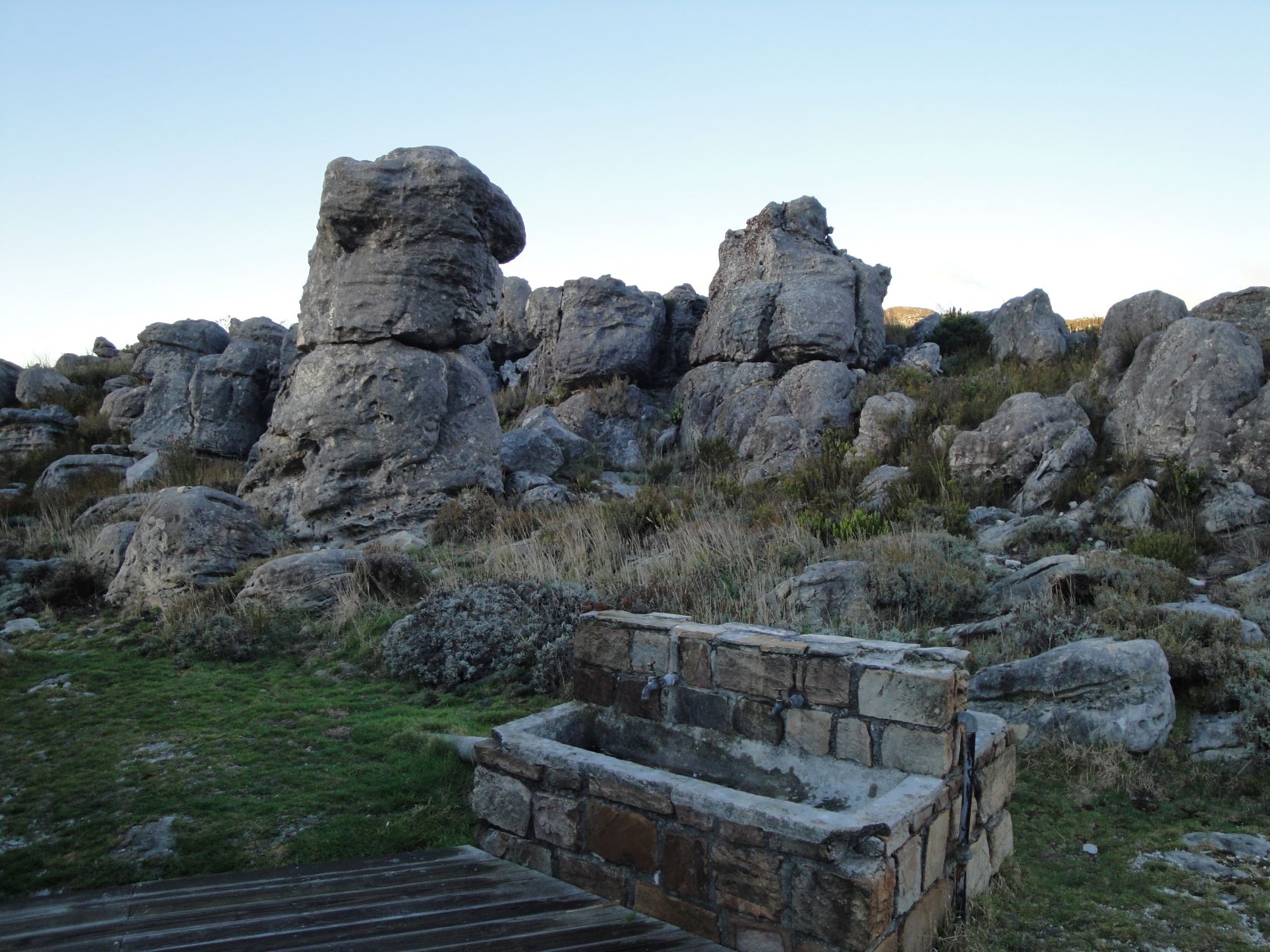
A short boardwalk took us to the sleeping hut. There is also a sheltered area where you can ‘braai’ (barbeque).


Our lunch was quite simple (and very cold) for this chilly day. We enjoyed mini sausages, cherry tomatoes and cheeses. Luckily we had hot coffee and tea to drink to warm us up!


For the rest of the afternoon we walked around a bit to explore the area. But it got so cold and wet that we decided it was better in the hut. Berto decided it was a good time to try to explain declination to me. All I remember was that it was about geographic north and true north. I don’t think I was a very good student, because I decided it was much more enjoyable to enjoy a glass of red wine.


With no electricity available at the hut, we packed a fire early (for light, heat and to prepare our dinner). We put a big piece of steak on the fire and enjoyed it with a green salad that we made at home.

In our cabin there were a couple of bunk beds with mattresses with a fireplace in the middle. It was bitterly cold and raining when we went to sleep, but Berto had a plan how we would stay warm! He made a big fire and we placed our mattresses on the ground near the fireplace. We then snuggled into our sleeping bags and it was quite cozy!


Day 2:
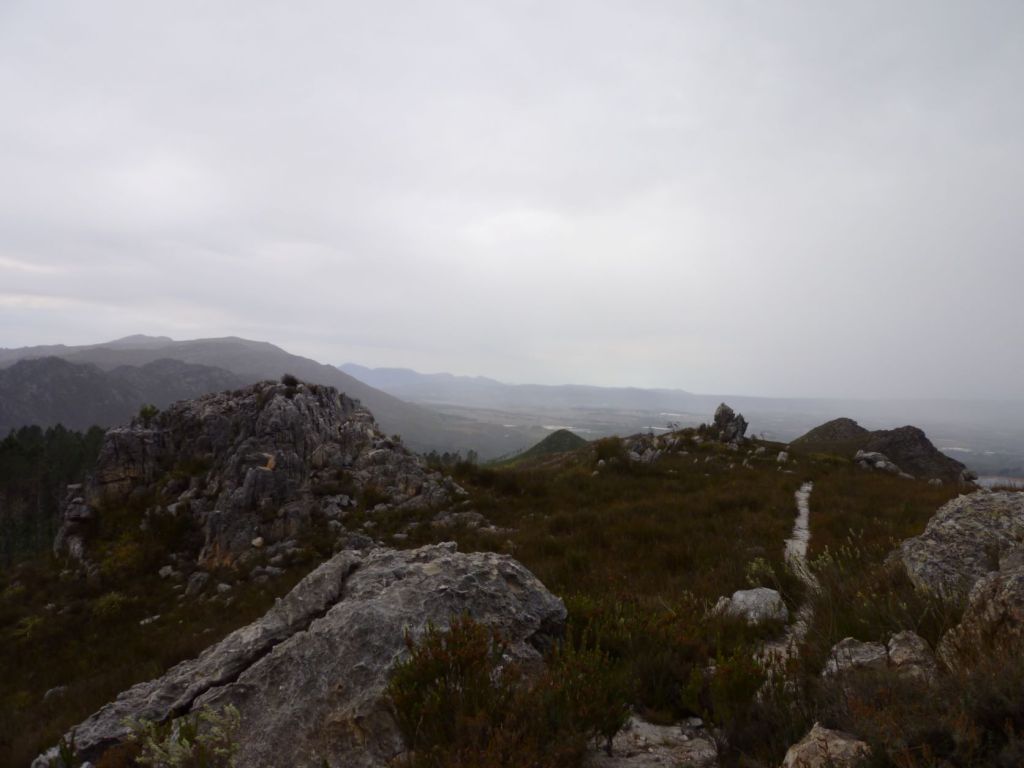
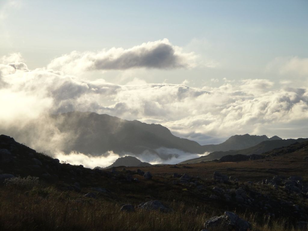
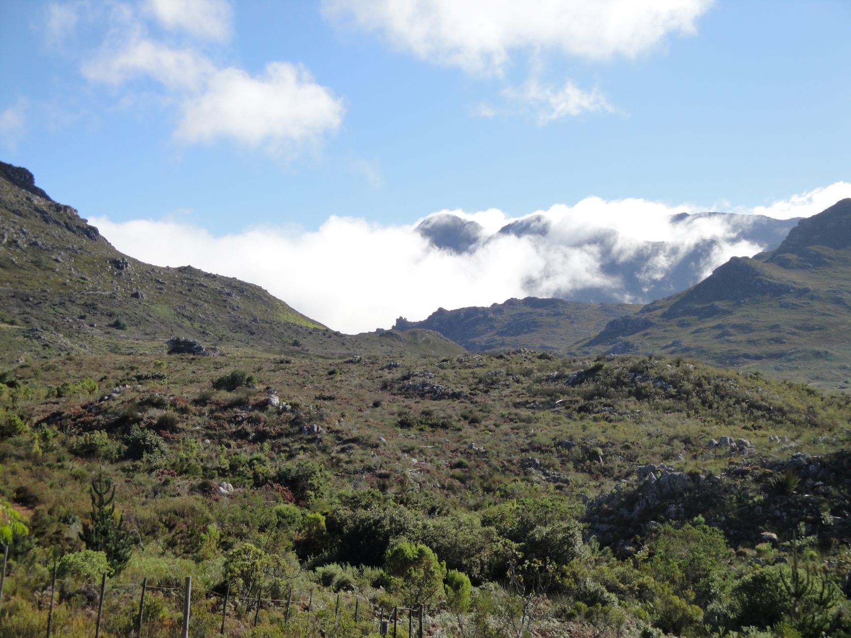
The next morning we were happy to see that the rain clouds had disappeared. There was a thick cloud of mist over the mountains and down in the valley, but we were excited that our walk down the mountain would be in sunny weather.

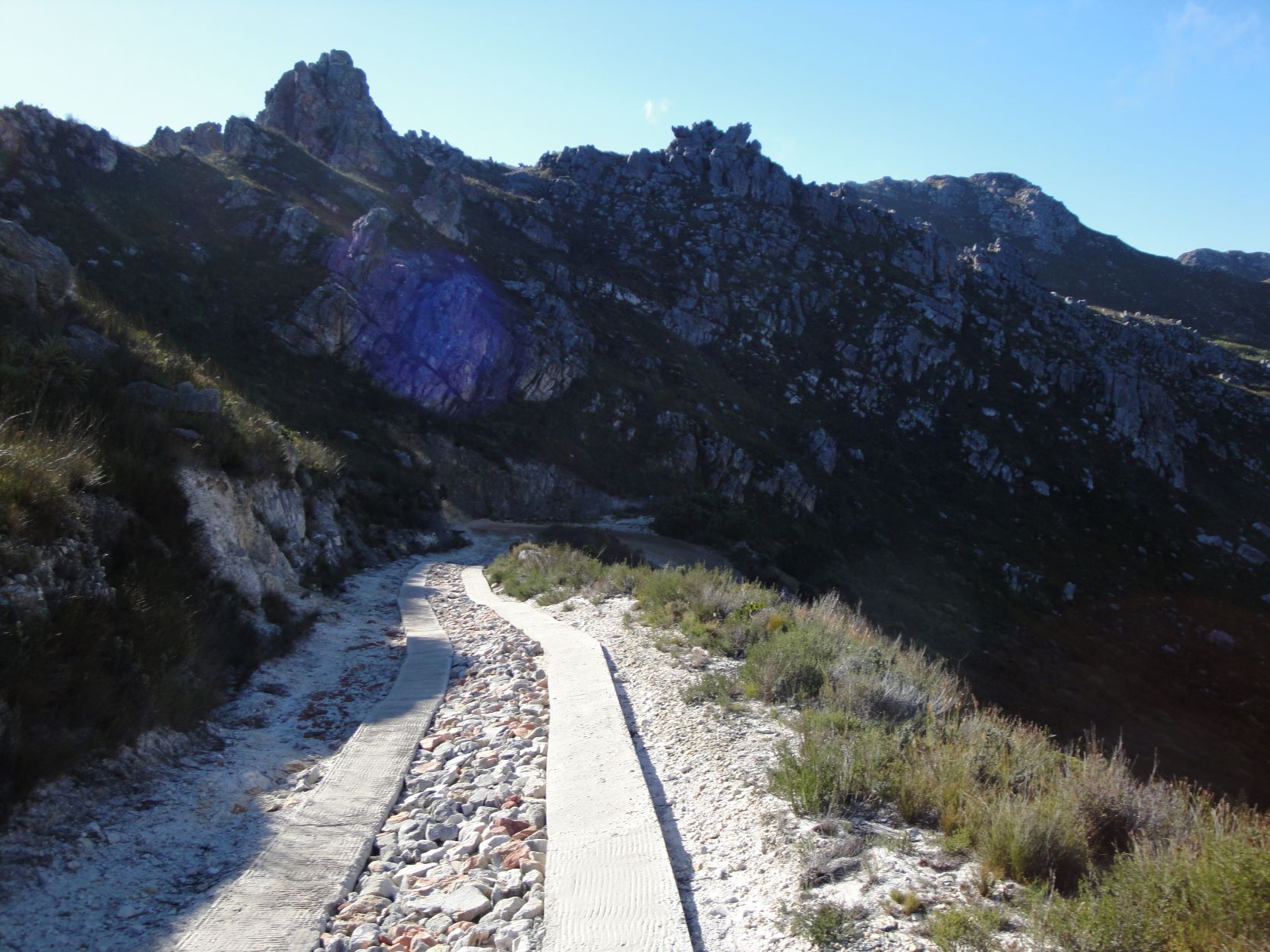
We only had to walk about 10km (6.2 miles) back to our car and it was most of the time on a jeep track – so an easy walk. But first it was time for breakfast. Berto fried bacon in our camp pot before adding some eggs. It would surely take us to the end of the trail.


Around 9:00 we took a few last photos of the beautiful scenery before packing our backpacks and walking down the mountain.


On this side of the mountain is a zipline adventure. It starts high in the mountains and then works its way down with 11 cables of more than 100m. We saw some of the adrenaline junkies enjoying this activity (well, we heard them long before we saw them).

It was such a beautiful walk down the mountains. The mist had completely disappeared and the sun was actually quite warm. It was the perfect day to be out in nature.

I complained to Berto last night that I didn’t see my favourite flower – the protea – on our route. But today, on our way down the mountain, I was lucky to see this beautiful flower. Oh, I love this beauty!


The last few kilometers were on a dirt road and took us to the main gate and parking area.


This was another great hike in the mountains near Cape Town and definitely a route we would love to hike again (maybe this time with our friends).

I love proteas too! Beautiful photos as usual, makes me want to go on a hike in a remote place far away from wifi connections haha Thank you for sharing 🙂
LikeLiked by 1 person
Oh yes, I like your idea of hiking in a remote place without wifi! Thank you for ‘hiking’ along … enjoy your week!
LikeLike
You are great hikers and such incredible place to hike . and incredible images
LikeLiked by 1 person
Thanks Anita! Absolutely, this was one of our favourite hikes … such a beautiful place to enjoy nature!
LikeLike
Baie dankie. Hierdie klink nou wraggies ‘n lekker staproete. Jy onthou goed!
LikeLiked by 1 person
Jy’s reg Toortsie, dit was een van ons lekkerste staproetes nog! En ek dink ‘n mens onthou beter wanneer jy na die foto’s kyk – dit bring altyd die herinneringe terug.
LikeLiked by 1 person
😁
LikeLiked by 1 person
Even the rainy day looked like it had beautiful landscapes but the next day with a blue sky, gorgeous!
LikeLiked by 1 person
Yes, the rainy day wasn’t too bad … but to hike when the sky is blue and the sun is shining, that’s always the best!
LikeLike
Absolutely beautiful! Those misty views are stunning AND I would love to have a crack at that zipline. You would certainly hear me!! 🙂
LikeLiked by 1 person
Thanks Mel! Oh yes, I can imagine that you would have left the hiking route and found your way to the zipline 😁!!
LikeLiked by 1 person
It’s so cool that there are so many huts you guys can hike to!
LikeLiked by 1 person
You’re absolutely right! That makes the backpack a little lighter, because we don’t have to hike with a tent! Although the huts are very basic, you don’t really need anything more … just a roof over your head (and a bed/mattress is always a bonus) 😉.
LikeLiked by 1 person
I love your big open views…so different from my deep, dense forests. That protea flower is absolutely stunning.
LikeLiked by 1 person
Yes Caroline, those open views are something you’ll see most of the times on hikes in South Africa. I think the reason why I love the protea flower so much, is because not one of them looks the same (there are so many different species) and I’m always looking forward to see what nature has on offer when we go for a hike in the mountains!
LikeLiked by 1 person
Such beautiful views and stunning natural scenery. Beautifully photographed too. Easy to see why you enjoyed it so much.
Pity about that exotic plantation at the start though, I hope Cape Nature has plans to remove it eventually to allow the natural vegetation to return.
LikeLiked by 1 person
Thanks! This definitely rates as one of our top favourite hikes! Yes, we also hope that Cape Nature will assist with the natural vegetation (we said it back in 2015 when we’ve done this hike … maybe we should go and do this hike again to see whether anything’s been done).
LikeLiked by 1 person
Ten spyte van die reen is dit darem maar ‘n pragtige omgewing, Corna! Soveel om te sien en in te neem. Die protea is darem maar pragtig! Beslis ‘n pragtige staproete die. Sal my suster moet vertel!
LikeLiked by 1 person
Jy’s reg Aletta, dit is so mooi in die Hottentots Holland berge … en dit was ‘n absolute bonus dat dit nie te moeilik was nie (geen lere of kettings nie 😉). Og, daardie proteas – ek’s altyd so bly as ek van hulle kan sien op ons staptogte!
LikeLike
Ek het gesien die lere en kettings was nie daar nie😂 proteas is beslis ‘n bonus
LikeLiked by 1 person
Great to see another chunk of your home country’s fine landscapes. I wholeheartedly approve of your impromptu coffee sessions. “The rain is coming, quick coffee!!!!” The morning mist photos in the dim light are really magical.
LikeLiked by 1 person
Leighton, those coffee moments in nature are simply the best! Yes, I have to agree … the photo’s of the morning mist were some of my favourite ones too!
LikeLiked by 1 person
Yet another lovely hike with a hut to overnight in. So pleased that the rain showers cleared for the second day and you were rewarded with clear skies. Berto’s fried bacon and eggs in the cooking pot looked to be a good start to the day as well. I’m always impressed by how well you cater for yourselves on these expeditions Corna. Hope your week has started well. Marion
LikeLiked by 1 person
Thanks Marion, this was surely one of our favourite hikes! And absolutely great to walk to a hut (in stead of carrying a heavy backpack loaded with a tent, that’s for sure)! Yes, we do like to eat well hey … even on a hiking trip 😉. Thanks, we’re having a great week (of sunshine) and getting ready for our new adventure starting late next week …
Hope you are doing well and that the weather is giving you a break every now and then with a little bit of sunshine!
LikeLiked by 1 person
Wow that mist over the mountains, it’s so beautiful. Also lovely to see you both looking so content on your hikes (ours are normally us both sweating, shouting at each other for being lost and getting some sort of injury along the way) haha!
LikeLiked by 1 person
Haha Hannah, I had a good laugh now about your hikes 😁. Yes, it’s not always ‘plain sailing’ on our hiking trips either … but I have such a laid back husband that there is seldom any conflict on these trips! And a glass of wine in the evening makes you remember only the good stuff!! Oh yes, I loved the views of the mist over the mountains in down in the valley … doesn’t it look like candy floss to you?
LikeLiked by 1 person
Wow, what an amazing and beautiful hike! Great post and photos.
LikeLiked by 1 person
Thank you Tricia! This was indeed a wonderful hike and we would love to go back again … we love being out in nature!
LikeLiked by 1 person
As always I enjoyed my virtual walk with you 🙂 The scenery is magnificent – I especially loved seeing the mist down in the valley on day 2!
LikeLiked by 1 person
Ah, I’m so glad you came along again Sarah! Oh yes, the mist in the valley was awesome to see … I stumbled a couple of times while going down because I kept my eyes on that beautiful white cloud 😊.
LikeLiked by 1 person
It’s funny how much of a difference the weather can make on how the landscape appears. I’d rather have the rain on the trek up and sunshine on the journey back down. This looks like a nice overnight trip.
LikeLiked by 1 person
I’m totally with you … rainy weather on the way up and sunshine down!! Yes, this was definitely one of the hiking trips we really enjoyed and would love to do again.
LikeLiked by 1 person
What a difference it makes when the sun shines. Being cold and wet, not so much fun, although in the right company you can make the best of it and have a good time anyway. I hope no one ever asks me to explain geographic North and true North!
LikeLiked by 1 person
I just know that in sunny weather, everything seems so much easier (especially hiking) … but you’re right, doesn’t matter the weather conditions, we always have fun! Every now and again Berto tries to explains ‘declination’ to me, but I’m afraid I still don’t understands it 😁.
LikeLike
Here’s one of those strange coincidences that happen to me. I just read your post about North and True North when Grant popped up and I said “I must go and pick up my book that’s just come in”, so off we promptly went. Coming back I opened the book to look at the dedication page and what did it say “To Doug….True North”. I cannot remember the lat time the expression even came up…now twice within half an hour. These things happen to me all the time.
LikeLiked by 1 person
😲 … I’m not even going to say ‘that’s strange’, because it sometimes happens to me as well. Is there a name for this you think … or are we just special?
LikeLike
Oh special for sure!
LikeLiked by 1 person
👏 I like it!
LikeLike
Beautiful area and you two always have such a variety of food. Zip Line…count me in!
LikeLiked by 1 person
You can be on the zip line and then I’ll take the pictures … you brave one!! It is indeed a beautiful part of South Africa. Thanks for popping in on our blog Diane. Have a great weekend 🌸.
LikeLike
Thank you for taking us along another great hiking adventure. Great post filled with beautiful images 🌸💕
LikeLiked by 1 person
And thank you for joining us again on another great hiking trip in the mountains Henrietta! This was surely a favourite of ours and we hope to visit this trail again in the near future!
LikeLiked by 1 person
Fantastic, all the best with the planning
LikeLiked by 1 person
The morning views from the hut and the mist are so lovely. If I saw the rain approaching, I probably wouldn’t stop for a coffee! You were well prepared for your cozy stay in the cabin.
LikeLiked by 1 person
Haha, we always look for an opportunity to have coffee in nature 😁. And yes, I absolutely agree with you … just loved that morning view with the mist down in the valley!
LikeLiked by 1 person